Moving north from Bleaklow Head, Sykes Moor lies between Wildboar Grain and Longdendale, to the east of the Pennine Way. How to get there.
The 'Y-Lobe'
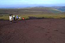
The view right is SW from Sykes Moor shows the lower end of a large, flat, Y-shaped expanse of exposed peat, created by a fire in the late 1960s. It has been nicknamed the Y-Lobe because of its shape. The area did not recover naturally and remained as exposed peat for more than 30 years. It was reseeded in 2004 by Moors for the Future and the landowners as part of the moorland restoration programme.
It is difficult to appreciate its size and shape from the ground. It is 400m long from east to west
Find out more about the Y-Lobe.
The Y shape is seen more easily from remotely sensed images, especially aerial photographs.
Learn more about the aerial photography of the Y-Lobe.
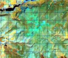
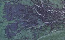
The Y-shape can also be seen on a satellite image (right) taken from space.
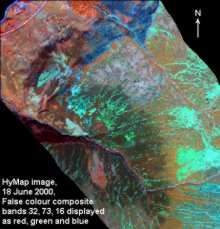
Here is another type of remotely sensed image of Sykes Moor. It is an aerial scanner image, taken by HyMap
See what features you can infer from the colours, forms and textures in the image.
We have seen Sykes Moor on three types of remotely sensed images
- True colour aerial photograph.
- Landsat Thematic Mapper satellite image.
- HyMap aerial image
The information we can extract from each image varies due to the following differences:
- Spatial resolution (pixel size) - aerial photographs best.
- Number of bands and whether they record invisible light - HyMap best.
- Area covered and cost per square kilometre - Landsat TM best.
These properties affect:
- The scale of the map produced - images with smaller pixels allow mapping at larger scales because more detail can be seen, e.g. about 1:100,000 for Landsat TM, 1:10,000 for HyMap 3m images and 1:5,000 for the aerial photos used here.
- The information mapped - e.g. the degree of generalisation. Larger pixels and/or few bands usually means that more generalised classes must be used. e.g. a 'woodland' class instead of separate 'coniferous' and 'deciduous' woodland classes.
Now we'll look at vegetation patterns on Sykes Moor.
> Next site: 6. Sykes Moor - vegetation.
< Previous site: 5. Bleaklow from the air.
< Start of tour.
