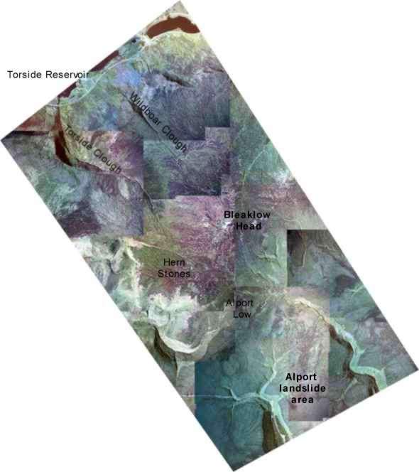
Mosaic'ed aerial photographs (above) showing the transect study area.
- These aerial photographs were taken in August 1998.
- They were taken by a large survey camera mounted on an aircraft.
- The survey was commissioned by the then MAFF (now DEFRA).
- They are used to produce habitat maps and identify small agri-environmental features such as hedges and walls (Watson et al., 2001), and are analysed with other spatial data within DEFRA's Geographical Information System (GIS).
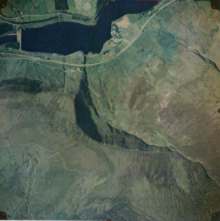
- This photo right shows an example of one of the unprocessed photos.
Photo Mosaics
- The photos (top) have been mosaic'ed together.
- The tones vary because the contrast is different in each photo.
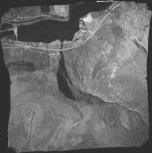
- They do not fit exactly because the camera produces radial distortion (tall objects lean away from the centre of the photo and scale is smaller at the edges).
- These distortions can be removed by orthorectification to produce a seamless photomap (as the Getmapping company's aerial photos available on the Multimap website or Google Maps).
- This photograph (right) shows the orthorectified version of the above photo.
Inverted Relief
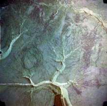
- Aerial photos can make valleys appear raised, as though they are ridges.
- This is because we are used to seeing north-facing slopes as bright, since north is usually at the top and an artificial light source would be shining towards the page.
- This is why relief shaded maps show south-facing slopes in apparent shadow.
- In reality, most British aerial photographs will be taken when the sun is in the south, southeast or southwest so that south-facing slopes will be brightest.
- This inverted relief phenomenon is seen very well on the Alport Moor aerial photo.
- See the Getmapping aerial photo of this area.