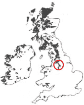
The Peak District is in the North of England, to the east of the Manchester, Stockport and Stoke-on-Trent, and west of Sheffield and Nottingham.
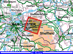
The Transect lies in the High Peak area of the Peak District National Park, to the east of Glossop.
The Peak District National Park is shown as the large brown area in the centre of the image.
The red box shows the location of the satellite image and larger scale map shown below.
- Large, detailed line map of the study area.
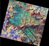
This satellite image (right) is of the same area as the map above.
It's a Landsat TM satellite image, from 1990. It is a 'false colour' image, using a combination of different light wavelengths (both visible and non-visible).
See what features you can identify from the map above.
- Find out more about the Landsat TM image...
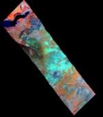
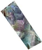
The transect is also represented by a HyMap image.
HyMap is a multispectral scanner, taken from a aircraft platform.
It's also a false colour composite, using the same bands as the Landsat satellite image above.
- Find out more about the HyMap image...
There are also a series of aerial photographs of the transect area. We have joined them together, to form this mosaic aerial image.
- Find out more about the aerial photography...
What now?
If you're a casual visitor, the virtual tour is a great place to start. It's a graphic-rich walk through the transect area introduced above. It will help you get a feel about what this area of the Dark Peak is like.
The Background to the Peak District introduces the area a little more.
The Themes pages are more detailed discussions about geography of the area: