This image was acquired on 18th June 2000 by BNSC and NERC for the SAR and Hyperspectral Campaign (SHAC).
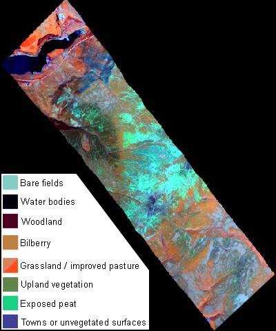
- HyMap is a hyperspectral sensor with 126 very narrow bands;
- i.e. there are 126 different images of the transect.
- Three have been used to make a false colour composite similar to the Landsat TM image
- It has the same spectral range as the Landsat TM image - from blue visible light to the longer wavelengths of near infrared and mid-infrared, but it doesn't have a thermal band like Landsat.
- The narrow bands allow more information to be extracted, for instance about peat composition and vegetation type and vigour.
- The aircraft carrying HyMap flew at an altitude of 1,500m so a very detailed image with 3m pixels was obtained.
- An image with 5m pixels is also available, acquired on the same day from 2,800m.
Other airborne images
Many other types of scanner images are acquired by aircraft. Visit the NERC Airborne Research & Survey Facility (ARSF) to find out about some of those available in the UK.
Radar
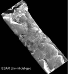
- A radar image was also acquired by a synthetic aperture radar (SAR).
- An example of one of its views is shown opposite.
- Radar can see through cloud, which was fortunate as it was raining with very low cloud when the image was acquired (3rd June 2000).
- Radar works like a torch shining sideways at the terrain, except that long wavelength microwave energy is used instead of light.
- It creates shadows and illuminates slopes facing the beam. This is why the NE facing slope of Torside Clough, Lady Clough and the Alport Valley are bright - they faced the radar beam.
- The SAR sensor sends out a pulse of microwave energy which hits the ground and is scattered back towards the sensor.
- Slopes facing the beam scatter lots of energy back towards the sensor, so they are bright - those facing away, or those that are very smooth scatter less so they are darker, i.e. the lighter the colour, the stronger the microwave beam was scattered towards the sensor.
- The brighter areas are those facing directly onto the beam which are rough surfaces and dry.
- The reservoir is very dark because its surface is smooth.
The plane carrying the SAR was travelling from NW to SE, on a track parallel to the transect, but well to the right. The sensor was looking SW-wards.
Radar images can also be acquired by SAR sensors carried on satellites.
Digital Elevation Model (DEM)s
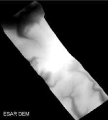
- An image of the height of the land was also obtained, known as a digital elevation model (DEM).
- It has been used to produce the block diagrams and slope profiles shown in the Virtual Tour at Alport, Sykes Moor and Torside.
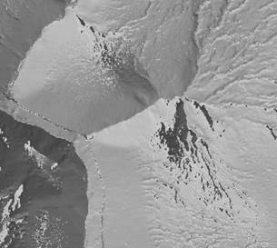
- DEMs are often made with LiDAR data, like the one below. LiDAR stands for light direction and ranging. The LiDAR sensor is mounted on an aircraft. A laser beam of light is used to scan the ground. The time taken for the pulse of light to return to the sensor is proportional to distance between the sensor and the ground; for instance, hilltops return the beam more quickly to the sensor. The flying height of the aircraft is known, so the height of the ground can be calculated.
- DEMs are often shown as hillshade images, like the one below of Nether North Grain. The sun position here is set to be in the northeast, so that north-facing slopes are illuminated. This may sound counter-intuitive, but is what we are used to seeing. See inverted relief.