Facts
- The Peak District National Park was the first National Park ever designated in Britain, formed in 1952.
- It covers 1438 square kilometres, nearly all of which is privately owned
- It contains a stretch of the Pennine Way, the first long distance country path
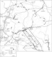
- The National Trust's High Peak Estate covers the southern half of the study area, south of Bleaklow.
Location
- It lies in the southern tip of the Pennines in the north midlands
- The majority of its area is in north Derbyshire but also covers parts of Cheshire, south east Lancashire, south west Yorkshire and north Staffordshire.
- It is surrounded by two industrial belts which include the towns of Sheffield to the east and Manchester and Macclesfield to the west.
- Air pollution from these cities has been cited as one of the causes of the decline in Sphagnum moss, the plant which forms blanket bogs
Purpose
The National Park's purpose is to...
- Conserve and enhance natural beauty, wildlife and cultural heritage
- Promote opportunities to understand and enjoy their special qualities
- Foster the economic and social-well-being of local communities
- The Peak District contains upland Heather moorlands which is a rare habitat worldwide, and blanket peat, an internationally scarce resource.
- The Peak District Biodiversity Action Plan (BAP) has been formulated to help protect these and other habitats in line with the EU Habitats Directive
The Landscape
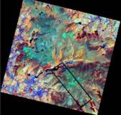
- The Peak District has often been describes as an 'island', a large rural landscape of contrasts surrounded by two industrial belts to either side.
- This can be seen on the Landsat TM satellite image
- Its landscape can be broadly categorised into 2 parts, each with their own individual characteristics:
1. The White Peak is the 'inner heart' of the Peaks.
- It sits on a relatively low Carboniferous Limestone plateau (300 - 450m above sea level), where wide basins, limestone dales of elm woodlands and gorges emerge from the landscape.
- The landscape has been incised by rivers creating distinctive features in the limestone scenery of arches and rock spires
2. The Dark Peak landscape is as its name suggests, is a dark and harsh environment, a stark contrast to the rolling dales of the White Peak which it encloses, forming the periphery of the Peak District.
- It is characterised by bleak, exposed moorland vegetation and a topography of steep slopes and cliff-like edges.
- It's climate is wet, cold and unpredictable. Rainfall exceeds 1650mm on the summits of Kinderscout and Bleaklow and in winter, temperatures can remain below zero degrees for over 8 hours a day.
- It is a high mountainous area (often reaching more then 600m above sea level) with an underlying geology of mudstones
- The mudstone geology, together with the climate give rise to peaty conditions in the Dark Peak
- These soils support siliceous vegetation (acid loving) which are much less diverse than those found in the White Peak
- The main vegetation habitats are Heather moorland, cotton grass moorlands and siliceous grasslands.
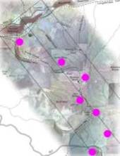
Now take the virtual tour to see what the Dark Peak is like
To find out more about the geographical issues raised here, visit the themes pages which consider geology, vegetation, peat, water quality & landslides in more detail (Recommended for those seeking more in-depth geographical discussions - casual users note that these pages focus on characteristics of the Dark Peak).
We strongly recommend that you take the virtual tour before delving into the more complex material in the themes pages.


