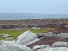
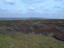
Northwest of Bleaklow summit, looking back towards the Longdendale valley, peat erosion is of a lesser extent with less exposure of the underlying material. The revegetated areas are usually lower than their surroundings, as shown in the photo as the lighter green vegetation.
See bilberry revegetation from the air.
The bilberry and heather area is managed by burning, Accidental fires, however, can cause deep burns into the peat itself, causing hardening and crusting of the peat's surface.
Take a look at the burnt areas from the air and familiarise yourself with what the area from the Hern Stones up to Bleaklow is like. (Hint: Burnt areas appear as a light mid blue tones on these images).
Once you've had a good look round Bleaklow Head, lets move on northwards to Sykes Moor.
> Next site: 6. Sykes Moor - from ground, air and space.
< Previous site: 5. Bleaklow.
< Start of tour.


