Alport Moor is just off the Snake Pass road (A57), towards the bottom of the transect map.

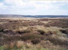
This picture right shows the view northeast from the position where the A57 crosses the Pennine Way.
The vegetation is a mixture of heather, cotton grass and Juncus (click on the picture right to learn more about these).
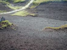
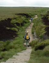
Where the Pennine Way runs through Alport Low, areas of bare peat can be seen.

To find out a bit more about how this exposure occurred.
To learn more about peat formation and erosion, visit the peat themes pages..
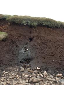
At Alport Low (and other locations throughout the virtual tour), piping can be seen in the peat:

- Groundwater in peat moves through different zones of the peat.
- Below the water table where the ground is fully saturated, water flows at a regional scale.
- Above the water table where the ground is not fully saturated, water may flow in soil pipes.
- Water flowing through pipes erode tunnels, which can vary in size from a few millimetres to several metres across (as seen here where peat meets mineral soil).
- Did you see the piping at Alport Moor?.
The virtual walk now continues up the Pennine Way, following it northwards towards Hern Stones. Here you'll see peat erosion and examples of typical moorland degradation.
> Next site: 4. Hern Stones.
< Previous site: 2. Alport Moor: (Peat Cores).
< Start of tour.
