The moorlands of Alport are typical examples of a less eroded and regenerating blanket peat landscape. Click the image to enlarge and add annotations.
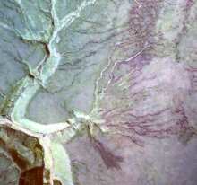
This aerial photo shows the Lady Clough landslide, Nether North Grain and Upper North Grain, two of the streams that drain from Alport Moor.
It shows the vegetation in its true colours - click on the image to see the vegetation labels.
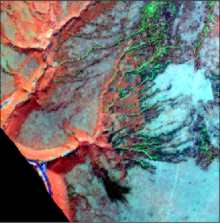
The image opposite shows another aerial image of the same area taken with a scanning sensor called HyMap
The image uses false colours as it is recording invisible light.
Click on the image to see an interpretation.
Notice how the aerial photo is easier to interpret because it uses true colours, but the HyMap image shows the exposed peat more clearly.

This diagram shows the slope profile NW-SE across Nether North Grain.
Click the image to see the location of vegetation types on the slope.
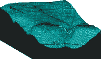
The location of the profile is shown on this block diagram.
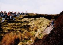
The peat has been exposed in many places (click on the photo to enlarge), but the peat on Alport Moor is less severely eroded than at Bleaklow (Site 5 on the tour).
For more information on the history of peat, visit the peat theme pages, which show how peat cores are used to reconstruct past environments.
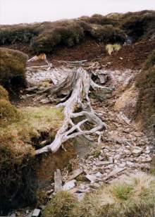
This 8,000 year old tree stump is a pine.
It is a remnant of woodland which once covered the uplands before the blanket peat formed.
It grew on the mineral soil (which now underlies the blanket peat)
The trees died as climate became wetter, or were felled, and became covered by the then newly forming blanket peat.
We can date the tree by examining its tree rings - a technique known as dendrochronology.
See the Hidden History section in the peat themes pages for more on the historic information contained within blanket peat.
Alport Moor is a suitable place to take a peat core.
> Next site: 2. Alport Moor (Peat Cores).
< Previous site: 1. Lady Clough.
< Start of tour.
