| Census | Topology | Info Maps | Info Landscapes | Info Spaces | ISP Maps | Weather Maps |
| Wireless | Web Site Maps | Surf Maps |
|
Sorry, the Cybergeography Research web pages are no longer being updated. The project ran from 1997-2004, but my research has moved away into other areas (see my blog for latest). If you have any questions or comments, please email me at: m.dodge (at) manchester.ac.uk. Cheers, Martin Dodge, February 2007. |
|
A range of maps of the
geographic structure of text-based virtual reality Multi-User
Dimensions (MUDs) and graphical 3D virtual worlds.
|
|
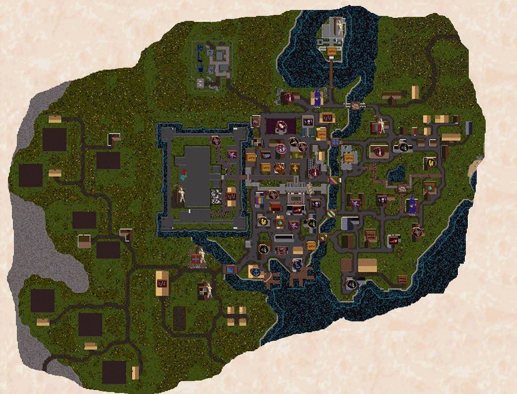
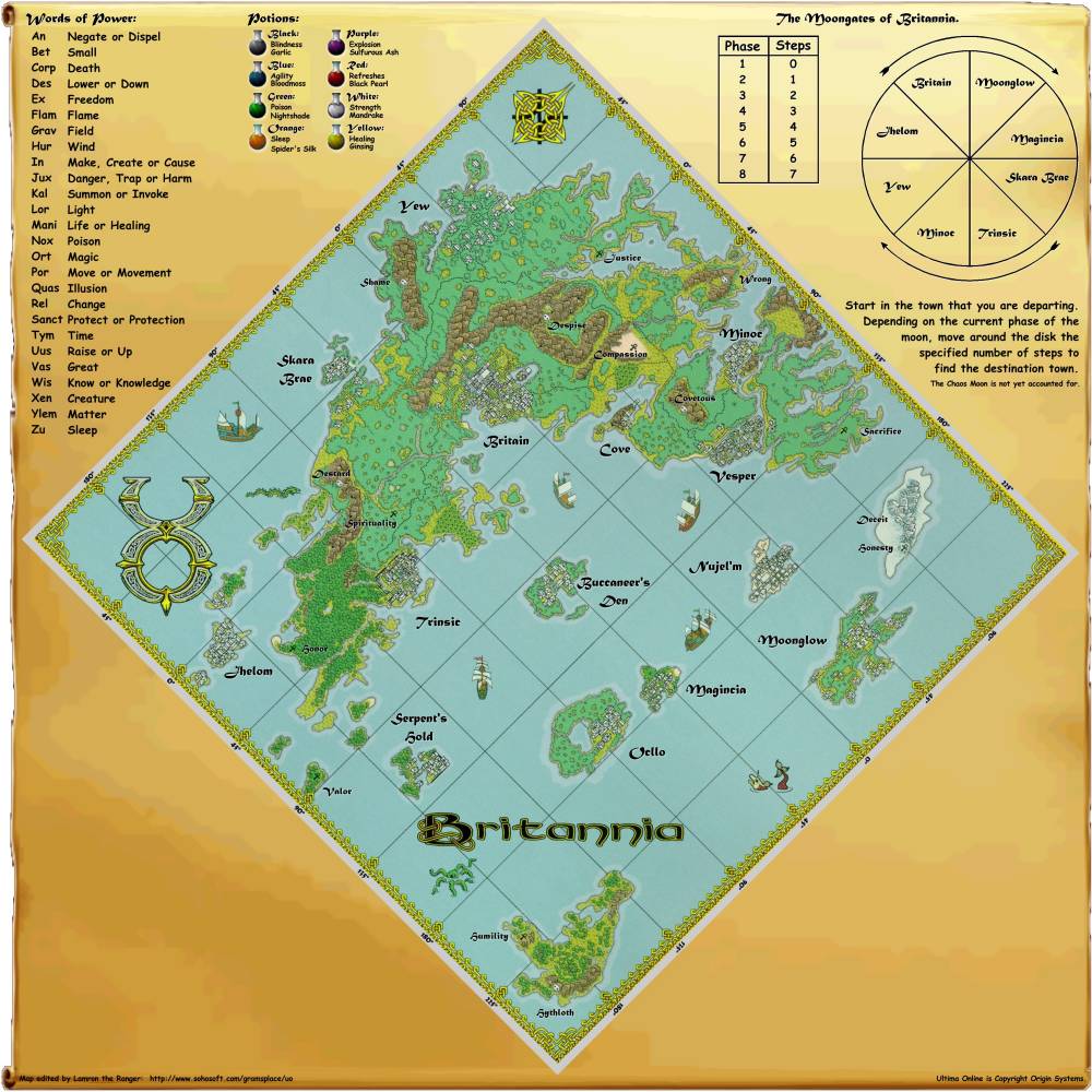
One of the most popular multi-player virtual worlds on the Internet is Ultima Online by Origin. This provides a huge land called Britannia for questing adventures. Gram has produced a great map of the land of Britannia. Further information on the geography of Ultima Online is available. Below, is a map of the City of Compassion from the The Grand Atlas of Britannia.
|
 |
![]()
 |
|||
|
|||
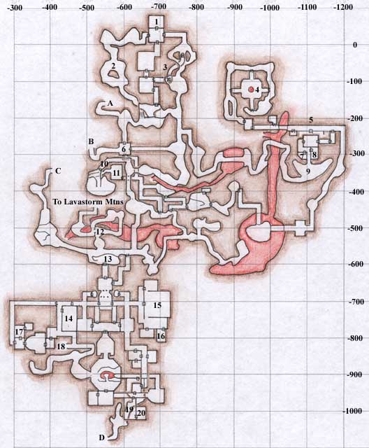 |
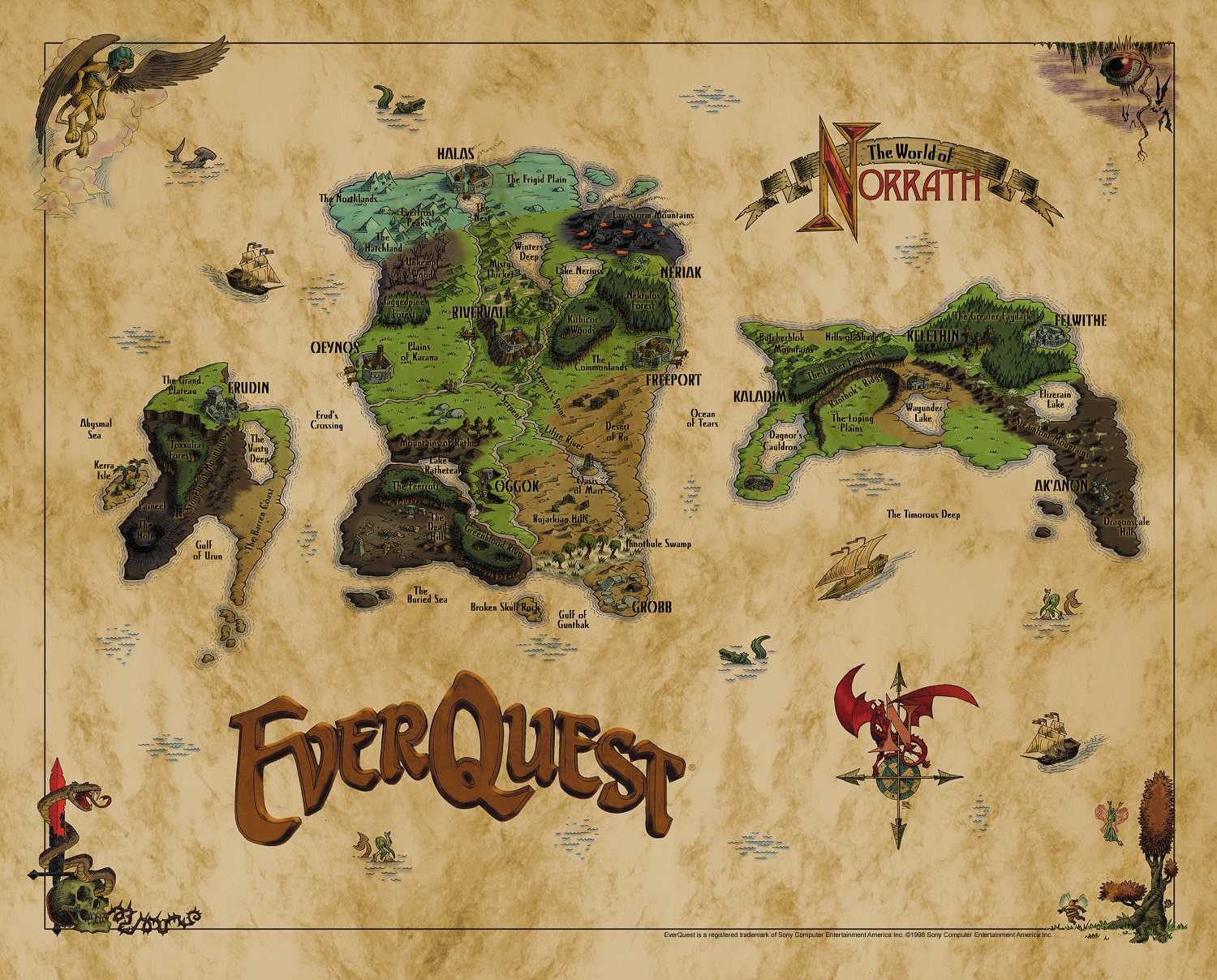
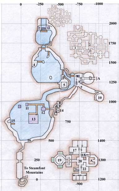
These maps are from the EQ Atlas created and maintained by Muse. This tremendous Atlas contains a huge wealth of maps and information on the geography of EverQuest. The map on the left shows the cavernous realm known as Solusek's Eye on the main island of Antonica. The right-hand map is of the city of Ak'Anon, 'nestled in the Steamfont Mountains on the southern edge of Faydwer'.
|
 |
|
 |
 |
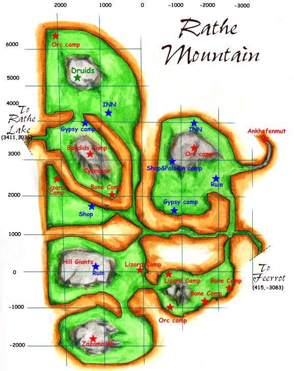
| The map above shows the Rathe Mountains and is available from Chizuyu's Map Shop of the Norrath. |
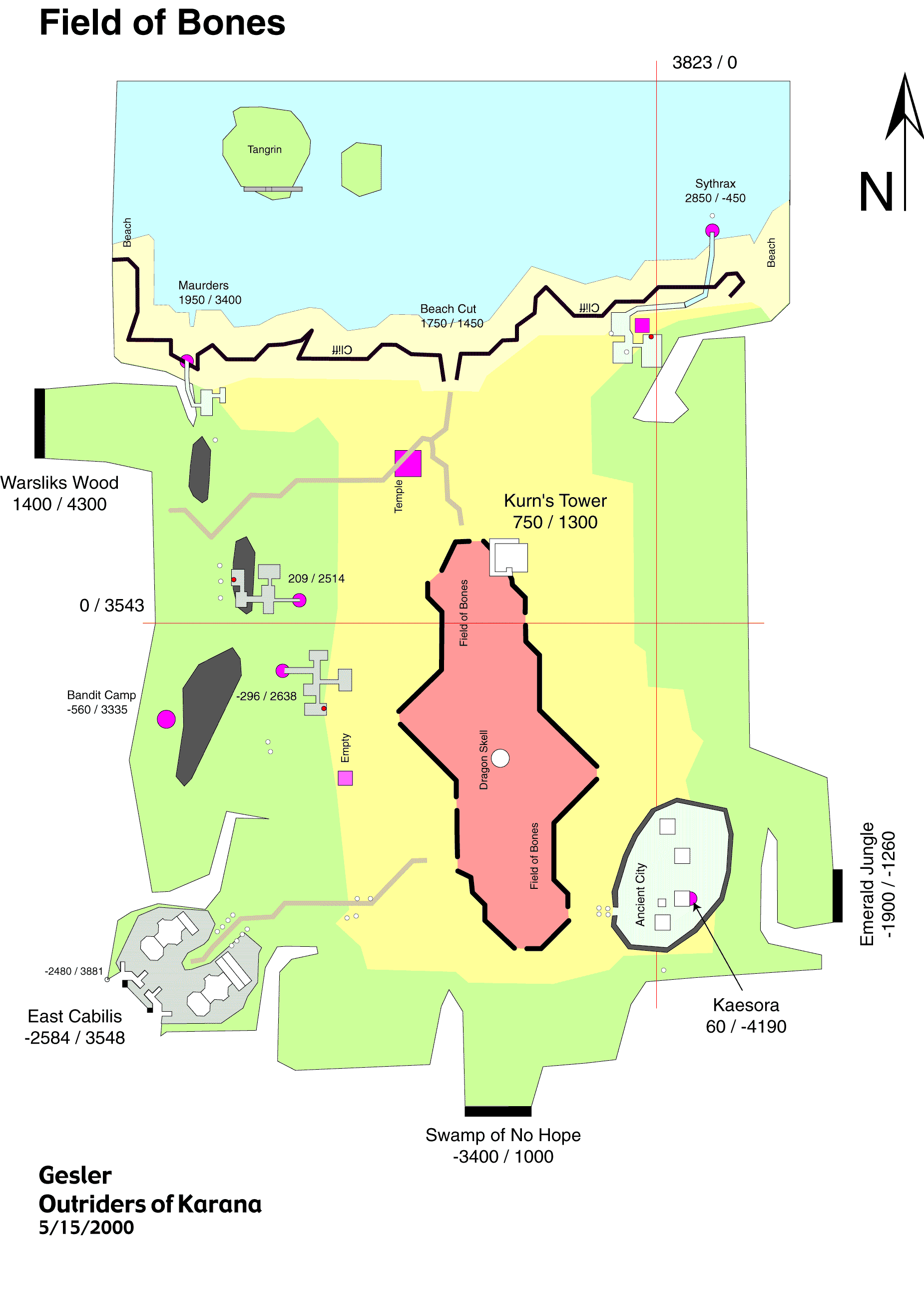
The Outriders of Karana in their Kunark
Mapping Project produced the above map of the Field
of Bones.
|
![]()
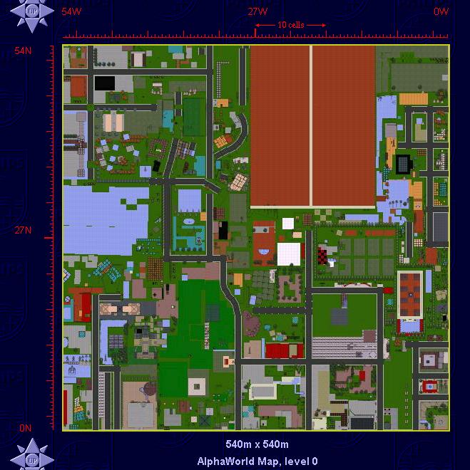
| "Satellite" maps of a growing city in AlphaWorld, a huge 3D multi-user virtual world run by ActiveWorlds. The maps were produced by Roland Vilett at different snap-shots over the past five year and by comparing them you can clearly see the rapid urban development in this particular corner of cyberspace. |
 |
 |
|
AlphaWorld in December 1996
|
AlphaWorld in February 1998
|
 |
|
|
A small portion of the latest
AlphaWorld satellite
map from August 2001.
|
|
|
[For more information see the Map of the Month article "Mapping a Virtual City" in Mappa.Mundi Magazine.] |
|
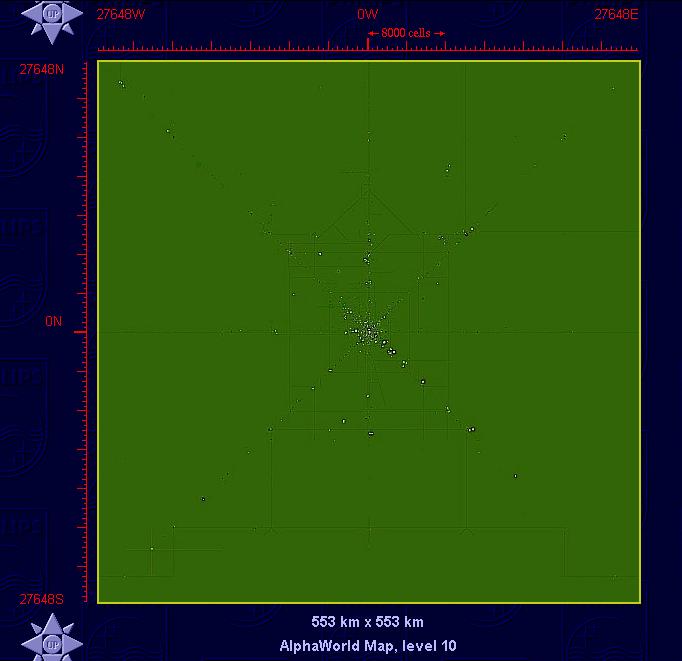
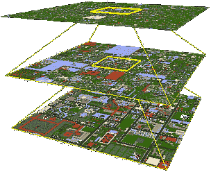
| Greg Roelofs and Pieter van der Meulen, while working at the Advanced Technology Group at the Philips Multimedia Center (PMC) in Palo Alto, California, developed a sophisticated multi-scale map of AlphaWorld. Using their marvelous map it is possible to explore geography of AlphaWorld through a range of scales, at its most detailed the map provides an aerial-photo style view of streets and buildings. |
|
|
| Level 0 | Level 10 |
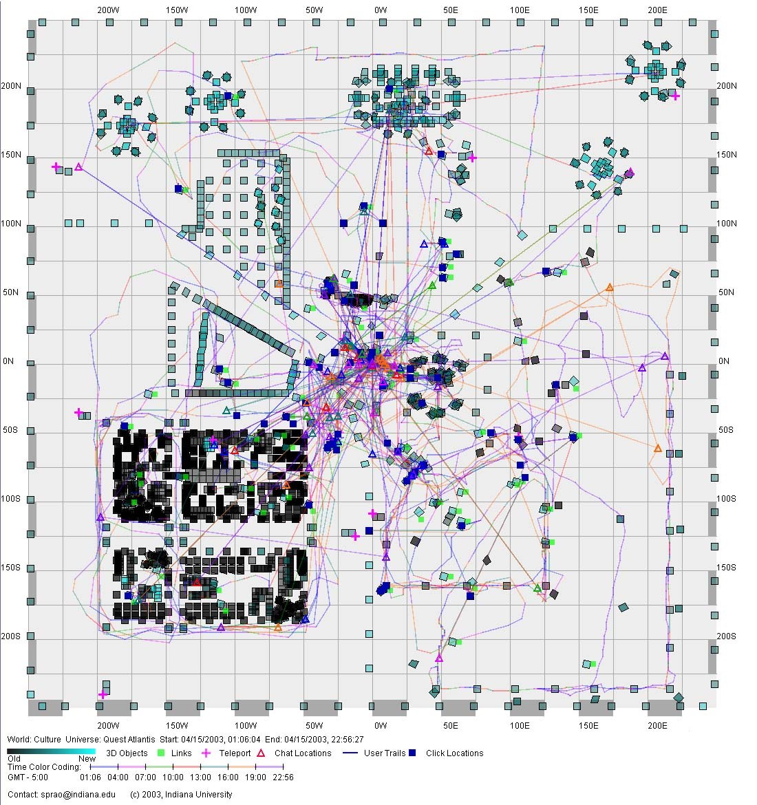 |
The map shows user trails over time. It was produced using a visualisation tool developed by Katy Börner, Shashikant Penumarthy and colleagues at the School of Library and Information Science, Indiana University. The gallery page give more examples. This research paper gives more details on their
analysis: "Visualizing
the Spatial and Temporal Distribution of User Interaction Data
Collected in Three-Dimensional Virtual Worlds", by Katy
Börner, William R. Hazlewood and Sy-Miaw Lin. |
|
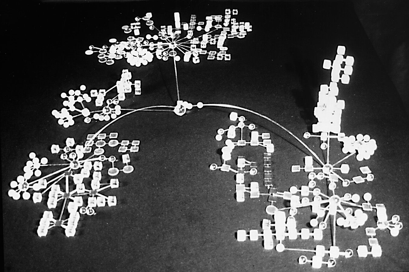
The map below shows the topology of the public 'rooms' at the centre of BayMOO using a physical plexiglas model. It was created by Peter Anders and his students by Thomas Vollaro and Susan Sealer. More information on the conceptual development of the BayMOO 3D model is available. For more information on Peter Anders work mapping MUDs see his paper, "Envisioning Cyberspace: The Design of Online Communities", Fifth International Conference on Cyberspace, June 1996. |
| A detailed, hand-drawn, topology map of part of the Discworld MUD. This MUD is based on the detailed geography of Terry Pratchett books. The map was originally created by the MUD player 'choppy', as is part of a comprehensive atlas of Discworld MUD. |
| A map of part of FurryMUCK, a MUD based around the role-playing theme of anthropomorphics (the giving of human-like qualities to animals). The map is one set of maps originally created by Tom Turrittin and now updated and maintained by FurryMUCK player 'quill'. |  |
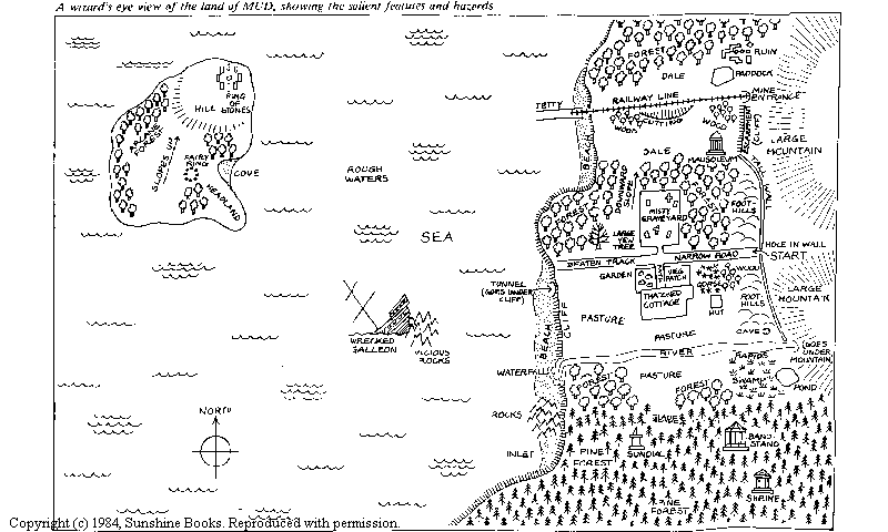
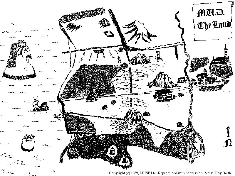
| Sketch maps
of the original Essex MUDs from Richard
Bartle, who pioneered MUDs in collaboration with Roy
Trubshaw. They run their company MUSE
which develops MUDs.
The map above is of MUD1 from 1984 and the map below is a 'birds-eye' sketch map of MUD2. More historical information on the Essex MUDs is available. |
Julian Dibbell, "My
Tiny Life: Crime and Passion in a Virtual World",
(Fourth Estate, 1999).
[Buy
the book from Amazon.com and support Cyber-Geography Research]
Peter Anders, Envisioning
Cyberspace: Designing 3D Electronic Space,
(McGraw-Hill, 1998).
[Buy
the book from Amazon.com and support Cyber-Geography Research]
Mapping MUDs, Mappa.Mundi Magazine.
Qvortrup L., (ed.), 2002, Virtual
Space: Spatiality in Virtual Inhabited 3D Worlds,
Springer: London.
[Buy
the book from Amazon.com and support Cyber-Geography Research]
Snowdon D.N., Churchill E.F., and Frecon E. 2003, Inhabited Information Spaces: Living with your data, Springer.
|
Sorry, the Cybergeography Research web pages are no longer being updated. The project ran from 1997-2004, but my research has moved away into other areas (see my blog for latest). If you have any questions or comments, please email me at: m.dodge (at) manchester.ac.uk. Cheers, Martin Dodge, February 2007. |