| Census | Topology | Info Maps | Info Landscapes | Info Spaces | ISP Maps | Weather Maps |
| Wireless | Web Site Maps | Surf Maps | MUDs & Virtual Worlds | Historical |
|
Sorry, the Cybergeography Research web pages are no longer being updated. The project ran from 1997-2004, but my research has moved away into other areas (see my blog for latest). If you have any questions or comments, please email me at: m.dodge (at) manchester.ac.uk. Cheers, Martin Dodge, February 2007. |
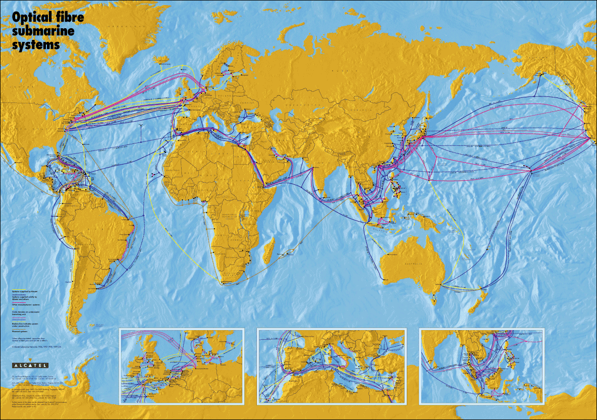
| Terrestrial high-speed fibre optic network, long-haul submarine cables and telecommunications satellites provide the vital infrastructure that wires the world together. Maps are used to plan, manage and promote this infrastructure. |
|
A street level route map of the fibre-optic backbone in the city of Palo Alto, California. The map shows the routes as of April 2000. The network is operated by the City of Palo Alto Utilities. |
 |
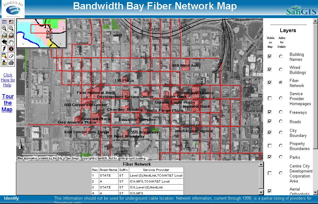 |
This image is from Bandwidth Bay interactive network map which allows you to explore the fiber optic networks and wired buildings in downtown San Diego. The interactive map was developed by the San Diego Geographic Information Source. "A Tour of the Bandwidth Bay Fiber Network Map", a paper by Andrew G. Abouna gives more technical details on the map. |
|
A map of the fibre optic cables in downtown Philadelphia, produced by the Central Philadelphia Development Corporation. The thicker and darker the red, the more fibre-optic cables run down that street. The yellow diamonds are locations of telecoms hotels. |
|
|
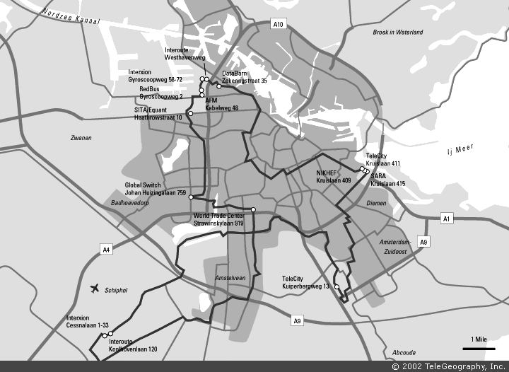
TeleGeography's metropolitan
area networks report provides technical data and detailed
maps on many network providers in major U.S. and European cities. |
|
![]()
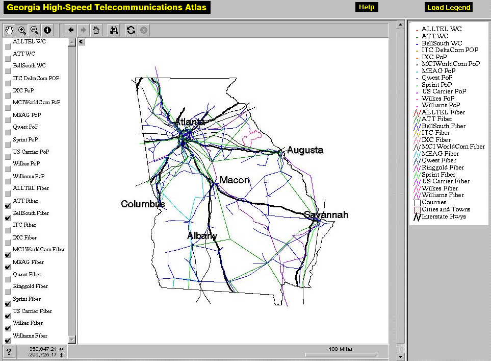 |
The Georgia High-Speed Telecommunications Atlas provides detailed route maps of multiple fibre optic network providers within the state. The atlas uses an interactive mapping system, shown opposite, allowing you to explore the data fully. It is being developed by the Georgia Center for Advanced Telecommunications Technology and the Center for Geographic Information Systems. Below is an example of their print quality maps. |
|
Further information is given the
paper "Georgia
High-Speed Telecommunications Atlas: An ArcIMS Implementation",
by Steven P. French and XuDong Jia.
|

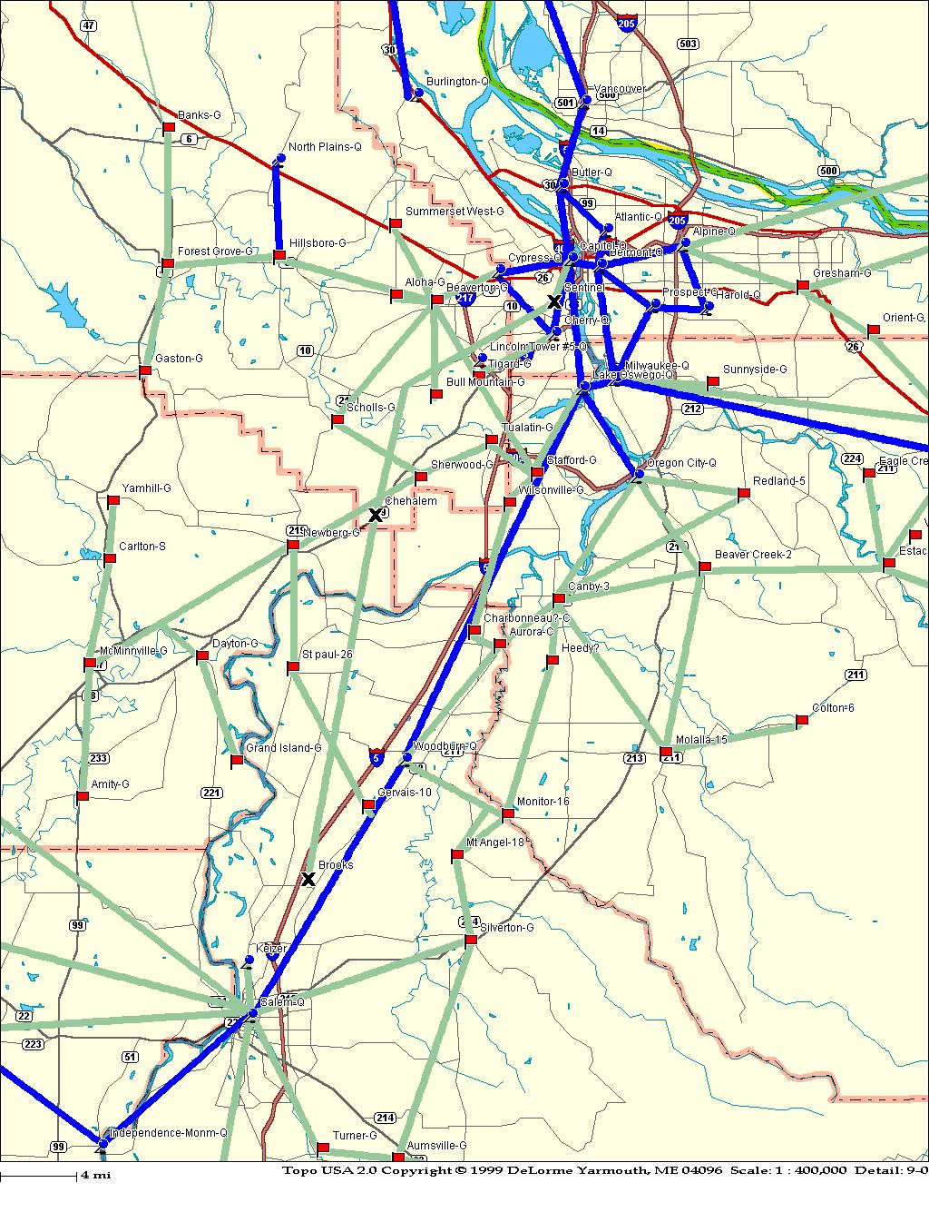 |
Detailed map of the fibre optic
routes in the metropolitan region of Oregon, USA. A series
of maps are available for the whole state, produced by the
Oregon Economic & Community Development Department.
|
![]()

|
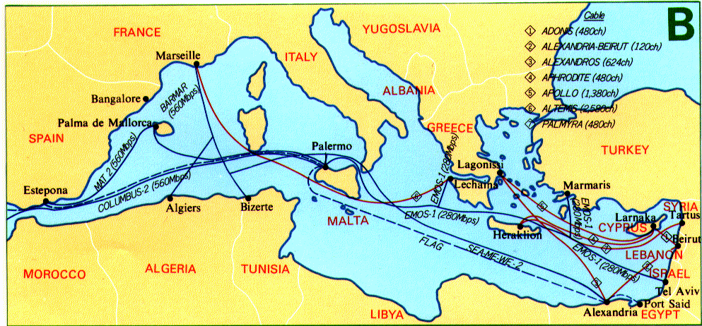
A map from KDD Submarine Cable Systems Inc. showing the submarine cable infrastructure in the Asian region in 1996. KDD is a major telecommunications company and its submarine cable division is one of the leading contractors laying and maintaining cables around the world. Below is an another map from KDD showing the cable infrastructure for the Mediterranean region in 1996. |
![]()
 |
 |
|
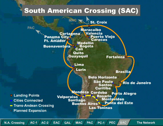
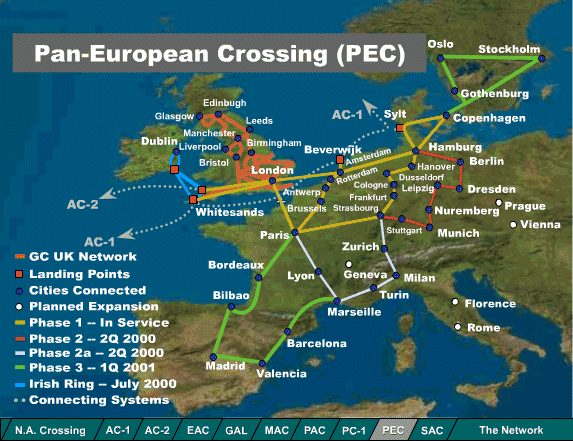
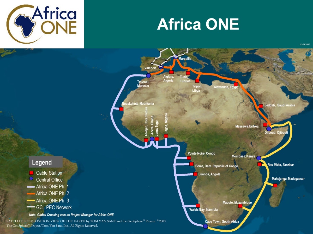
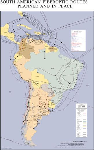
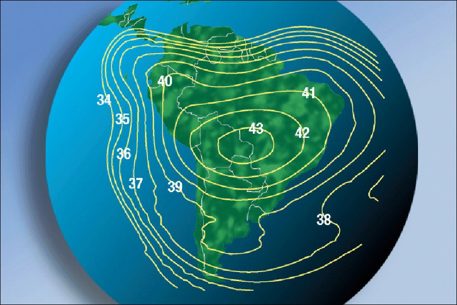
Maps of the network infrastructure of Global Crossing, one of the leading network operators. These maps show the state of built and planned networks in South America and Europe, in spring 2000. See their network map. |
![]()
| |
 |
![]()
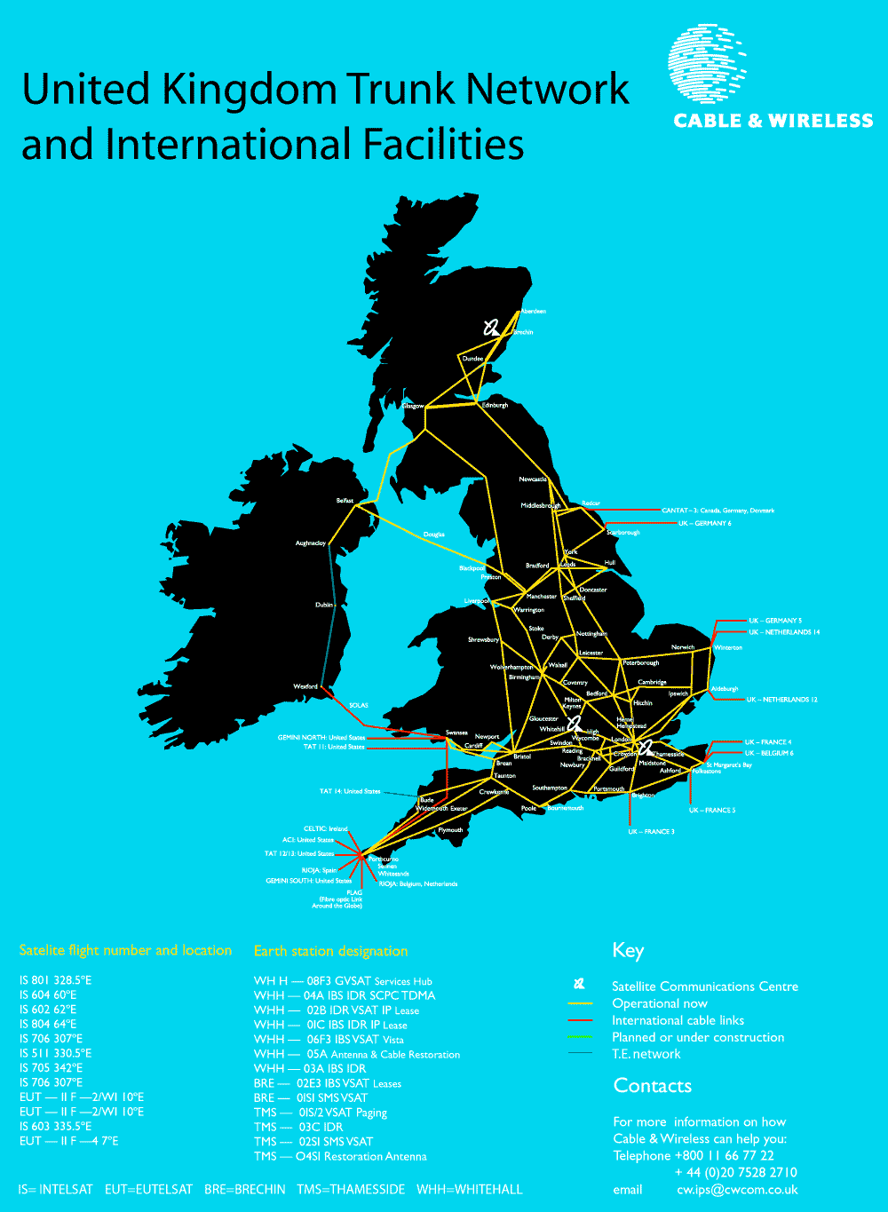 |
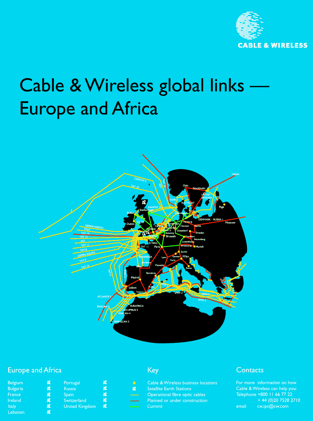
Cable & Wireless is global telecommunications carrier operating undersea cables in many different regions of the world. The maps show Cable & Wireless's UK and European network facilities. |
| The TeleGeography, Inc. research consultancy tracks the global geography of submarine and satellite telecommunications infrastructure. They publish detailed maps, like the one show opposite. | 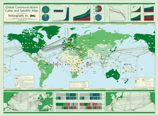 |
 |
KMI Corporation specialises in research on fiber-optic markets and they produce a series of maps of land and submarine cable infrastructure. A small example is on the left. |
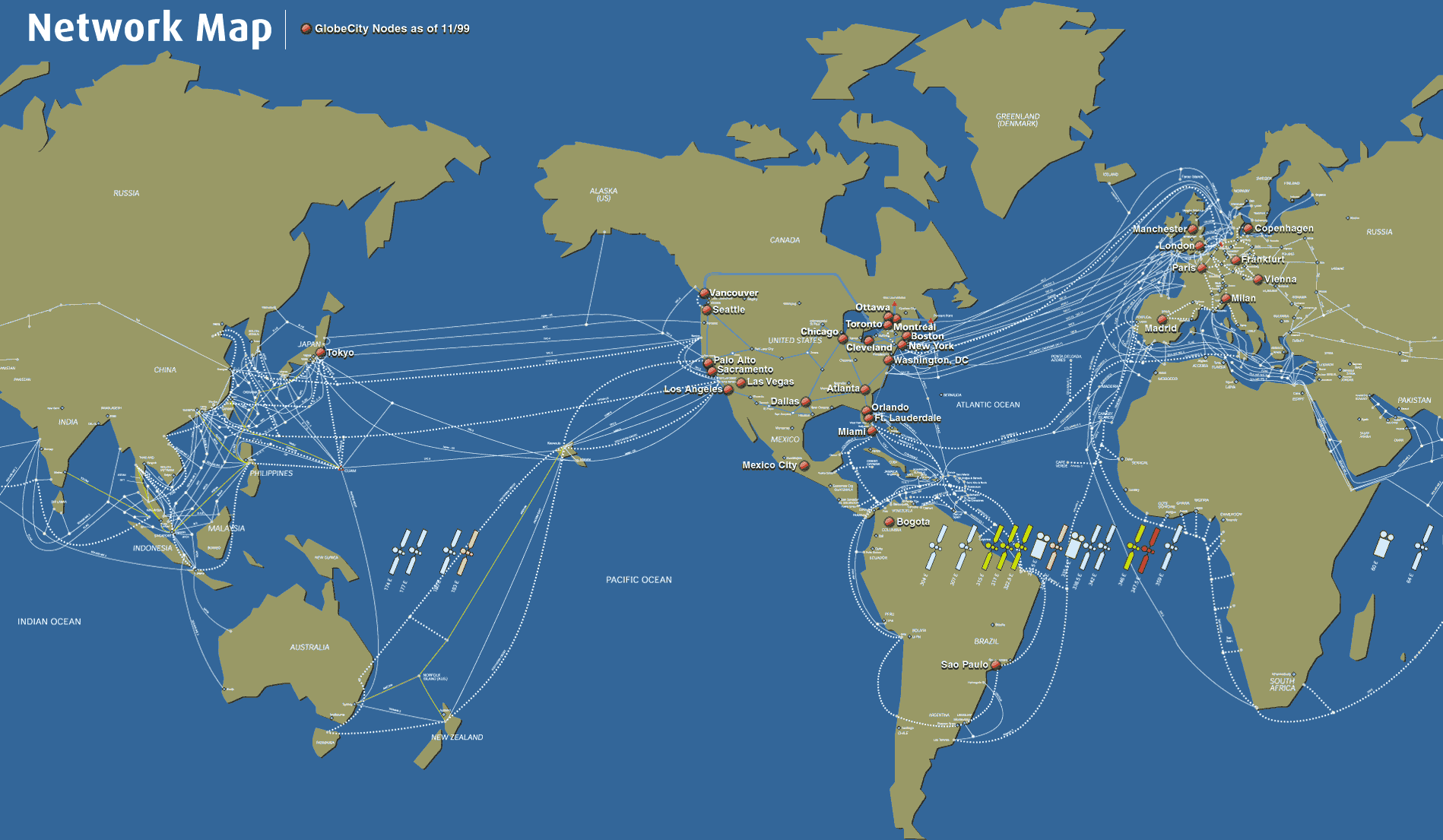
| The cable and satellite infrastructure of Teleglobe Inc., a global telecommunications corporation, as of November 1999. |
![]()
|
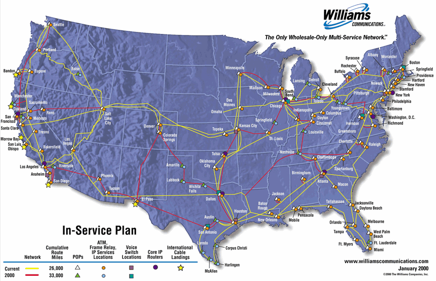
A map of the extensive fibre
optic network of Williams
Communications spanning much of the USA. The map shows the
extent of the network as of January 2000. For the latest information
you should consult their interactive
map.
|
![]()
| For further information on
submarine cable infrastructure see the comprehensive resource "Submarine Cables of the World
WWW Information Page", maintained by the International Cable
Protection Committee.
Also, see the article "Mother Earth Mother Board" by Neal Stephenson, from Wired (December 1996) where he looked at the FLAG project. The article "Evolution of a Wired World: the growth of an undersea, international network" by Susan Dumett in Pretext Magazine (March 1998) traces the history of submarine cables. |
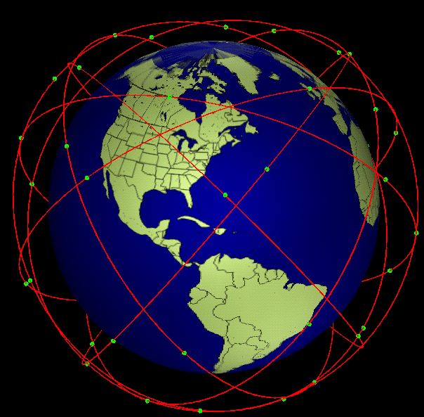
| Constellations of satellites, such as the Teledesic system,
are being deployed to provide global network infrastructure. The SaVi
(satellite visualization) system can visualise the orbital
patterns of these satellites as shown in the example images here. SaVi
was originally developed by Robert Thurman and Patrick Worfolk, in The
Geometry Center, University of Minnesota.
Click on the image on the right to see an animated version (536KB). |

|
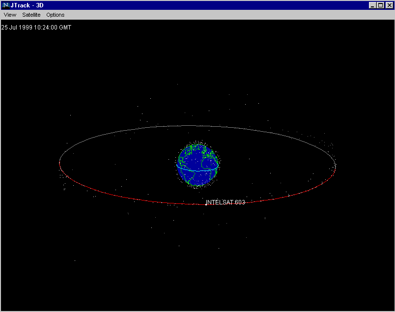
| This image shows J-Track 3D, an interactive visualisation of satellite tracks created by the Mission Operations Laboratory at NASA's Marshall Space Flight Center. |
![]()
|
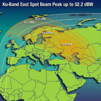
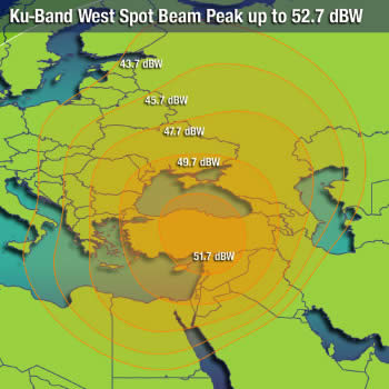
These are footprint
maps which show the geographic coverage of Intelsat
communications satellites in different regions of the world.
|
|
 |
 |
 |
 |
|
These footprint maps show the
coverage of Telstar
8 and Telstar
5 telecommunications satellites. The Telstar fleet of
satellites is operated by Loral
Skynet.
|
|
![]()
|
Sorry, the Cybergeography Research web pages are no longer being updated. The project ran from 1997-2004, but my research has moved away into other areas (see my blog for latest). If you have any questions or comments, please email me at: m.dodge (at) manchester.ac.uk. Cheers, Martin Dodge, February 2007. |