| Census | Topology | Info Maps | Info Landscapes | Info Spaces | ISP Maps | Weather Maps |
| Wireless | Web Site Maps | Surf Maps | MUDs & Virtual Worlds |
|
Sorry, the Cybergeography Research web pages are no longer being updated. The project ran from 1997-2004, but my research has moved away into other areas (see my blog for latest). If you have any questions or comments, please email me at: m.dodge (at) manchester.ac.uk. Cheers, Martin Dodge, February 2007. |
| A range of the historical maps of ARPANET, the Internet, Usenet, and other computer networks, tracing how these pioneering networks grew and developed. |
 |
The pioneering research of Paul Baran in the 1960s, who envisioned a communications network that would survive a major enemy attacked. The sketch shows three different network topologies described in his RAND Memorandum, "On Distributed Communications: 1. Introduction to Distributed Communications Network" (August 1964). The distributed network structure offered the best survivability. |
![]()
|
(Scanned from Where Wizards Stay Up Late: The Origins of the Internet, by Katie Hafner and Matthew Lyon, page 50.) |
 |
![]()
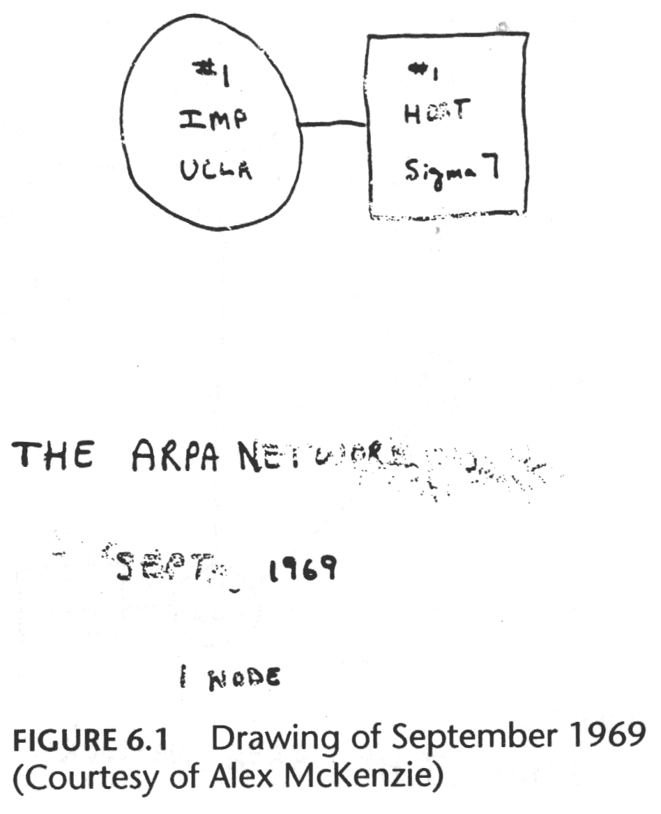
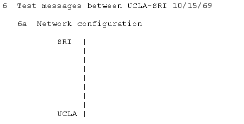
| The first
node on ARPANET at University California Los Angeles (UCLA) on the 2nd
of September 1969. (Source : "Casting the Net", page 55) |
 |
|
|
![]()
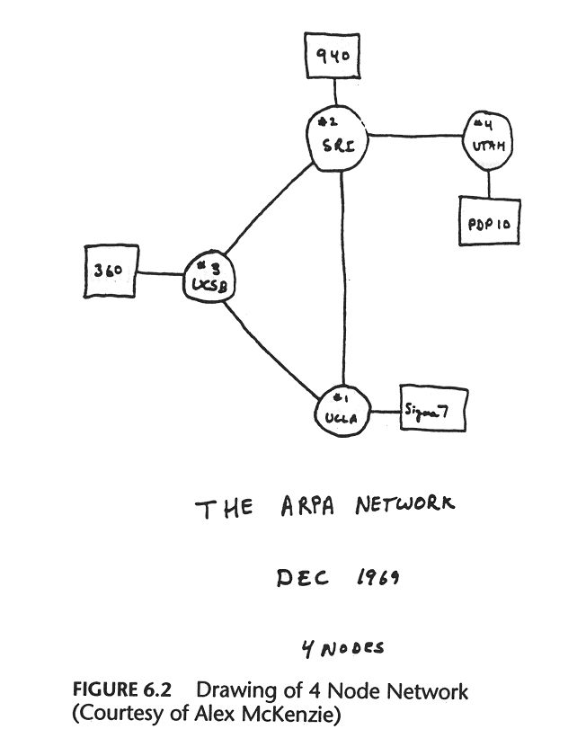
| By the end of
the year there are four nodes on the "ARPA NETWORK", as shown in
schematic above. These were University of California Los Angeles
(UCLA), University of California Santa Barbara (UCSB), University of
Utah and the Stanford Research Institute (SRI). (Source : "Casting the Net", page 56. See also The Computer Museum's Timeline.) |
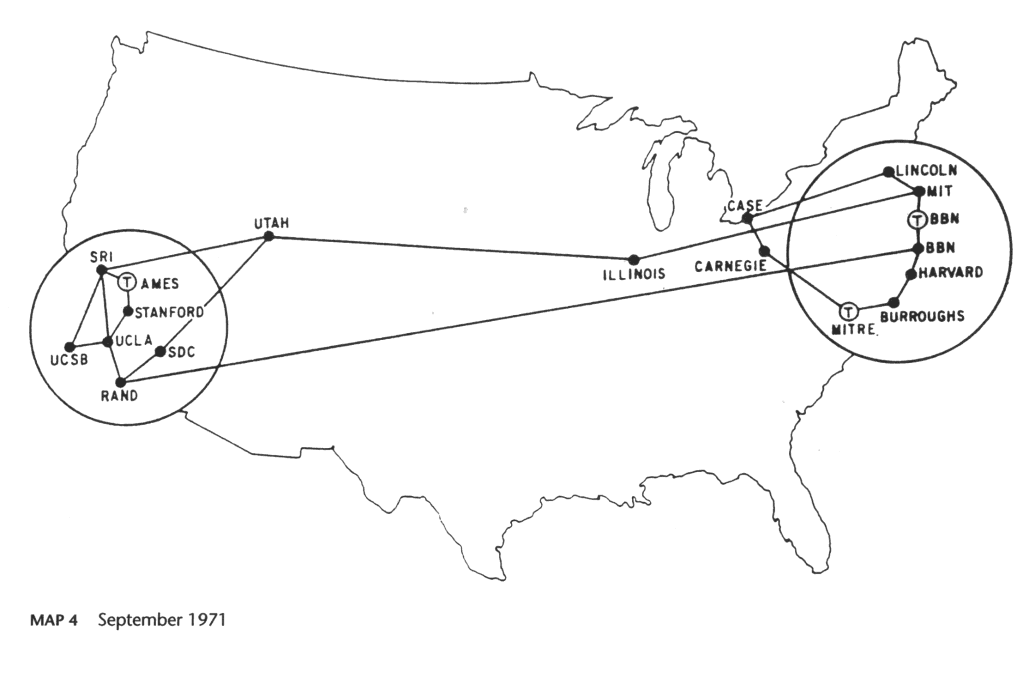
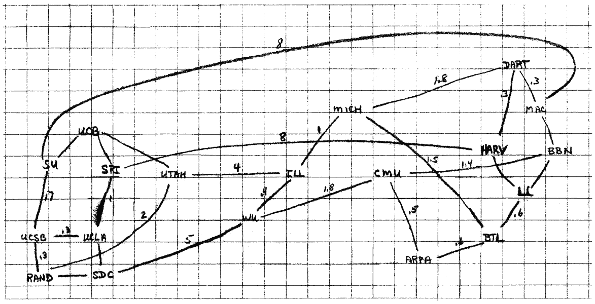
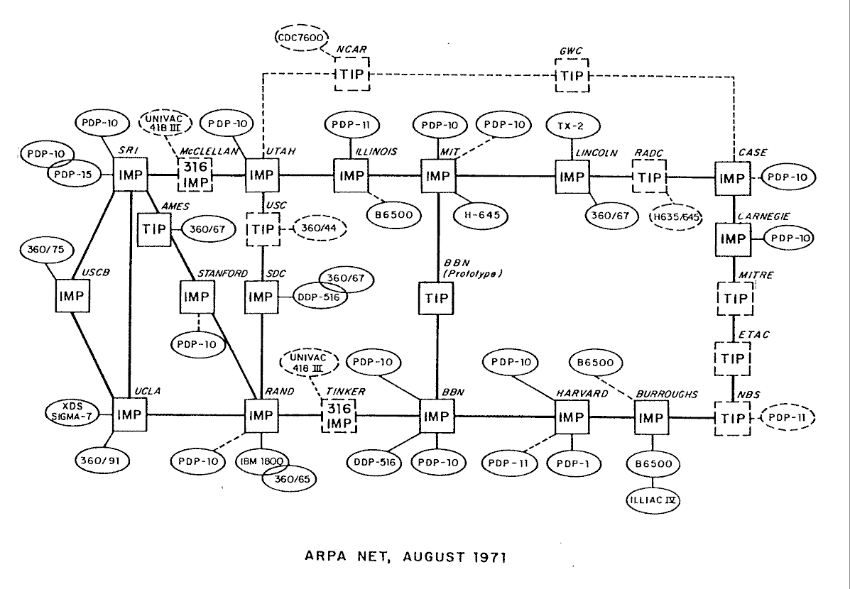
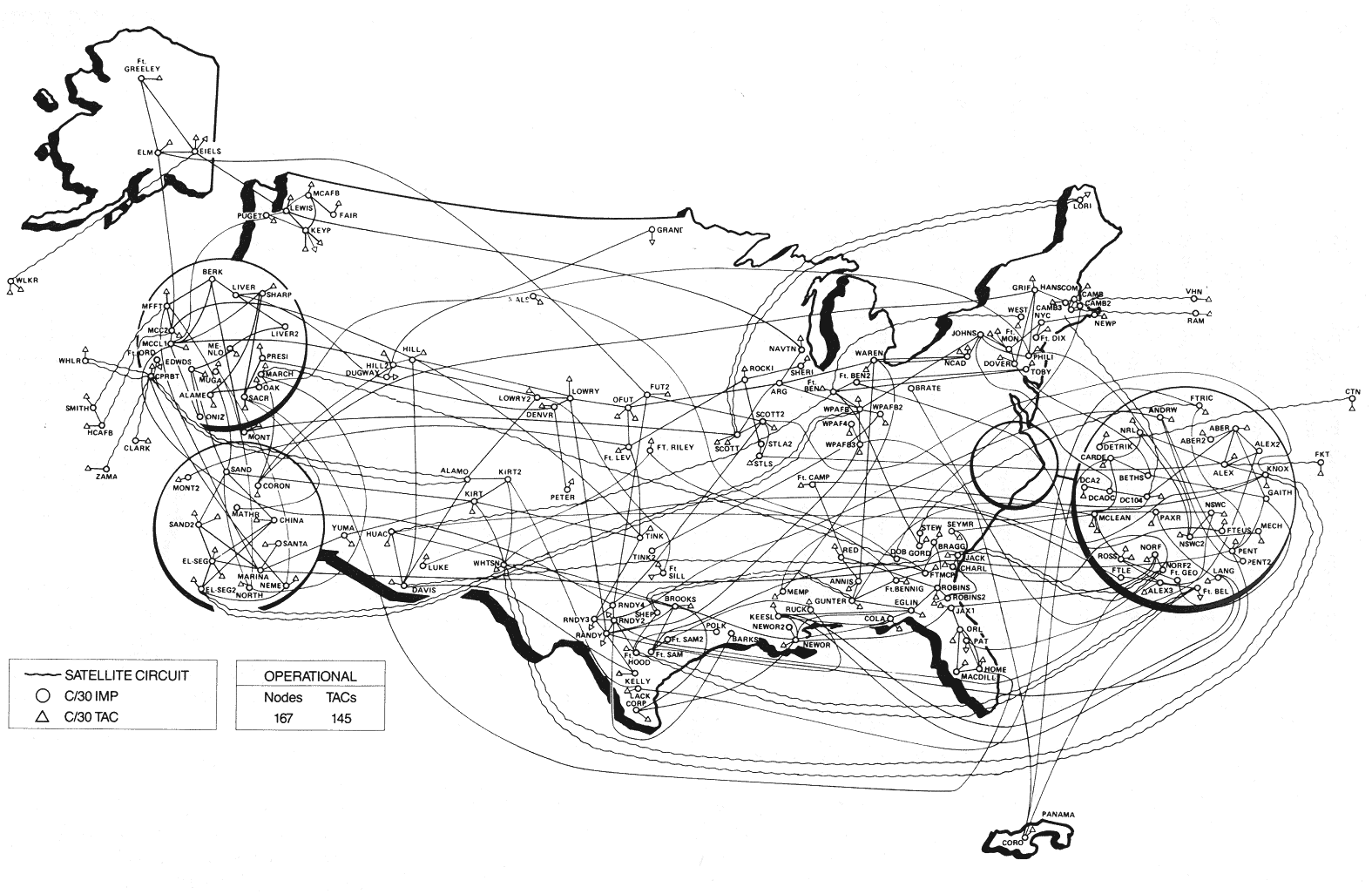
| ARPANET grew
rapidly as more sites are connected. The map above shows the situation
in September 1971 and the one below is from October 1980, which
includes a packet satellite link UCL in London. (Sources : "Casting the Net", page 64; CCR, page 93) |
 |
 |
|
|
|
 |
 |
|
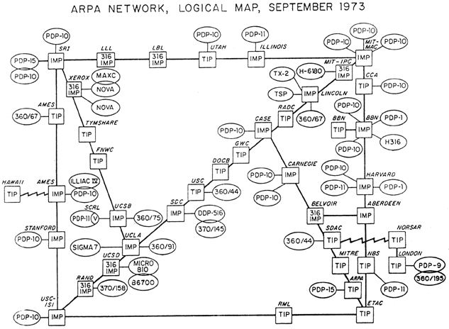
RFC-432
Network Logical Map, has a similar map of ARPANET |
|

|
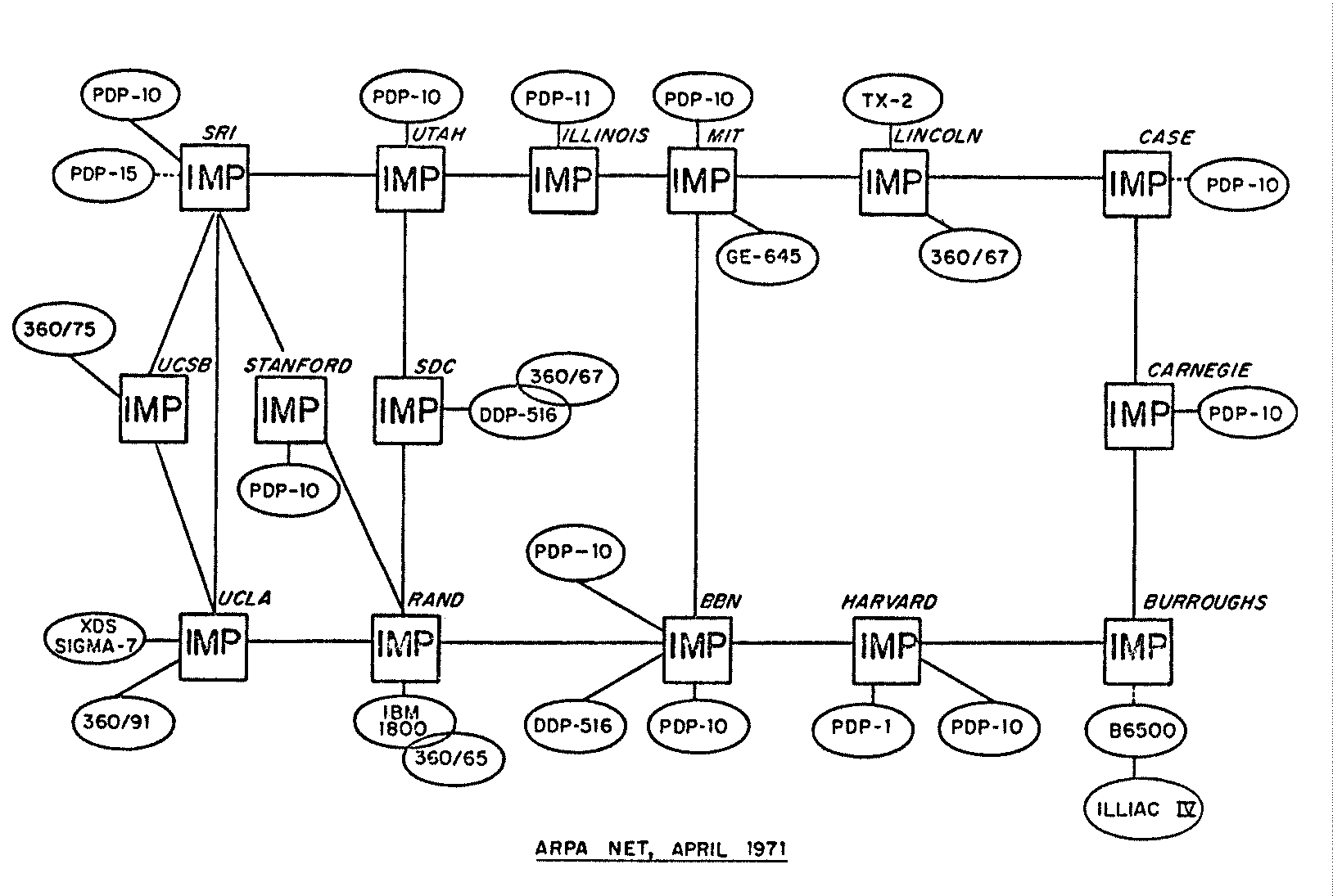
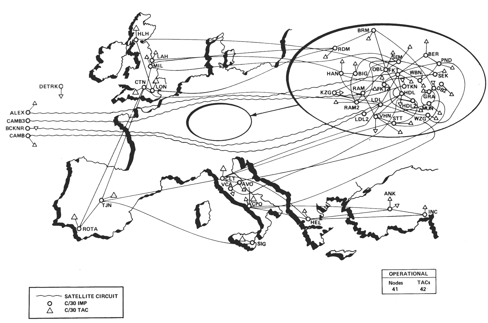
The map above shows the topology
of ARPANET in March 1977. It was scanned by Larry Press from the ARPANET
Completion Report, Bolt, Beranek and Newman,
Burlington, MA, January 4, 1978.
|

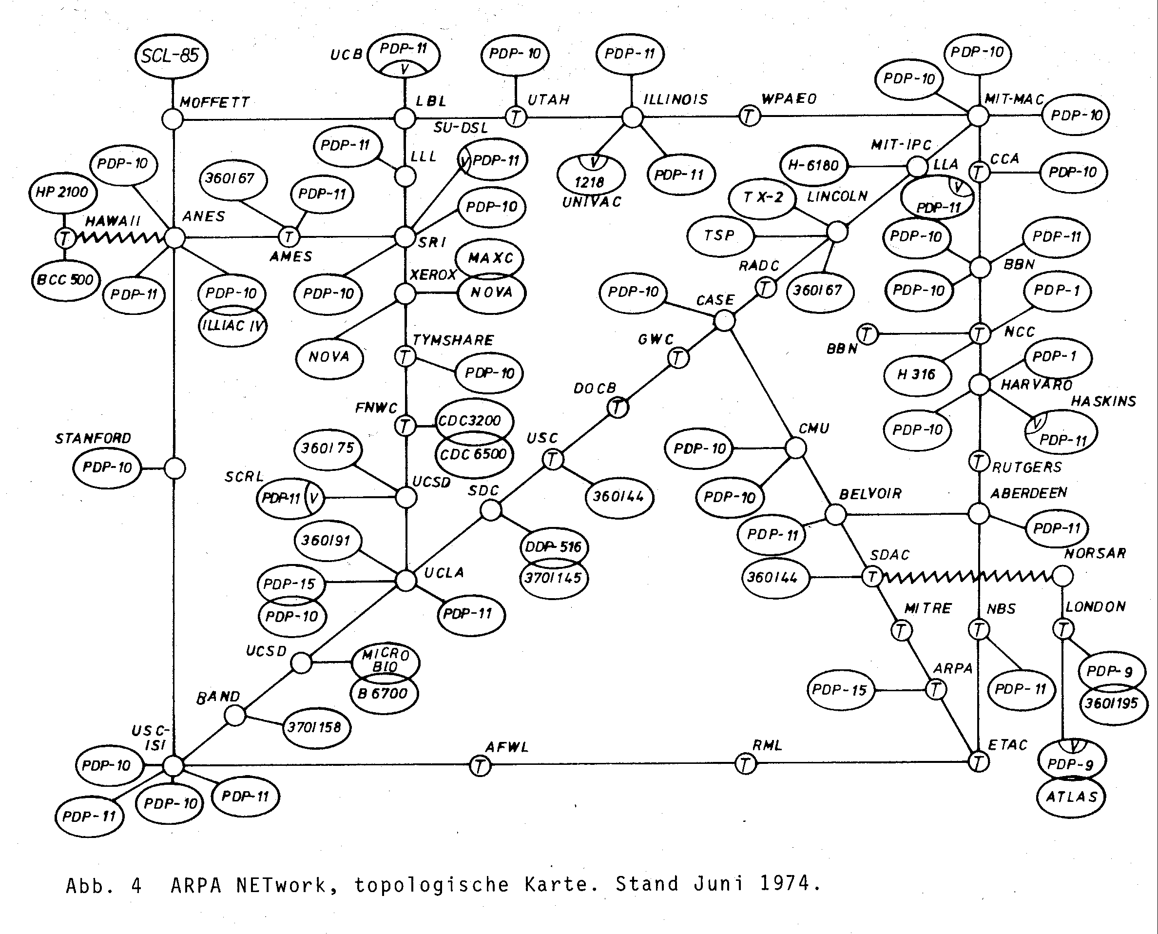
| [For more information on this map see the Map of the Month article "ARPANET, October 1980" in Mappa.Mundi Magazine.] |
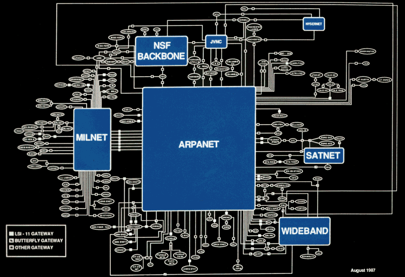
| This interesting looking map shows the state of the core of the Internet in August 1987. It could be described as the "Internet on a chip". This coloured version was provided by Craig Partridge. |
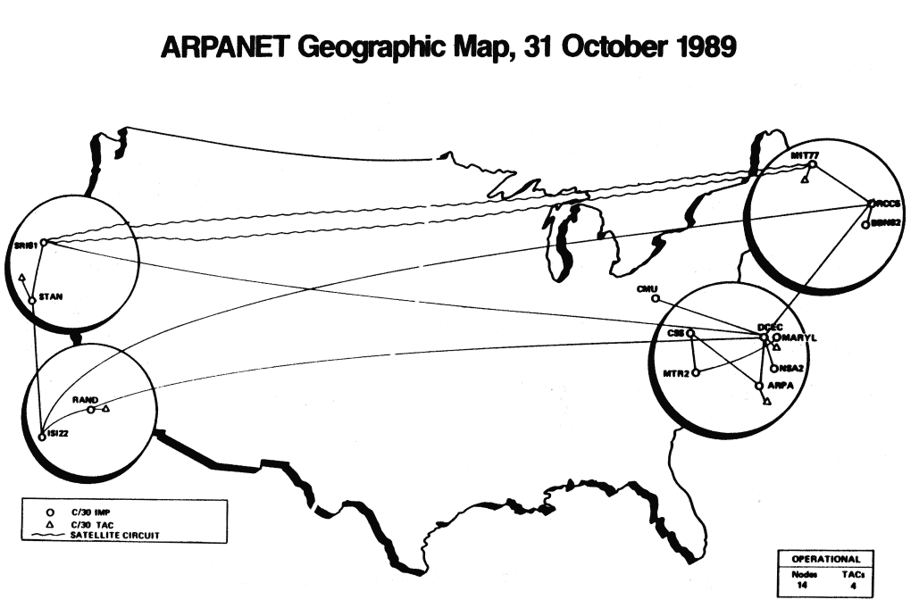
| The state of ARPANET in October 1989, near the end of its life, with only a few nodes left. It was finally decommissioned in 1990 having been largely replaced by NSFNET. (Source: CCR, page 110) |
![]()
 |
|
|
 |
USENET in 1981.
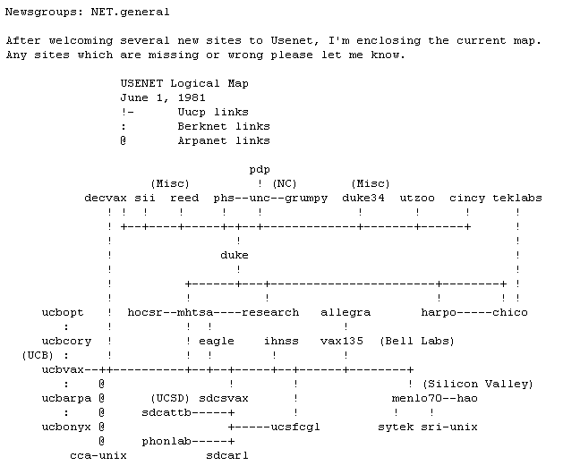
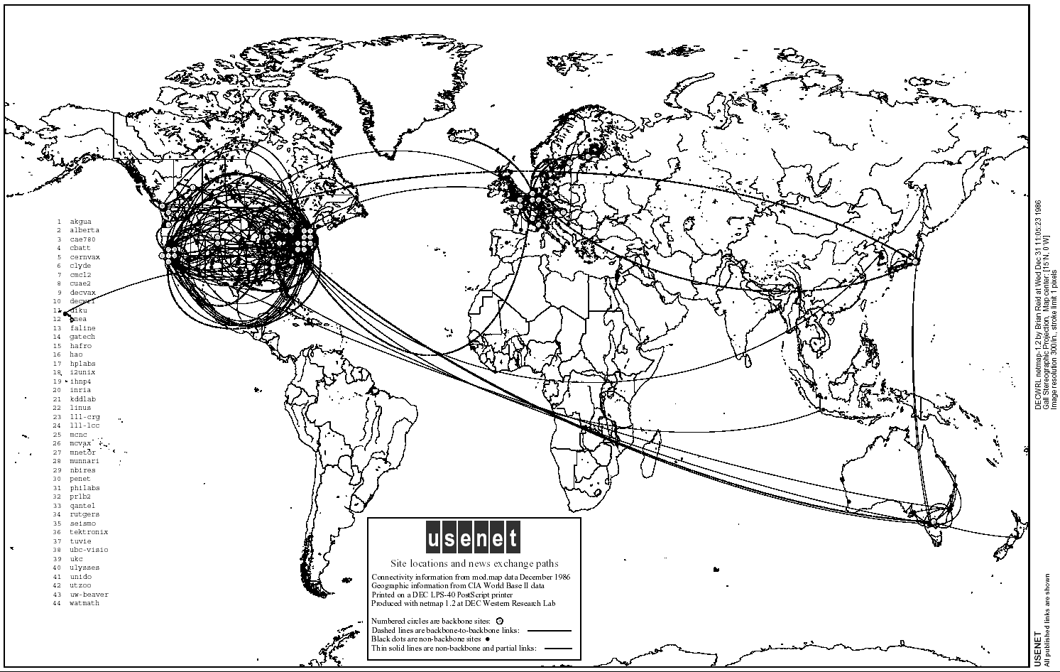 |
The map was one of the first produced by Brian Reid as
part of a decade long USENET monitoring project. For details see the
Map of the Month article "Flowing from
site to site", Mappa.Mundi Magazine, May 2001. |
![]()
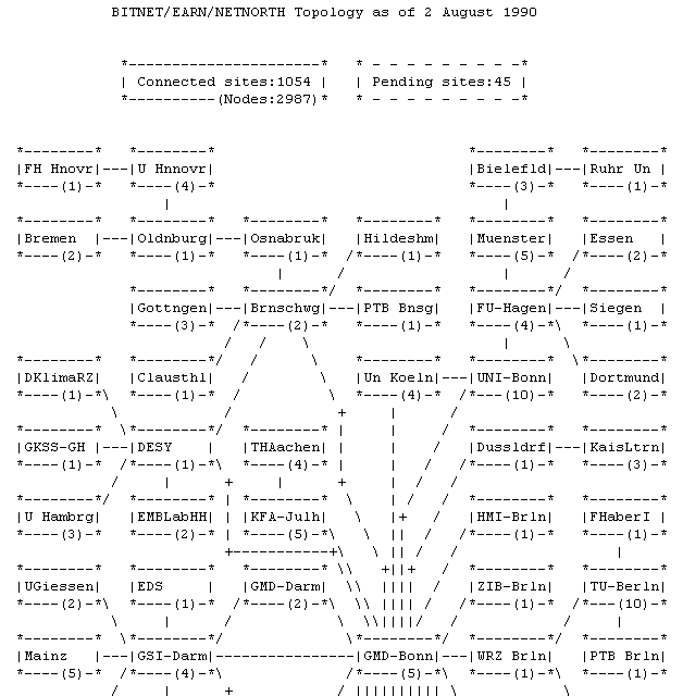
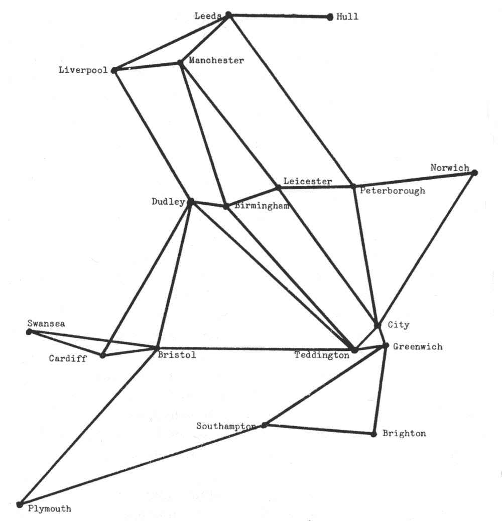
The topology of the BITNET in 1981 (partial map)
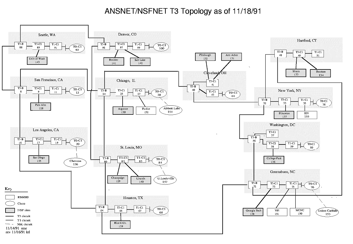
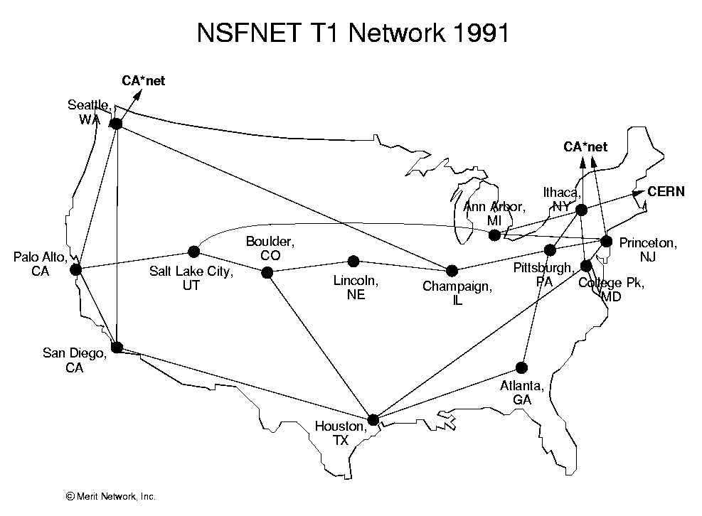
The NSFNET infrastructure and topology in 1991.

 |
A sketch of the packet switching network in the United Kingdom proposed by Donald Davies, a pioneer in networking in the 1960s. (Source: National Archive for the History of Computing, scanned with permission from Janet Abbate's, "Inventing the Internet", 1999, page 31). |

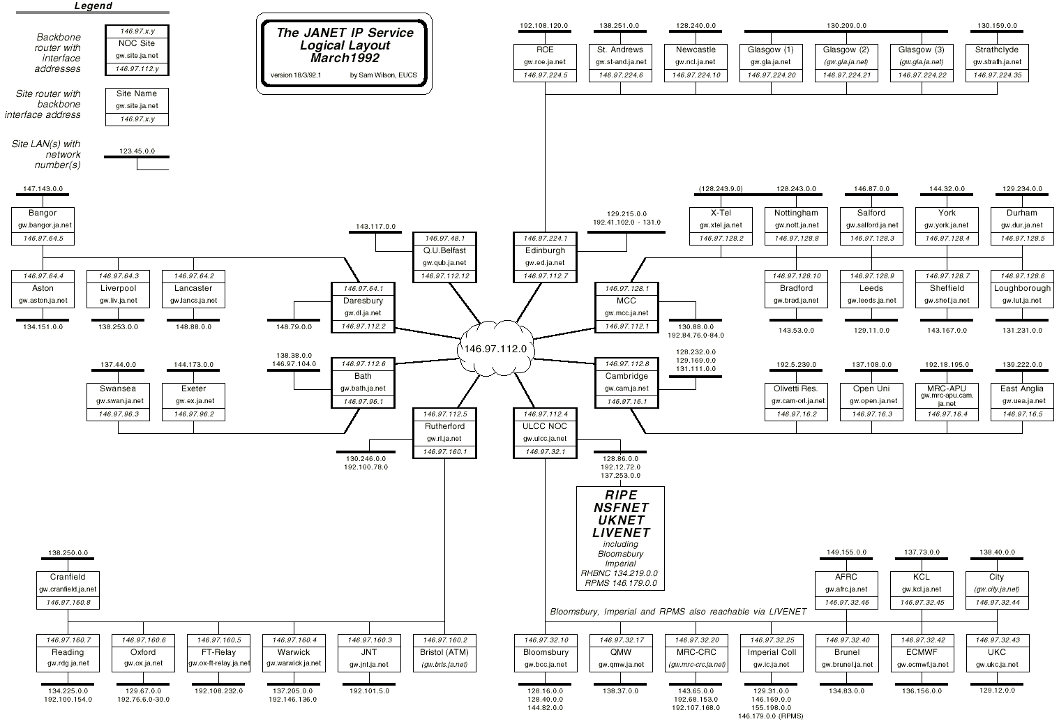
| These maps show the structure of JANET, the UK's academic and research network, in 1992. The one above shows international connections with 256 Kbps links to Europe and the "Fat-Pipe" transatlantic link to the USA running at 768 Kbps. Not surprisingly the capacity of these links have been increased massively since then. |
|
See the Internet History 1962-1992 from The Computer Museum History Center for more old maps of the Net. Thanks to Peter H. Salus's book
"Casting the Net : From ARPANET to Internet and beyond...",
for providing many of the maps used. [Buy
the book from Amazon.com and support Cyber-Geography Research]
ARPANET maps are also taken from an article in Computer Communications Review (CCR), entitled "Selected ARPANET Maps", Vol. 20, October 1990, pages 81-110. Also, thanks to Jon Crowcroft, in UCL's department of computer science, for the JANET maps.
|
|
Sorry, the Cybergeography Research web pages are no longer being updated. The project ran from 1997-2004, but my research has moved away into other areas (see my blog for latest). If you have any questions or comments, please email me at: m.dodge (at) manchester.ac.uk. Cheers, Martin Dodge, February 2007. |