Martin DodgeCurrently I work as a Senior Lecturer in Human Geography in the School of Environment, Education and Development, at the University of Manchester.
Mail : Department of
Geography, |
|
Martin DodgeCurrently I work as a Senior Lecturer in Human Geography in the School of Environment, Education and Development, at the University of Manchester.
Mail : Department of
Geography, |
|
August 2010 - Current:
Senior Lecturer in Human
Geography in the School of Environment and Development, University of
Manchester.
August 2005 - August 2010:
Lecturer in Human Geography in
the School of Environment and Development, University of Manchester.
August 2002 - July 2005:
Researcher in CASA and
lecturer Department of Geography, UCL.
December
2001 - July 2002:
Researcher and Information
systems administrator for CASA.
May 2001 - December 2001:
Director of reseach, Peacock
Maps, Washington D.C. (temporary
secondment).
1998 - April 2001:
Researcher and Information systems administrator for CASA.
1996 - 1998:
Research fellow in CASA, working on the VENUE project (Virtual
Environments for Urban Environments).
1994 - 1996:
Research assistant in the Department of City and Regional Planning,
University of Wales Cardiff.
1993- 1994:
Research assistant in the Department of Geography, University of
Nottingham.
My research interests (past and present) are in the following areas :
|
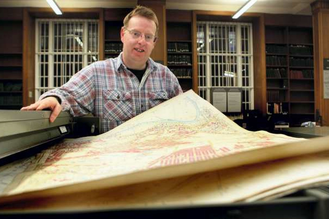
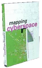
Dodge M, Kitchin R, 2000, Mapping Cyberspace (Routledge, London). [Full text available under Creative Commons and as a free pdf, 2017] |
 |
| Dodge M, Kitchin R, 2005, Mapping Cyberspace, Chinese language translation (Weber, Taiwan). | 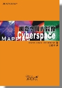 |
|
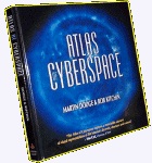
Dodge M, Kitchin R, 2001, Atlas of Cyberspace (Addison-Wesley, London). [Available as a free pdf download. ] |
 |
| Dodge M,
McDerby M, Turner M, 2008, Geographic
Visualization: Concepts, Tool an Applications
(Wiley, Chichester, England). |
 |
| Dodge M,
Kitchin R, Perkins C, 2009, Rethinking Maps: New Frontiers in
Cartographic Theory (Routledge, London). [Paperback version was published July 2011 with a new cover] |
 |
| Dodge M,
2010, Classics in Cartography:
Reflections on Influential Articles from Cartographica
(Wiley-Blackwell, Chichester, England). |
 |
| Kitchin R,
Dodge M, 2011, Code/Space: Software and Everyday
Life (MIT Press, Cambridge, MA). Released as Open
Access in 2021; full book available as a pdf
download. [ promotional pdf flyer; Reviews: Annals; Computational Culture; Cartographica; IJGIS; Cultural Geographies; Regional Studies; Journal of Transport Geography; review forum in Dialogues in Human Geography ; Environment and Planning B] Winner of the AAG's Meridian Book Award for Outstanding Scholarly Work in Geography, 2011. |
 |
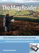
| Dodge M,
Kitchin R, Perkins C, 2011, The Map Reader: Theories of Mapping
Practice and Cartographic Representation
(Wiley-Blackwell, Chichester, England) [Some more details on the content are in this promotional pdf flyer.] |
 |
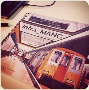
Brook R, Dodge M, 2012, Infra_MANC: Post-war infrastructures of Manchester (Bauprint, Manchester). [ PDF Download] |
 |
Paterson M, Dodge M (eds.), 2012, Touching Space, Placing Touch (Ashgate, Farnham, England). |
 |
| Dodge M (eds.), 2015, Mapping: Critical Concepts in Geography, Volumes 1-4 (Routledge, London). | 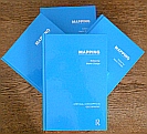 |
Brunn SD, Dodge M (eds.), 2016, Mapping Across Academia (Springer, London). |
 |
Wyke T,
Robson B, Dodge M, 2018, Manchester - Mapping the City
(Birlinn, Edinburgh).
|
 |
Brook R, Dodge M, Hogg J, 2020, Cold War Cities: Politics, Culture and Atomic Urbanism, 1945-1965 (Routledge). |
 |
Ayshford J, Dodge M, Jones H S, Leitch D, Wolff D, 2024, The Simons of Manchester: How One Family Shaped a City and a Nation (Manchester University Press). |
 |
| Billington M, Dodge M, 2025, Ernest Leonard Leeming: Urmston's Concrete King (Epona Publishing). |  |
| Blackwell B, Dodge M, Hopkins J, Steele M, 2025, Building Towards Bicentenary: A Campus History of the University of Manchester, 1824-2025 (University of Manchester). |  |
| Brook R, Dodge M, 2025, The Perspectivists: Exhibition Catalogue (The Modernist) |  |
Kitchin R, Dodge, 2018, "The (in)security of smart cities: vulnerabilities, risks, mitigation, and prevention", Journal of Urban Technology, in press. (local copy of the pre-press version of this article)
Dodge M, 2017, "Mapping II: News media mapping; new mediated geovisualities; mapping and verticality", Progress in Human Geography, in press. (local copy of the pre-press version of this article)
Dodge M, 2017, "Cartography I: Mapping deeply, mapping the past", Progress in Human Geography, Vol. 41, No. 1, pages 89-98. (local copy of the pre-press version of this article)
Dodge M, Brook R, 2015, "The Guardian underground telephone exchange", Transactions of the Lancashire and Cheshire Antiquarian Society, Vol. 108, pages 20-55. (local copy of page proofs of this article)
Dodge M, Perkins C, 2015, "Reflecting on J.B. Harley’s influence and what he missed in 'Deconstructing the Map'", Cartographica, Vol. 50, No. 1, pages 37–40. (local copy of page proofs of this article)
Dodge M, Brook R, 2014, “Dreams
of helicopter travel in the 1950s and Liverpool’s undeveloped plans
for a city centre heliport”, Transactions
of the Historic Society of Lancashire and Cheshire, Vol. 163,
pages 111-125. (local
copy of draft of this paper; with more illustrations than appear
in the published version)
Dodge M, Kitchin R, 2013, "Crowdsourced: cartography: mapping experience and knowledge", Environment and Planning A, Vol. 45, No. 1, pages 19-36. (local copy of this paper)
Kitchin R, Gleeson J, Dodge M, 2012, "Unfolding mapping practices: A new epistemology for cartography", Transactions of the Institute of British Geographers. Vol. 38, No. 3, pages 480-96. (local copy of this paper)
Perkins C, Dodge M, 2012,
"Mapping the imagined future: The roles of visual representation in
the 1945 City of Manchester Plan", Bulletin of the John Rylands University
Library, Vol. 89, No. 1, pages 247-276. (local
copy of this paper)
Zook M, Devriendt L, Dodge M, 2011, "Cyberspatial
proximity metrics: Reconceptualizing distance in the global urban
system", Journal of Urban
Technology, Vol. 18 No. 1, pages 93-114. (local
copy of this paper)
Perkins C, Dodge M, 2009, "Satellite
Imagery and the Spectacle of Secret Spaces", Geoforum,
Vol. 40, No. 4, pages 546-60. (local
copy of this paper)
Dodge M, Kitchin R, 2009, "Software,
Objects, and Home Space", Environment
and Planning A, Vol. 41, No. 6, pages 1344-65. (local
copy of this paper)
Kitchin R, Dodge M, 2007, "Rethinking Maps", Progress in Human Geography, Vol. 31, No. 3, pages 331-344. (local copy of this paper)
Dodge M, Kitchin R, 2007, "'Outlines of a World Coming into Existence’: Pervasive Computing and the Ethics of Forgetting", Environment and Planning B: Planning and Design, Vol. 34, No. 3, pages 431-445. (local copy of this paper)
Dodge M, Kitchin R, 2007, "The Automatic Management of Drivers and Driving Spaces", Geoforum, Vol. 38, No. 2, pages 264-275. (local copy of this paper)
Kitchin R, Dodge M, 2006, “Software and the Mundane Management of Air Travel”, First Monday, Command Lines: The Emergence of Governance in Cyberspace special issue, Vol. 7, No. 9. <www.firstmonday.org/issues/special11_9/>
Dodge M, Kitchin R, 2005, "Codes of Life: Identification Codes and the Machine-Readable World", Environment and Planning D: Society and Space, Vol. 23, No. 6, pages 851-881. (local copy of this paper)
Dodge M, Kitchin R, 2005, "Code and the Transduction of Space", Annals of the Association of American Geographers, Vol. 95, No. 1, pages 162-180. (local copy of this paper)
Dodge M, Kitchin R, 2004, "Flying Through Code/space: The Real Virtuality of Air Travel", Environment and Planning A, Vol. 36, No. 2, pages 195-211. (local copy of this paper)
Kitchin R M, Dodge M, 2001, " 'Placing' Cyberspace: Why Geography Still Matters", Information Technology, Education and Society, Vol. 1, No. 2, pages 25-46.
Brunn S, Dodge M, 2001, "Mapping the 'Worlds' of the World-Wide Web: (Re)Structuring Global Commerce Through Hyperlinks", American Behavioral Scientist, Vol. 44, No. 10, pages 1717-1739. (local copy of this paper)
Dodge M, Kitchin R, 2000, "Exposing the 'Second Text' of Maps of the Net", Journal of Computer-Mediated Communication, Vol. 5, No. 4. (local copy of this paper)
Doyle S, Dodge M, Smith A, 1998, "The Potential of Web-Based Mapping and Virtual Reality Technologies for Modelling Urban Environments", Computers, Environment and Urban Systems, Vol. 22, No. 2, pages 137-155. (local copy of this paper)
Dodge M, 2024, "Busy making good money: the development of the Simon engineering businesses", in Ayshford J, Dodge M, Jones H S, Leitch D, Wolff D (eds.), 2024, The Simons of Manchester: How One Family Shaped a City and a Nation (Manchester University Press), pages 151-193.
Ward S V, Dodge M, 2024, "Building Jerusalem: the Simons’ role in housing reform and town planning", in Ayshford J, Dodge M, Jones H S, Leitch D, Wolff D (eds.), 2024, The Simons of Manchester: How One Family Shaped a City and a Nation (Manchester University Press), pages 218-250.
Brook R, Dodge M, Hogg J, 2021, "Cold war cities: Spatial planning, social and political Processes, and cultural practices in the age of atomic urbanism, 1945-1965", in Brook R, Dodge M, Hogg J (eds), Cold War Cities Politics, Culture and Atomic Urbanism, 1945-1965 (Routledge), pages 1-35. (Pageproof of the chapter is available)
Dodge M, Brook R,
2021, "Visual essay: Cold war telecommunication and urban vulnerability
– underground exchange and microwave tower in Manchester", in Brook R,
Dodge M, Hogg J (eds), Cold
War Cities Politics, Culture and Atomic Urbanism, 1945-1965
(Routledge), pages 301-316. (Pageproof
of the chapter is available)
Dodge M, 2020,
“Cotton”, in Dobraszczyk P and Butler S (eds), Manchester
Something Rich and Strange (MUP), pages 112-116. (Pageproof
of the chapter is available)
Dodge M, 2020, “Shopping centre”, in Dobraszczyk P and Butler S (eds), Manchester
Something Rich and Strange (MUP), pages 64-68. (Pageproof
of the chapter is available)
Dodge M, 2019,
"Flat-pack smart urbanism - IKEA" in Graham
M, Kitchin R, Mattern S, Shaw J (eds), How
to Run a City Like Amazon, and Other Fables (Meatspace Press),
paragraphs 605-622. (An uncorrected
pageproof of the chapter is available)
Dodge M, Kitchin
R, 2019, "The challenges of cybersecurity for smart cities" in Coletta
C, Evans L, Heaphy L, Kitchin R (eds) Creating
Smart Cities (Routledge, London), pages 205-216. (An uncorrected
pageproof of the chapter is available)
Dodge M, 2019,
"Rural" in Ash J, Kitchin R, Leszczynski A (eds), Digital
Geographies (Sage), pages 36-48. (An uncorrected
pageproof of the chapter is available)
Dodge M, 2017, "Mapping the geographies of Manchester's housing problems and the twentieth century solutions" in Theakstone W (ed) Manchester Geographies (Manchester Geographical Society, Manchester)
Brunn S, Dodge M, 2016, "What is where? The role of map representations and mapping practices in advancing scholarship", in Brunn S, Dodge M (eds) Mapping Across Academia (Springer, New York). (A draft untypeset version is available)Dodge M, Zook M,
2009, "Internet-based
Measurement", in Kitchin R, Thrift N, (eds) International
Encyclopedia of Human Geography (Elsevier, Oxford), 569-79.
Kitchin R, Dodge M,
2009, "Airport Code/spaces", in Cwerner S, Kesselring S, Urry J, (eds) Aeromobilities (Routledge,
London), pages 96-114. (draft
version of this chapter)
Kitchin R, Dodge M,
2008, "Cybergeography", in Kemp K, (ed) Encyclopedia
of Geographic Information Science (Sage), pages 58-59.
Dodge M, Jayne M, MacKian S, Perkins C, Smyth F, 2007, "EBL from the Very First Day: Developing New Senses of Place", in Case-studies: CEEBL-Supported Projects, 2006-7 (CEEBL, University of Manchester), pages 71-87.
Dodge M, Kitchin R, 2006, "Virtual Places", in Douglas I, Huggett R, Perkins C, (eds) Companion Encyclopedia of Geography, 2nd Edition (Routledge, New York), pages 519-536. (page proof version of this chapter)
Dodge M, Kitchin R, 2006, “Spatialising Cyberspace”, from Mapping Cyberspace, reprinted in Bell D (ed) Cyberculture: Key Concepts in Media and Cultural Studies (Routledge, London), Vol. 2, chapter 28, pages 107-128.
Dodge M, Kitchin R, 2006, "Net:Geography Fieldwork Frequently Asked Questions", in Weiss J, Nolan J, Trifonas P, Nincic V, Hunsinger J, (eds) The International Handbook of Virtual Learning Environments (Springer, Netherlands), pages 1143-1172. (page proof version of this chapter)
Dodge M, 2005, "The Role of Maps in Virtual Research Methods", in Hine C (ed) Virtual Methods: Issues in Social Research on the Internet (Berg Publishers, Oxford), pages 113-128. (page proof version of this chapter)
Zook M, Dodge M, Aoyama Y, Townsend A, 2004, "New Digital Geographies: Information, Communication, and Place", in Brunn S D, Cutter S L, Harrington J W (eds) Geography and Technology, (Kluwer, New York), pages 155-176. (page proof version of this chapter)
Dodge M, Kitchin R, 2004, "Charting Movement: Mapping Internet Infrastructure", in Hanley R E (ed) Moving People, Goods, and Information in the 21st Century, (Routledge, New York), pages 159-185. (page proof version of this chapter)
Dodge M, 2004, "Geographies of E-Commerce: The Case of Amazon.com", in Graham S (ed) The Cybercities Reader, (Routledge, London), pages 221-225.
Dodge M, 2002, "Explorations in AlphaWorld: The Geography of 3D Virtual Worlds on the Internet", in Fisher P and Unwin D (eds) Virtual Reality in Geography, (Taylor & Francis, London), pages 305-331.
Kitchin R, Dodge M, 2002, "There's No There There: Virtual Reality, Space and Geographic Visualization", in Fisher P and Unwin D (eds) Virtual Reality in Geography, (Taylor & Francis, London), pages 341-361.
Kitchin R, Dodge M, 2002, "The Emerging Geographies of Cyberspace", in Johnston R J et al. (eds) Geographies of Global Change: Remapping the World, (Blackwell Publishing), pages 340-354.Dodge
M,
2001, "Finding the Source of Amazon.com: Examining the Store with the
'Earth's Biggest Selection", in Leinbach T R, Brunn S D (eds) Worlds
of
E-Commerce: Economic, Geographical and Social Dimensions, (John
Wiley and Sons), pages 167-180.
Dodge M, Shiode N, 2000, "Where on Earth is the Internet? An Empirical Investigation of the Geography of Internet Real Estate", in Wheeler J O, Aoyama Y, Warf B (eds) Cities in the Telecommunications Age: The Fracturing of Geographies, (Routledge, New York), pages 42-53.
Dodge M, 2000, "Mapping the World-Wide Web", in Rogers R (ed) Preferred Placement: Knowledge Politics on the Web, (Jan van Eyck Akademie, Netherlands), pages 81-98.
Dodge M, 2000, "Accessibility to Information Within the Internet: How can it be Measured and Mapped?", in Janelle D G, Hodge D C (eds) Information, Place, and Cyberspace, (Springer, Berlin), pages 187-204.
Shiode N, Dodge M, 1999, "Visualising the Spatial Pattern of Internet Address Space in the United Kingdom", in Gittings B (ed) Innovations in GIS 6: Integrating Information Infrastructure with GI Technology, (Taylor & Francis, London), pages 105-118.
Batty
M,
Dodge M, Jiang B, Smith A, 1999, "Geographical Information Systems and
Urban Design", in Stillwell J, Geertman S, Openshaw S (eds) Geographical
Information
and Planning, (Springer, Berlin), pages 43-66.
Batty M, Dodge M, Doyle S, Smith A, 1998, "Modelling Virtual Environments", in Longley P A, Brooks S M, McDonnell R, Macmillan B (eds) Geocomputation: A Primer, (Wiley, Chichester, UK).
Ayshford J, Dodge M, 2024, “Ban
the Bomb or Atoms for Peace”, The
Modernist, vol. 52 (November), pages 56-59.
Dodge M, 2023, A
Salford Venice: Manchester Docks in Edwardian Times
(softback booklet, pp.26)
Ayshford J, Dodge M, 2022, Who Built Wythenshawe: Exhibition Catalogue (softback booklet, pp.44).
Dodge M, 2021, “The 1920s
vision for better highways by EL Leeming”, Salford Link magazine,
winter 2021 issue, pp.7-9.
Dodge M, 2021, "The
challenge of the missing cotton industry and comprehending the real
Northern powerhouse in the nineteenth century", Transactions
of the Manchester Statistical Society, vol 2018-2019, pages
77-102.
Dodge M, 2021, "Capenhurst", The Modernist, Killer vol. 39 (May), pages 44-49.
Dodge M, Ronan A, 2019, Celebrating Burnage Garden Village: Resource
Booklet and Exhibition Catalogue (a5 softback booklet,
pp.40).
Dodge M, 2018, "Smoke Free Zone: Cleaning the Air for Healthier Modern Cities", The Modernist, vol. 26 (March), pages 4-7. (pre-publication version with more illustrations is available)
Dodge M, 2017, "Fort Beswick: Been, Gone and Forgotten", The Modernist, vol. 24, pages 10-15. (pre-publication version with more illustrations is available)
Dodge M, 2016, "Governing from the bunker – where would the government go after the end of the world?", The Modernist, Vol. 21, pages 14-19. (pre-publication version with more illustrations is available)
Dodge M, 2016, Mapping the Historical Geographies of Higher Education in Greater Manchester symposium, 9th November 2016, print programme and booklet of abstracts, 23pp.
Brook R, Dodge M, 2016, Making Post-War Manchester: Visions of
an Unmade City, May 2016, print catalogue in support of
public exhibition, 70pp.
Dodge M, 2015, "High-speed rail: The route to economic growth?", Geography Review, Vol. 28, No. 4,
pages 12-16.
Brook R, Dodge M, 2015, "Engineering the airwaves: Cold war concrete", The Modernist, Vol. 14, pages 30-33. (local copy of page proofs of this article)
Dodge M, Kitchin R, 2013, "Code/space and the nature, production and enrolment of software", Dialogues in Human Geography, Vol. 3, No. 2, pages 249-522.
Dodge M, 2010, "Code/space", URBIS Research Forum Review, Vol. 1, No. 2, pages 15-25.
Dodge M, Perkins C, 2010, "Mapping Manchester and its Hidden Hydraulic Engineering”, Civil Engineering Surveyor, March, pages 21-25.
Dodge M, Perkins C, 2009, Mapping Manchester Exhibition e-Catalogue, John Rylands Library, University of Manchester.
Dodge
M, Perkins C, 2009, "The
‘View from Nowhere’? Spatial Politics and Cultural Significance of
High-Resolution Satellite Imagery", Geoforum,
Vol. 40, No. 4, pages 497-501. (local
copy of this article)
Dodge M, Kitchin R and Zook M, 2009, "Guest
Editorial:
How Does software Make Space? Exploring Some Geographical Dimensions
of Pervasive Computing and Software Studies", Environment
and Planning A, Vol 41, No. 6, pages 1283-93.
Dodge M, Perkins C, 2008, "Reclaiming
the Map: British Geography and Ambivalent Cartographic Practice",
Environment and Planning A,
Vol. 40, No. 6, pages 1271-76. (local
copy of this article)
Perkins C, Dodge M, 2008, "The Potential of User-Generated Cartography: A Case Study of the OpenStreetMap Project and Mapchester Mapping Party", North West Geographer, Vol. 8, No.1, pages 19-32.
Dodge M, 2007, "De Cartografie van de Cyberspace", Agora, Vol. 23, No. 4, pages 27-30. (Dutch language)
Dodge M, 2004, "Mapping Secret Places and Sensitive Sites: Examining the Cryptome 'Eyeballing' Map Series", Society of Cartographers Bulletin, Vol. 37, No. 1, pages 5-11. (page proof version of this article)
Dodge M, Kitchin R, 2002, "Mapping Cyberspace", Society of Cartographers Bulletin, Vol. 36, No. 2, pages 1-6.
Dodge M, Kitchin R, 2002, "New Cartographies to Chart Cyberspace", GeoInformatics, Vol. 5, April/May 2002, pages 38-41. (local copy of this article)
Dodge M, Kitchin R, 2001, "Ways to Map Cyberspace", Directions Magazine, November 7th. (local copy of this article)
Dodge M, 2001, "Cybergeography", (guest editorial), Environment and Planning B: Planning and Design, Vol. 28, pages 1-2.
Dodge M, Doyle S, Smith S, Fleetwood S, 2000, "Realite Virtuelle Set SIG Internet Pour la Planification Urbaine", La ville numerique, Les Cashiers du Numberique, Vol. 1, No. 1, pages 59-73.
Dodge M, 2000, "Mapping Where the Data Flows", OnTheInternet, April. (local copy of this article)
Dodge M, 1999, "Mapping the Internet", The Guardian, Online section, October 28th, pages 2-3.
Dodge M, 1999, "Measuring and Mapping the Geographies of Cyberspace: A Research Note", NETCOM - Networks and Communications Studies, Vol. 13, No. 1/2, pages 53-67.
Shiode N, Dodge M, 1999, "Spatial Analysis of the World Wide Web", NETCOM - Networks and Communications Studies, Vol. 13, No. 1/2, pages 9-24.
Dodge
M,
1999, "Building an Atlas of Cyberspace", Cartographic Perspectives,
No. 34, pages 47-52. (local
copy
of this article)
Smith A, Dodge M, Doyle S, 1998, "Visual Communication in Urban Planning and Urban Design", Case Studies of Visualisation in the Social Sciences, Advisory Group on Computer Graphics.
Shiode N, Batty M, Dodge M, 1998, "The Centre for Advanced Spatial Analysis and Its Projects on Geographic Information Systems and Urban Analysis", Theory and Application of GIS, Vol. 6, No. 1, pages 81-86 (in Japanese).
Dodge M, 1998, "Competing in Cyberspace: The Top-Twenty UK Universities", Environment and Planning B: Planning and Design, Vol. 25, No. 5, pages 637-638.
Dodge M, 1998, "Journey to the Centre of the Web", in Staple G C (Eds) TeleGeography 1999: Global Telecommunications Traffic Statistics & Commentary (TeleGeography, Inc., Washington, DC), pages 150-154.
Dodge M, 1998, "The Geographies of Cyberspace: A Research Note", NETCOM - Networks and Communications Studies, December 1998, Vol. 12, No. 4, pages 383-396.
Dodge M, Smith A, Doyle S, 1997, "Virtual Cities on the World-Wide Web: Towards a Virtual City Information System", GIS Europe, October, Vol. 6, No. 10, pages 26-29. (Note, this a draft version of the paper which differs from the published version. The published version was titled "Urban Science".)
Dodge M, 1997, "A Cybermap Atlas: Envisioning the Internet", TeleGeography 1997/97, pages 63-68.
Smith A, Dodge M, 1997, "The World Wide Web - Not Just for Nerds", Planning, 11th April, Issue 1213, pages 16-17.
Dodge M, 1996, "Mapping The World Wide Web", GIS Europe, September, Vol. 5, No. 9, pages 22-24.
White S, Dodge M, Webster C, 1996, "Constructing a Public Services Information System", BURISA, March, pages 7-11.
Dodge M, White S, 1995,"Public Services in Wales: Analysing Supply and Demand for Healthcare and Education", Mapping Awareness, September, Vol. 9, No. 7, pages 24-27.
Programmable City Working Paper 24: The (in)security of Smart Cities: Vulnerabilities, Risks, Mitigation and Prevention, Rob Kitchin and Martin Dodge, February 2017.
Centre for Environment and Society Research Working Paper 22: Infrastructure and the Rebuilt City after the Second World War (Ed. P.J. Larkham): Helicopter Dreaming: The Unrealised Plans for City Centre Heliports in the Post-war Period, Martin Dodge and Richard Brook, May 2013.
NIRSA Working Paper 35: Objects, Code and Home Spaces, Martin Dodge and Rob Kitchin, January 2008.
NIRSA
Working
Paper 29: Code,
Vehicles
and Governmentality: The Automatic Production of Driving
Spaces, Martin Dodge and Rob Kitchin, March 2006.
CASA Working Paper 94: Information Maps: Tools for Document Exploration, Martin Dodge, July 2005.
CASA Working Paper 92: The Ethics of Forgetting in an Age of Pervasive Computing, Martin Dodge and Rob Kitchin, March 2005.
CASA Working Paper 83: Net:Geography Fieldwork Frequently Asked Questions, Martin Dodge and Rob Kitchin, September 2004.
CASA Working Paper 82: Codes of Life: Identification Codes and the Machine-Readable World, Martin Dodge and Rob Kitchin, May 2004.
CASA Working Paper 81: Code, Space and Everyday Life, Martin Dodge and Rob Kitchin, April 2004.
CASA Working Paper 39: Examining Different Approaches to Mapping Internet Infrastructure, Martin Dodge and Rob Kitchin, December 2001.
CASA Working Paper 21: New Technologies for Urban Designer: The VENUE Project, Michael Batty, Martin Dodge, Bin Jiang and Andy Smith, April 2000.
CASA Working Paper 12: Finding the Source of the Amazon.com: Examining the Hype of the "Earth's Biggest Bookstore, Martin Dodge, July 1999.
CASA Working Paper 8: The Geography of Cyberspace, Martin Dodge, May 1999.
CASA Working Paper 3: GIS and Urban Design, Michael Batty, Martin Dodge, Bin Jiang & Andy Smith, June 1998.
CASA Working Paper 2: Visual Communication in Urban Planning and Urban Design, Andy Smith, Martin Dodge and Simon Doyle, June 1998.
CASA Working Paper 1: Modelling Virtual Urban Environments, Michael Batty, Martin Dodge, Simon Doyle and Andy Smith, January 1998.
'Safeguards
in a World of Ambient Intelligence' edited by David Wright, et
al., for Surveillance
& Society,
2009, Vol. 6, No. 3, pages 331-33.
'Surveillance as Social Sorting: Privacy, Risk and Digital Discrimination' edited by David Lyon, for Environment and Planning B: Planning and Design, 2005, Vol. 32, pages 313-15.
'Cartographica Extraordinaire: The Historical Map Transformed' by Rumsey and Punt, for Environment and Planning B: Planning and Design, 2005, Vol. 32, pages 154-55.
'The Internet on Earth: A Geography of Information' by Aharon Kellerman, for Environment and Planning B: Planning and Design, 2004, Vol. 31, pages 478-80.
'Technospaces: Inside the New Media' by Sally R. Munt (ed.), for Environment and Planning B: Planning and Design, 2002, Vol. 29, pages 935-37.
'Digital Information Graphics' by Matt Woolman, for Graphics International, October 2002, issue 99, page 43.
'The Internet: An Ethnographic Approach' by Miller and Slater, for Environment and Planning B: Planning and Design, 2001, Vol. 28, pages 624-625.
Dodge M, 2024, "Marketing the
Manchester Ship Canal", Newcomen Society for the Study of the History of
Engineering and Technology (Manchester branch), 26 November 2024.
Billington M, Dodge M, 2024, "Ernest
Leonard Leeming: Urmston’s Concrete King", Manchester Region
Industrial Archaeology Society (MRIAS), 11 April 2024.
Dodge, M, 2024, "Social housing in Manchester - Brief history from Victoria Square tenements in the 1890s to the Wellington Street estate in the 1960s", invited talk at Manchester Grammar School, 26 February 2024.
Dodge N, 2023, "From the Oaks estate
villas to the Owens Park student village", invited talk to Holy
Innocents Church, Fallowfield, 9 December 2023.
Billington M, Dodge M, 2023, "Ernest Leonard Leeming: Urmston’s Concrete King", invited talk to Eccles and District Historical Society, 12 October 2023.
Ayshford J, Dodge M, 2023, "The Simons of Manchester – the lives and public service of Ernest and Shena Simon, 1912-1939", invited talk to Heaton Chapel Literary and Philosophical Society, 25 September 2023.
Ayshford J, Dodge M, 2023, "Who built Wythenshawe?", invited talk to Friends of Wythenshawe Hall, 30 April 2023.
Ayshford J, Dodge M, 2022, "The Simons of Manchester – the lives and public service of Ernest and Shena Simon, 1912-1939", invited talk to The Historical Association, Manchester branch, 22 October 2022.
Dodge M, 2020 "Manchester's Flirtation
with Flats in the Thirties", invited talk in webinar Building the
Vision: 100 Years of Affordable Housing, organised by Burnage
A Place Called Home, 17 September 2020. (slides
of the presentation)
Dodge M, 2019, “Mapping Manchester",
invited talk to Eccles and District Historical Society, 11
September 2019.
Dodge M, 2019, "100 Complicated Years
of Municipal Housing in Manchester", invited talk at Burnage Public
Library, 4 July 2019.
Dodge M, Bolton L, 2019, "Transport
that Transformed Manchester", workshop with talks by George Turnbull and
Geoff Senior, Manchester Central Library, 26th June 2019.
Dodge M, 2019, "Mapping Manchester - the good, the bad and the missing ones", lecture for Saddleworth Historical Society, 10 April 2019.
Dodge M, 2019, "Exploring Manchester's
Urban History", workshop for the Geographical Association Annual
Conference at the University of Manchester Library, 10 April
2019.
Dodge M, 2019, "Historical Geographies
of Infrastructure – The value of maps, plans, diagrams and other visual
documentations", invited talk at Interdisciplinary Infrastructure
Investigations workshop, Sheffield Hallam University, 20 March
2019.
Dodge
M, 2019, "Mapping Cottonopolis: The challenge of the missing cotton
industry and comprehending the real Northern powerhouse in the
nineteenth century", lecture for Manchester Statistical Society,
12 March 2019.
Dodge M, 2019, "Manchester : Mapping
the city", lunchtime lecture for Manchester Geographical Society,
12 February 2019.
Dodge M, 2019, "Making the Northern
Powerhouse : mapping trade, industry and transformative transport", Geographical
Association, Blackpool, 7 January 2019.
Dodge M, 2018, "Manchester: Mapping the
City", Portico Library, Manchester, 5 December 2018. (slides of the presentation)
Dodge M, 2018, "Mapping Manchester", Mapping
Manchester for Researchers, John Rylands Library, 4
December 2018. (slides
of the presentation)
Dodge M, 2018, "The In(Security) of
Smart Cities: Vulnerabilities, Risks, Mitigation, and Prevention", International
conference on Making Smart Cities Safe for Citizens, Heerlen,
Netherlands, 29 November 2018.
Dodge M, 2018 "Lost Infrastructures and Recovery through Historic Visual Representations: Case study of power generation in east Manchester in the post-war period", Investigating Infrastructure Conference, Sheffield Hallam University, 13 June 2018. (slides of the presentation)
Dodge M, 2017, "A chorography for cyberspace: cables, code, and computer history", Revolution, Evolution, Imposition? Thinking, Framing, and Doing Digital Geographies, The Inaugural Symposium of the Digital Geographies Working Group, Royal Geographical Society, London, 30th June 2017. (slides of the presentation)
Dodge M, 2017, "A kind of deep mapping of the city: infrastructural urbanism, indexical knowledges and cartographic chronology", Chorographies: Traditions and Trajectories in the Spatial Humanities, Lancaster University, 16th June 2017. (slides of the presentation)
Dodge M, 2017, "Mapping Manchester", Geographical Association, Blackpool, 6th March 2017. (slides of the presentation)
Dodge M, 2016, "From manufacturing industries to a services economy: The emergence of a "New Manchester" in the 1960s", Modernist Society / BDP Architects, Manchester, 16th September 2016. (slides of the presentation)
Dodge M, 2016, "Hacking the smart city
and the challenges of security",
Creating Smart Cities: Collaboration, Citizenship and Governance
Conference, Maynooth
University, Ireland, 5th September 2016. (abstract
and slides of the presentation)
Dodge M, Brook R, 2016, "Infrastructures, histories, visualities", Infrastructure, Cities and Development: Research Networking Event, Alliance Manchester Business School, University of Manchester, 22nd June 2016.
Dodge M, 2016, "Verticality and urban mobility: Learning lessons from past visions of elevated transport systems in the post-war city", Above. Degrees of Elevation Workshop, The Institute for Advanced Studies in the Humanities, University of Edinburgh, 12th May 2016. (talk abstract and slides of the presentation)
Dodge M, Brook R, 2015 "Cold war urbanism: the challenge of survivable city infrastructures", International Conference of Historical Geography, 9th July 2015. (slides of the presentation)
Dodge M, 2014, "Tunnels under Manchester: Mapping the cold war 'Guardian' underground telephone exchange", Manchester Modernist Society talks, Manchester Central Library, 2nd October 2014. (slides of the presentation)
Dodge M, Brook R, 2014, "Secrecy,
obscurity, security, obsession: ‘Guardian’ telecommunications bunker
deep under Manchester city centre and Cold War urbanism', Cold War
Bunkers session, RGS-IBG Annual
International Conference, 29th August 2014. (slides
of the presentation)
Dodge, M, 2014, "Vertical urbanism and the unrealised hopes of mass
helicopter travel", Vertical
Worlds session, RGS-IBG Annual
International Conference, 28th August 2014. (slides
of the presentation)
Dodge M, 2014, "Making historic maps of Manchester freely and widely
available online", invited presentation at Partnership and Innovation in the Digital
Library, University of Manchester, 3rd April 2014. (slides
of the presentation)
Dodge M, 2014, "Code and conveniences", invited presentation at the Programmable City project launch, National University of Ireland, Maynooth, Ireland, 25th March 2014. (slides of the presentation)
Dodge M, Sherman D, 2013, “Mapping Manchester: Changing cityscape captured in historical cartography”, invited talk to the Friends of Rylands Library, 21st November 2013. (slides of the presentation)
Dodge M, 2013, "Helicopter hopes in the 1950s and the unrealised plans for heliports in Liverpool and Manchester”, Getting There: Exploring the History of the North West’s Transport Links, Historic Society of Lancashire and Cheshire Study Day, Museum of Liverpool, 18th September 2013.
Dodge M, 2013, "Developing the airport and dreams of a heliport", The Making of Post-war Manchester, 1945-1974 symposium, 8th May 2013. (slides of the presentation)
Dodge M, 2013, "Vertical urbanism and the forgotten plans for heliports", invited seminar at the Department of Geography and Planning, University of Liverpool, 14th March 2013. (slides of the presentation)
Dodge M, 2013, "Planning for heliports: forgotten ambitions for urban space and movement", Infrastructure and the Rebuilt Post-war City workshop, 25th March 2013.
Dodge M, 2013, "Code/space", invited participation at Code As Control, an interdisciplinary international workshop, Hans-Bredow-Institut, Hamburg, 17-18th January 2013.
Dodge M, 2012, "Mapping software", invited seminar on The Shape of Knowledge, International Society for Knowledge Organisation (ISKO), 4th September 2012. (slides of the presentation)
Dodge M, 2011, "Mapping experiences and culture of opensource cartography”, Interdisciplinary Workshop on Visual Cognition, Space, Memory: The Sense of Place between Experience and Culture, Università di Bologna, 29th June 2011. (slides of the presentation)
Dodge M, 2010, "Knowing infrastructure", Society of Cartographers Summer School, 8th September 2011.
Dodge M, 2010, “Maps, memories and Manchester: The cartographic imagination of the hidden networks of the hydraulic city”, Mapping, Memory and the City: An International Interdisciplinary Conference, University of Liverpool, February 2010.
Dodge M, 2009, "Software surveillance of farms, farmers and food", Association of American Geographers Annual Conference, Las Vegas, 26th March 2009. (slides of the presentation)
Dodge M, 2009 "A new countryside code? Software, surveillance and simulation of rural space", Science and Technology Studies Unit seminar, University of York, 27th January 2009. (slides of the presentation)
Dodge M, 2007, "Countryside code", Codes and Conduct workshop, Lancaster University, 19-20th November 2007.
Dodge M, 2007, "Internet geographies", Site Gallery, Sheffield, 17th November 2007.
Dodge
M, 2006, "Exposing
the secret city: urban exploration as 'space hacking'", Going Underground: Excavating the
Subterranean City interdisciplinary workshop, SURF,
Salford University and Centre for the Study of Cities and Regions. Manchester, 21st
-22nd September 2007.
Dodge M, 2006, "Can mapmakers change the world?", panel participant at the Hyperlinked Society Symposium, Annenberg Public Policy Center, Universiy of Pennsylvania, Philadelphia, 9th June 2006.
Dodge M, Kitchin R, 2006, "Exposing the secret city: urban exploration as ‘space hacking’", Association of American Geographers Conference, Chicago, March. (slides of the presentation)
Kitchin R, Dodge R, 2006, "Managed bodies in managed vehicles navigating managed space: The automatic production of vehicular space", Association of American Geographers Conference, Chicago, March.
Dodge M, 2006, "Coding the city: spaces 'written' with software", Department of Geography seminar, University of Kentucky, 3 March. (slides of the presentations)
Dodge M, 2006, "Exposing the Secret City: Urban Exploration as ‘Space Hacking’", Geography Research Seminar, University of Manchester, 22 February. (slides of the presentation)
Dodge M, 2006, "Code in the city: spaces 'written' with software", FUTURE Conference - The Electronic City, Bratislava, 5th February. (slides of the presentation)
Dodge M, 2005, "The ethics of forgetting in an age of pervasive computing", Social Computing Symposium 2005, Redmond, WA, 24-26th April.
Dodge M, 2004, "Lost in the crowd no longer? Mobile phones and the prospects of continuous geosurveillance", Ordnance Survey research seminar, Southampton, 2nd December. (slides of the presentation)
Dodge M, 2004, "The Power of Maps in E-Research", Symposium on e-Social Science, Australian National University, Canberra, 12th November. (slides of the presentation)
Dodge M, 2004, "Cartography,
Privacy and Surveillance: Are Some Part of the Web Better Left
Unmapped", Web : Espaces de Navigation, Objets D'exploration,
Universite Paris 8, Paris, 13th May. (slides
of
the presentation)
Dodge M, 2004, "Lost in the
Crowd No Longer? Mobile Phones and the Prospects of Continuous
Geosurveillance", Visualization and Multimedia: Wireless GIS and
Location Based Services, Transdisciplinary Seminar Series,
Bristol, 26th March. (slides
of
the presentation)
Dodge M Batty M and Kitchin R, 2004, "No Longer Lost in the Crowd: Prospects of Continuous Geosurveillance", Association of American Geographers Conference, Philadelphia, March. (slides of the presentation)
Dodge M, 2004, "Seeing Inside the Cloud: Some Ways to Map the Internet", Media Art Net Lectures: Mapping, ZKM, Karlsruhe, Germany, 24th January. (slides of the presentation)
Dodge M, 2004, "Seeing Inside the Cloud: Some Ways to Map the Internet", Network Research Group seminar, Computer Science Department, University College London, 21st January. (slides of the presentation)Dodge M, 2003, "The Role of Maps in Virtual Research", Dynamic Maps workshop, HUMLab, Umeå University, Sweden, 17th September. (slides of the presentation)
Dodge M, 2003, "What is the Best
Way to Map the Internet?", Computer Laboratory wednesday seminar,
University of Cambridge, 30th April. (slides
of
the presentation)
Dodge M, 2003, "Do Internet Librarians Need Maps of Cyberspace?", Internet Librarian International 2003 Conference, Birmingham, 27th March. (slides of the presentation)
Dodge M and Haklay M, 2003, "Geography and Cybercrime: Does it Matter Where the Hackers Are?", presentation at the Association of American Geographers 99th Annual Meeting, New Orleans, 5-8th March. (powerpoint slides)
Dodge M, 2002, "Are There Any Good Maps of Cyberspace?", presentation at Applied and Interdisciplinary Informatics seminar, Computing Laboratory, University of Kent, 2nd December. (slides of the presentation)
Dodge M and Haklay M, 2002, "Where are the Hackers? Preliminary Analysis of the global geography of cybercrime", presentation for the Cities and Regions in the 21st Century, CURDS 25th Conference, Newcastle, 18th September. (powerpoint slides)
Dodge M, 2002, "Mapping the Networks of the Internet", Society of Cartographers 38th Annual Summer School, Liverpool, 3rd September 2002. (powerpoint slides)
Dodge M, 2002, "Maps of the Internet to Explore New Virtual Geographies", Social Research Methods and New Cultural Geographies seminar, Centre for Research into Innovation, Culture and Technology, Brunel University, 29th July. (powerpoint slides)
Dodge M, 2002, "Cybergeography: Notions of Cyberspace Mapping", Ordnance Survey seminar, Southampton, 24th July. (powerpoint slides)
Dodge M, 2002, "Critical Analysis of Cyberspace Mapping", CASA seminar, 3rd July. (powerpoint slides)
Dodge M and Haklay M, 2002, "Where are the Hackers? Preliminary Analysis of the Global Geography of Cybercrime", presentation for the Social Science Research Council summer institute of the Program on Information Technology, International Relations and Global Security, Columbia University, New York, 5-8th June 2002. (powerpoint slides)
Dodge M, 2001, "Information Mapping", presentation for Content Summit, Zurich, 9th November.
Dodge M, 2001, "Navigating Cyberspace: 2D Information Mapping", presentation for Environments seminar series, Department of Architecture, Princeton University, 9th October.
Dodge M, 2001, "Information Mappings: Tools for Cyberspace Exploration", presentation for V2 Wiretap, Rotterdam, Netherlands, 30th August.
Dodge M, 2001, "Mapping Cyberspace: Visualising the infrastructure and information spaces of the Internet", presentation for the Internet Society Netherlands, Utrecht, Netherlands, 26th March.
Dodge M, 2000, "What Does Cyberspace Look Like? Does Cybergeography Have The Answers?", Social and Historical Geography Seminar, University College London, 16th May.
Dodge M, 2000, "Mapping the Global Internet: Past, Present and Future", presentation at the Taub Urban Research Center, New York University, 12th April.
Dodge M, 2000, "What Does Cyberspace Look Like? Some Thoughts from a Geographer", presentation at the Department of Design & Media Arts, UCLA, Los Angeles, 10th April. (presentation slides)
Dodge M, 1999, "Mapping the World-Wide Web", paper presented at Preferred Placement: The Hit Economy, Hyperlink Diplomacy, and Web Epistemology, Symposium of the Design & Media Research Fellowship, Jan Van Eyck Akademie, Amsterdam, 16th October. (presentation slides)
Dodge M, 1999, "Finding the Source of the Amazon.com: Examining the Truth Behind the Hype of the "Earth's Biggest Bookstore", paper presented at E*Space 5 Conference, 10-15th July 1999, Cape Town. (presentation slides)
Dodge M, 1999, "Mapping the Net: Some Ideas From Cartography & Geography", presentation at the ISMA: Network Visualization workshop, San Diego, 15-16th April.
Dodge M, 1999, "Mapping The Network Society", paper presented at the 95th Annual Meeting of the Association of American Geographers, Honolulu, Hawaii, 23-27th March.
Dodge M, 1999, "Explorations in AlphaWorld: The Geography of 3D Virtual Worlds on the Internet", paper presented at RGS - IBG Annual Conference - Geographies of the Future, Leicester, 4th-7th January.
Dodge M, 1998, "Mapping the Net: Some Views and Ideas", presentation at Cooperative Association for Internet Data Analysis (CAIDA), University of California's San Diego Supercomputer Center, 24th November.
Dodge M, 1998, "Accessibility to Information Within the Internet: How Can it be Measured and Mapped?", presented at the Varenius Project workshop Measuring and Representing Accessibility in the Information Age, Pacific Grove, USA, 20-22nd November. (presentation slides)
Dodge M, 1998, "Avatars, Identity and Meta-Place: The Geography of a 3-D Virtual World on the Internet", paper presented at the Varenius Project workshop Place and Identity in an Age of Technologically Regulated Movement, Santa Barbara, USA, 8-10th October. (presentation slides)
Dodge M and Doyle S, 1998, "Towards the Virtual City: VR & Internet GIS for Urban Planning", paper presented at the Virtual Reality and Geographical Information Systems Workshop, Birkbeck College, London, 22nd May.
Dodge M, 1998, "Envisioning Cyberspace: Mapping Information Spaces of the Internet and the Web", presentation at the Knowledge Maps Workshop, Netherlands Design Institute, Amsterdam, 22-23rd April.
Dodge M, 1998, "Exploring the Space of Cyberspace: Mapping the Emerging Geographies of the Internet", presentation to the Geography Colloquium, Syracuse University, 30th March.
Dodge M, 1998,"The Geographies of Cyberspace", paper presented at the 94th Annual Meeting of the Association of American Geographers, Boston, 25-29th March .
Dodge M and Shiode N, 1998, "Where on Earth is the Internet? An Empirical Investigation of the Spatial Patterns of Internet "Real-Estate" in Relation to Geo-Space in the United Kingdom", paper presented at the Telecommunications and the City conference, Athens, Georgia, USA, 21-23rd March.
Dodge M Smith A and Doyle S, 1997, "Visualising Urban Environments for Planning and Design", Paper for the Graphics, Visualization and the Social Sciences Workshop, Loughborough, 8-9th May.
Dodge M, 1997, "Mapping the Internet, WWW and Cyberspace", E@Space III : Digital Cities / Analog Worlds workshop, Singapore / Malaysia, 11-16th May.
Dodge M and Jiang B, 1997, "Geographical Information Systems for Urban Design : Providing new tools and digital data for urban designers", Learning Spaces? Conference, De Montfort University, November 1997,
Dodge M, 1996,"The Visualisation and Analysis of Fire Incidents Using GIS", Joint European Conference and Exhibition on Geographical Information, March 27-29th 1996, Barcelona. Conference Proceedings, volume 1, pages 592-601.
Interview and quoted in The Mill (web), "Going underground: The Picc-Vicc Line and the future we never got", by James Gilmour, 14th December 2023.
Interviewed and quoted in the Manchester Evening News (web), “The forgotten story of the husband and wife who helped build Wythenshawe and gave their name to Simonsway”, by Damon Wilkinson, 22nd May 2022.
Interviewed and quoted on the Manchester Evening News (web), "Unearthed footage of Manchester in the 60s shows people wearing face masks and a roundabout in St Peter's Square", by Helen Carter, 6th March 2021.
Interviewed and quoted on the Manchester Evening News (web), "What happened to the other Chorlton? Why the great town by the Medlock is disappearing from Manchester's map", by Helen Carter and Chris Osuh, 30th July 2020.
Interviewed and quoted on the Manchester Evening News (web), "The city centre streets you used to be able to drive on", by Damon Wilkinson, 25th May 2020.
Interviewed and quoted on the Manchester Evening News (web), "This is what it was like to live in Kennet House - the lost Manchester council estate that looked like a giant ship", by Damon Wilkinson, 13th July 2019.
Interviewed for ‘Ladder to Nowhere’ social documentary on BBC Radio 4; broadcast Feb 2019, https://www.bbc.co.uk/programmes/m0002lts
Interviewed and quoted in the Manchester
Evening News website, "Were
these Manchester's daftest ever ideas?", by Damon Wilkinson, 19th
August 2018.
Interviewed and quoted in the Manchester Evening News, "It's
back to the future for train tunnel scheme", by John Connolly, 25th
June 2018, pp 30-31. (scanned copy of print
newspaper article)
Interviewed and quoted in the Manchester Evening News website,
"Why
doesn't Manchester have an underground rail network?", by John
Connolly, 23rd June 2018.
Interviewed and quoted in the Manchester Evening News, "The housing dream that turned sour", by Chris Osuh, 1st May 2018, pp. 6-7. (scanned copy of print newspaper article)
Interviewed and quoted in the Manchester Evening News, "The streets in the sky: Manchester's lost council estates", by Chris Osuh, 29th April 2018.
Interviewed and quoted in the Guardian newspaper website, "'Never drink in a flat-roofed pub': how the old joke became a reality", by Karl Whitney, 11 July 2017.
Interviewed for RTE Television in Ireland for their documentary on smart cities, 5 September 2016.
Interviewed and quoted extensively in the Guardian G2 story, "Lost Horizons", by John Harris, 6 May 2016.
Featured in the Manchester
Evening News website, "Helicopter
commutes and moving pavements - walk through the alternative Manchester
that never got built", by Lucy Lovell, 27 May 2016.
Featured in the Manchester Evening News,
"Revealed:
100 years of failed transport plans for Manchester - monorail and
underground tube included", by Todd Fitzgerald, 11 August 2015.
Featured in the
Irish Times, "People keep the lid on smart toilets", by D.
Ahlstrom, 26 March 2014, page 7.
Interviewed in the Manchester Evening News for a story “Manchester and rain – The Truth!”, by Yakub Qureshi, 10 October 2013, page 3.
Interviewed by the BBC News Manchester website, “Secret plan to demolish Manchester Town Hall revealed”, by Helen Carter Bennicke, 5 October 2013.
Interviewed in the Manchester
Evening News, “Revealed:
Plan by city chiefs to knock down the town hall”, by Paul Britton, 2
October 2013, pages 18-19.
Interviewed in the Manchester Evening
News for a story "Revealed, where the Blitz bombs fell..." on
14th December 2012.
Interviewed about the Infra_MANC exhibition for BBC Northwest Tonight (regional television news) on 28th February and BBC Radio Manchester, 23rd February 2012. Featured in a Manchester Evening News story, "Revealed: The 1950s plan for a futuristic Manchester of helipads and underground trains", 23 February 2012.
Interviewed for The Essential Guide to the 21st Century radio programme, by Kathleen Griffin, BBC World Service, 9th February 2000.
Interviewed live for The Material World, on BBC Radio 4 by Quentin Cooper (producer John Watkins), 4.30pm, 20th July 2000.
Project Varenius seed grant for "Planning for an Internet Census: Developing Methodologies for Measuring Internet Traffic" with Anthony Townsend, Shane Murnion and Paul Macnab, from the specialist meeting Measuring and Representing Accessibility in the Information Age.
University of London central research fund grant for the project "Mapping the data shadow: investigating the spatial implications of software surveillance", April 2004.
University College london Friends Programme grant for the project "London lecture" (with Stephen Coast), May 2004.
Manchester Geographical Society grant for the "MAPchester" workshop (with Chris Perkins), March 2006.
National Centre for e-Social Science (NCeSS) grant to support agenda setting workshop, January 2006.
School of Environment and Development, University of Manchester, research support fund grant for project "Geography of code-breaking", May 2006.
Centre for Enquiry-Based Learning, University of Manchester, small projects grant (with Mark Jayne, Sara MacKian & Chris Perkins), June 2006.
Manchester Geographical Society grant to support the ‘Mapping Manchester’ exhibition, April 2009.
Harley Fellowship in the History of Cartography, (administered by The National Archives), January 2010.
Manchester Geographical Society grant to support the ‘Mapping Manchester’ research and the 'bombs and bunkers’ project, March 2010.
Harley Fellowship in the History of Cartography, administered by The National Archives, January 2010.
University of Manchester, SEED Research Stimulation Fund grant for Mapping Manchester’s Urban Histories’ Web Portal, March 2010.
Manchester Statistical Society, Campion Fund grant for Post-War Manchester symposium and edited book, May 2013.
Cities@Manchester Seedcorn grant for Post-War Manchester symposium and edited book, May 2013.
University of Manchester, Social Responsibility in the Curriculum grant for Transport Geographies course, 2014.
University of Manchester, Alumni Office, Learning Enrichment Fund, grant for Mapping University History project, June 2015.
Manchester Geographical Society grant to support development of the Post-War Manchester edited book, August 2015.
School of Environment, Education and Development, University of Manchester, SEED Research Stimulation Fund grant to support 'Making Post-War Manchester: Visions of an unmade city' public exhibition, May 2016.
School of Environment, Education and Development, University of Manchester, Workshop and Conference Panel Support 2015/2016 used to fund the Mapping the Historical Geographies of Higher Education in Greater Manchester symposium, University of Manchester, 9th November 2016.
Historical plans and maps
digitisation projects:
Co-organiser of the Mapping the Historical Geographies of Higher Education in Greater Manchester symposium, University of Manchester, 9th November 2016.
Invited to participate in Creating Smart Cities: Collaboration, Citizenship and Governance Conference, Maynooth University, Ireland, 5-6th September 2016.
Serve as a committee member on the Research Group on University History, University of Manchester.
Co-curator of The
Perspectivists, an exhibition at the modernist, 58 Port
Street, Manchester, 4th July - 30th August 2025.
Curator of Marketing the
Manchester Ship Canal, public exhibition in Manchester
Central Library, July 2023 - January 2024.
Co-curator of Who Built
Wythenshawe, public exhibition, May-September 2022.
Co-curator of Celebrating
Burnage Garden Village, public exhibition, 2nd March -
31st May 2019.
Co-curator of the Making Post-war Manchester: Visions of an Unmade City, public exhibition, 6th - 24th June 2016. (see promo flyer; download the full catalogue pdf.)
Co-organiser of the Making of Post-war Manchester, 1945-1974 symposium, 8th May 2013.
Co-curator of the Infra_MANC exhibition, 24th February - 17th March 2012.
Co-curator of the Mapping Manchester exhibition, 25th June 2009 -17th January 2010.
Co-organiser of Mapchester mapping weekend, 13-14th May 2006.
Co-organiser of Geographic Visualization Across the Social Sciences: State of the Art Review workshop, University of Manchester, 12-13th June 2006. The final report from the workshop is available.
Geography of Cyberspace talk at The King's School, Canterbury, 2nd November 1998 and at Highgate School, London, 21st January 1999.
Discussant in the session on "Geography and the Net: Changing Social Relations in the Information Age", at the RGS - IBG Annual Conference - Geographies of the Future, Leicester, 4th-7th January 1999.
Refereed articles for a number of international journals, including, Geographical Analysis, Annals of the Association of American Geographers, Transactions of the Institute of British Geographers, Journal of Computer-Mediated Communication, Environment and Planning B, Computers, Environment and Urban Systems, International Journal of Geographical Information Science, Telecommunications Policy, Communications of the ACM, Area, Environment and Planning A, Environment and Planning D. Geoforum.
I used to write a regular email newsletter called the Cyber-Geography Research Bulletin.
I used to write a regular column called Map of the Month.
I serve on the journal editorial boards for Cartographica, GeoJournal, Information Visualization and the Journal of Computer-Mediated Communication. On the editorial board for the Springer book series on Information Visualization, run by Chaomei Chen.
Work on various conference program committees:
Second international workshop on Visual Interfaces to Digital Libraries, 18th July 2002, Portland, OR, USA.
ISMA: Network Visualization workshop, 15-16th April 2002.