ORDERING
- from publishers Birlinn
- from Waterstones
- from Amazon UK
- from Amazon (USA)
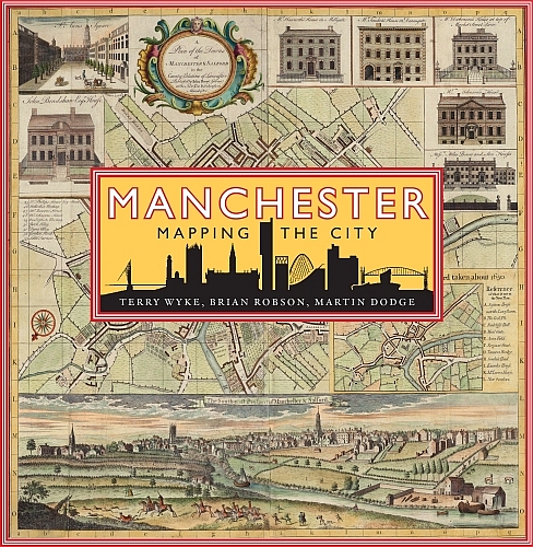
Manchester : Mapping the City
This innovative new book uses historic maps and unpublished original plans to chart the dramatic growth and transformation of Manchester as it grew rich on its cotton trade from the late 18th century, experienced periods of boom and bust through the Victorian period, and began its post-industrial transformation in the 20th century. Manchester: Mapping the City is the first history of the city seen through the eyes of its cartographers and their maps.
- DETAILS
- Published by Birlinn, October 2018
- ISBN 9781780275307
- Hardback format and full colour illustrations, 272pp
- RRP £30
Take a look through the book on this short video..
Introduction
Acknowledgements and map sources
1728 Eighteenth century panoramic views
1746 The towns first authentic street map
1753 Shudehill and the Hulme Charity
1780 The first modern canal
1788 The development of estate land in the growing town
1793 Laurent and Green: copy or complement?
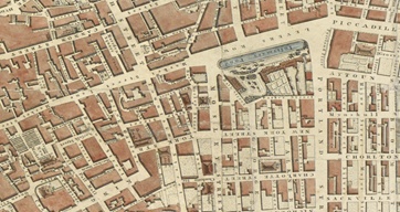
1809 Town directories and Pigots Manchester plans
1819 The Peterloo Massacre
1824a The mixed legacy of grand houses
1824b The coming of railways
1831 Spinning mills and the making of Cottonopolis
1832a Lines on maps: Dawson and parliamentary boundaries
1832b Moving the starting line: Manchester race courses
1837 Victoria Park: a gated enclave
1849 The scourge of cholera
1851a Adsheads map: a flawed masterpiece
1851b Municipal parks: health and civic pride
1857 The Art Treasures Exhibition and illustrated town guides
1866 A municipal palace: Alfred Waterhouses Town Hall
1868 Paying the cabbie
1881 Delivering plentiful clean water to the city
1889a The demon drink
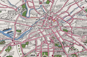
1889b A birdseye view
1889c The fear of fire: Goads insurance plans
1892 Salford at the end of Victorian industrialisation
1894 Manchester Ship Canal: The Big Ditch
1896 Trafford Park: the first industrial estate
1904 Mapping Manchesters slums
1906 Victoria Stations railway wall map
1908 Garden suburbs: Burnage and Chorltonville
1912 The Royal Exchange: parliament of the cotton lords
1916 The handy penny tram
1923 Moving the goalposts: Old Trafford and Maine Road
1926 Civic Week: a cartoon cartography of the city
1928 Wythenshawe: satellite town or garden city?
1937 Entertainments: stage, screen and the music scene
1945 Postwar visionary planning
1956 Fantasy transport: unrealised plans above and below ground
1958 Belle Vue: bread and circuses
1960 Introducing parking meters
1967 Masterplanning an educational precinct
1972a Soviet mapping: a view from the East
1972b Hulme Crescents and after
1975 Air pollution and smoke control areas
1976 Mapping the most famous street in Manchester
1978 The Arndale: shopping behemoth
1982a Taking to the skies: Manchester Airport
1982b Defining the green belt
1985 Inventing Salford Quays and MediaCity
1986 Castlefield: urban heritage
1996a Reconfiguring the city centre after the IRA bomb
1996b One man maps the city centre
2001 Regenerating east Manchester
2016 Recognising the wider city region
Further reading
Index
These samples are taken from the uncorrected page proofs.
- The Introduction (download chapter as a pdf)

- 1824 - The Coming of Railways (download chapter as a pdf)

- 1904 - Mapping Manchester's Slums (download chapter as a pdf)

- 1986 - Castlefield: Urban Heritage (download chapter as a pdf)

- looks the history of Manchester using a rich array of more than 100 street maps, land surveys, engineering plans and promotional birds-eye view.
- features original maps from the eighteenth to the twenty-first century, drawing on local archives and libraries. Illustrates and discusses the significant events and places that have featured in Manchesters history, such as Peterloo, the Ship Canal and the docks in Salford, Town Hall, Belle Vue, Victoria Station, and the two football grounds.
- Tells the story of some of the influential map-makers who have surveyed Manchester.
- Large format and lavish full colour illustrations throughout.
THE AUTHORS
- Terry Wyke is Honorary Research Fellow in History at Manchester Metropolitan University. His Public Sculpture in Greater Manchester was the winner of the Portico Book Prize in 2005.
- Brian Robson is Emeritus Professor of Geography at Manchester University where he worked on urban policy. Since retiring he has pursued his long-held fascination with historic urban maps.He has recently published a paper on Pigot's directory maps for Manchester in the Cartographic Journal.
- Martin Dodge is Senior Lecturer in Geography at Manchester University. Much of his current research focuses on Manchester and he has co-curated several high-profile public exhibitions about the city, including Infra_MANC and Making Post-war Manchester. Email: m.dodge@manchester.ac.uk
Excerpt of Civic Week cartoon map, 1926
(Browse the full map online from University of Manchester Library)
Excerpt from Charles Laurent's street map, 1793
(Browse the full map online from University of Manchester Library)
- The book is based on many years of research and disparate collecting of maps, plans and cartographic ephemera by the authors. We have been greatly helped by many people.
- Local librarians and archivists in a range of Manchester's key institutions have been especially generous in giving us their time and support.
- Staff at Chethams Library have taken a close interest in the project from its outset and generously allowed us to use the rich collection of maps and plans held by the Library.
- Special thanks are also due to the helpful staff at Manchester Central Library and Archives+;
- The maps team at Manchester University Library and the Heritage Imaging Team at the John Rylands Library;
- Other helpful institutions that provided maps and plans directly or provided helpful directions include the National Library of Scotland; Salford Local History Library; the Portico Library;the Greater Manchester Museum of Transport; the Manchester United Museum; the Canal Maps Archive; Trafford Archives and Local Studies;
- We also gained much benefit from the sterling efforts Digital Archives who have digitised several important historic maps for Manchester.
- Expert
help and guidance with the illustrations was provided by
Graham Bowden and Nick Scarle in the Cartographic
Unit, University of Manchester.
- Suggestions for accessing historic maps of Manchester online:
- Archives+ collection on Flickr
- University of Manchester Library digitised map collection
- Manchester maps interactive site
- Talks:
- Dodge M, 2018, "Mapping Manchester", Mapping Manchester for Researchers, John Rylands Library, 4 December 2018. (slides of the presentation)
- Dodge M, 2018, "Manchester: Mapping the City", Portico Library, Manchester, 5 December 2018. (slides of the presentation); Photograph of the Portico Library talk, courtesy of Carly Richardson

- Download the design of the book's dust jacket
- The
press release via the University of Manchester, 3rd October
2018, "Book
reveals exquisite and detailed map of Victorian Manchester"
- Press coverage for the book:
- i News, 19th October 2018, "How commuters in Victorian Manchester travelled with the Uber of 1868" by Dean Kirby
- The Northern Quota, 28th October 2018, "Mapping the City - new book explores the history of Manchester" by Katherine Relton-Grice
- Manchester
Evening News, 25 November 2018, "The
long-lost maps that tell the incredible story of
Manchester" by Damon Wilkinson
- Your
Manchester Magazine, Autumn 2018, "Putting
Manchester on the map"
- Reviews of the book:
- Review in the Society of Cartographers Bulletin (Dec. 2018) by A.H. Schulenburg
- Review in the International Map Collectors' Society Journal (No. 156, March 2019) by Donna Sherman
- Review in North West Geography (vol. 19, no.1, 2019) by Paul Hindle
- Review in the LivingMaps Review (spring 2019) by Jeremy Crump
- Review in GoodReads (8 May 2019) by Ali Davenport
- Review in WAML Information Bulletin (vol. 50. no. 2, March 2019) by Paige G. Andrew
- Review in Transactions of the Lancashire and Cheshire Antiquarian Society (vol. 111, 2019) by Morris Garratt
- Review in Sheetlines, Journal of the Charles Close Society (vol. 114, April 2019) by John Davies
- Review
in The Local Historian (vol. 49, no. 3, July 2019)
by Katrina Navickas
- Window display of the book in Waterstones flagship Manchester store on Deansgate (October 2018)

