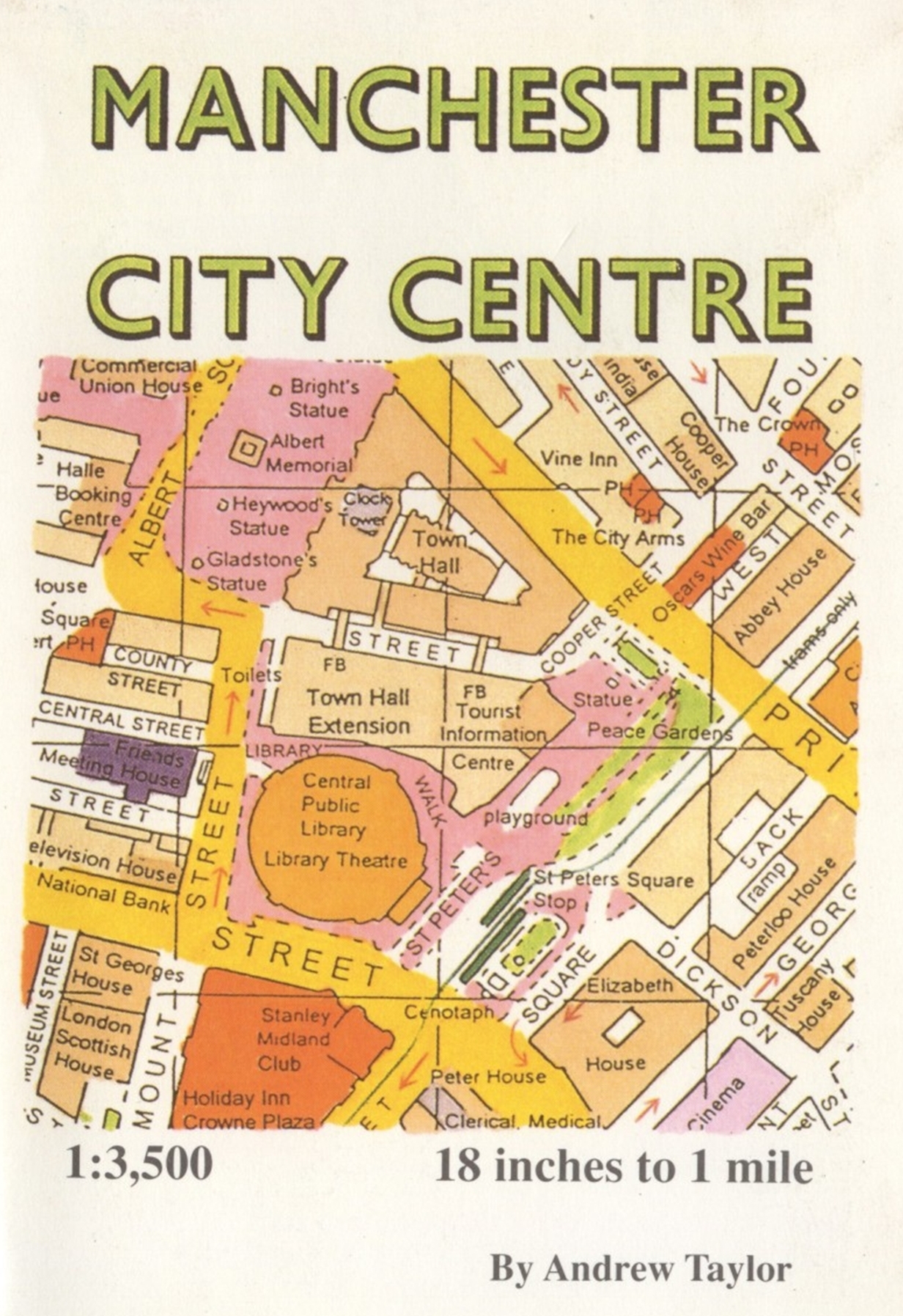
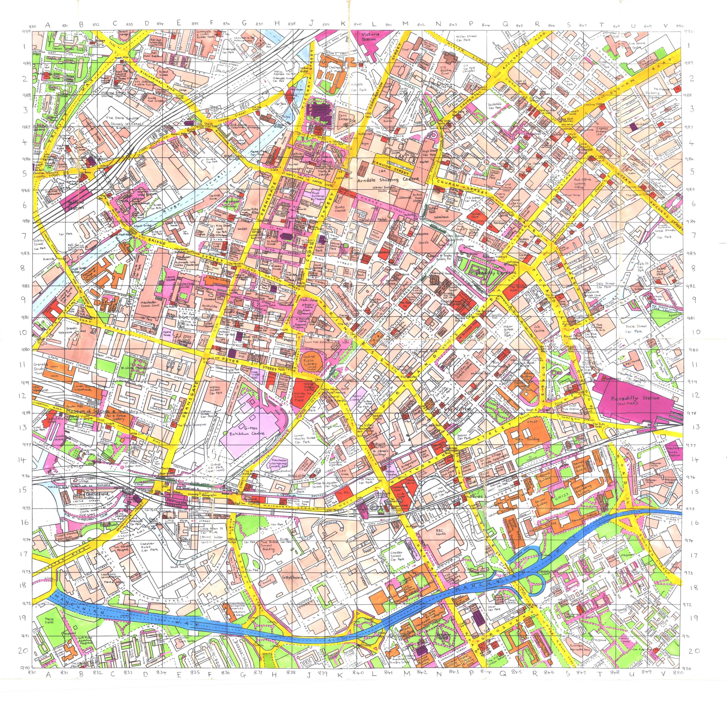
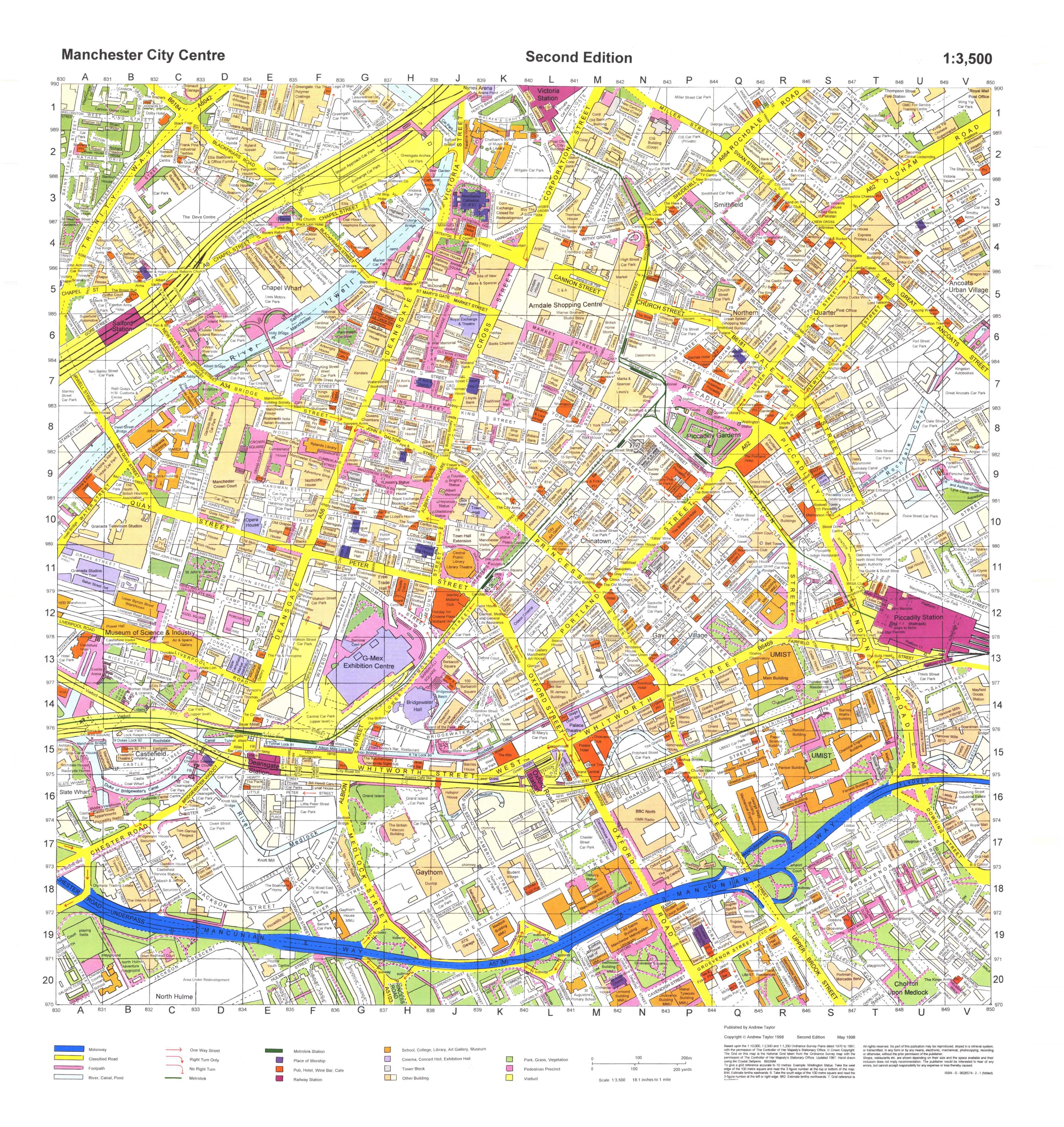
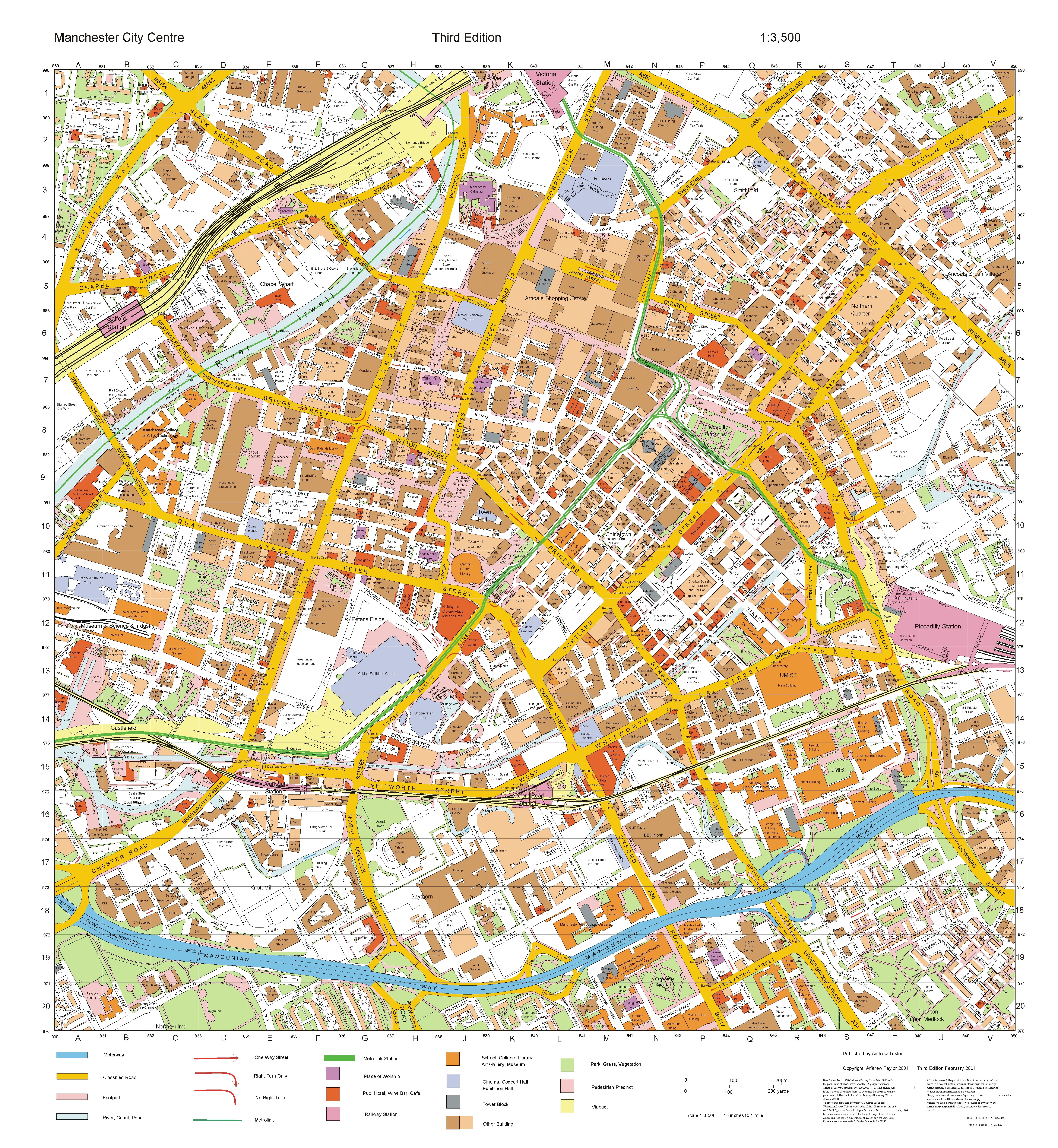
Andrew Taylor's Manchester City Centre Maps
This page provides access to a useful series of detailed street maps of Manchester city centre produced and published by Andrew Taylor from 1996 to 2013.
The maps were originally published in print format. (Some second hand copies can still be found for sale.)
With Andrew Taylor's permission all his maps are available for free online now as a service to the wider community. They are released under Creative Commons License for non-commercial use.
Martin Dodge
August 2021.
- 1995? Hand-letter map. Download: pdf ; large jpeg
- 1996, 1st Edition map. Download: pdf ; large jpeg
- 1998, 2nd Edition map. Download: pdf ; large jpeg
- 2001, 3rd Edition map. Download: pdf ; large jpeg
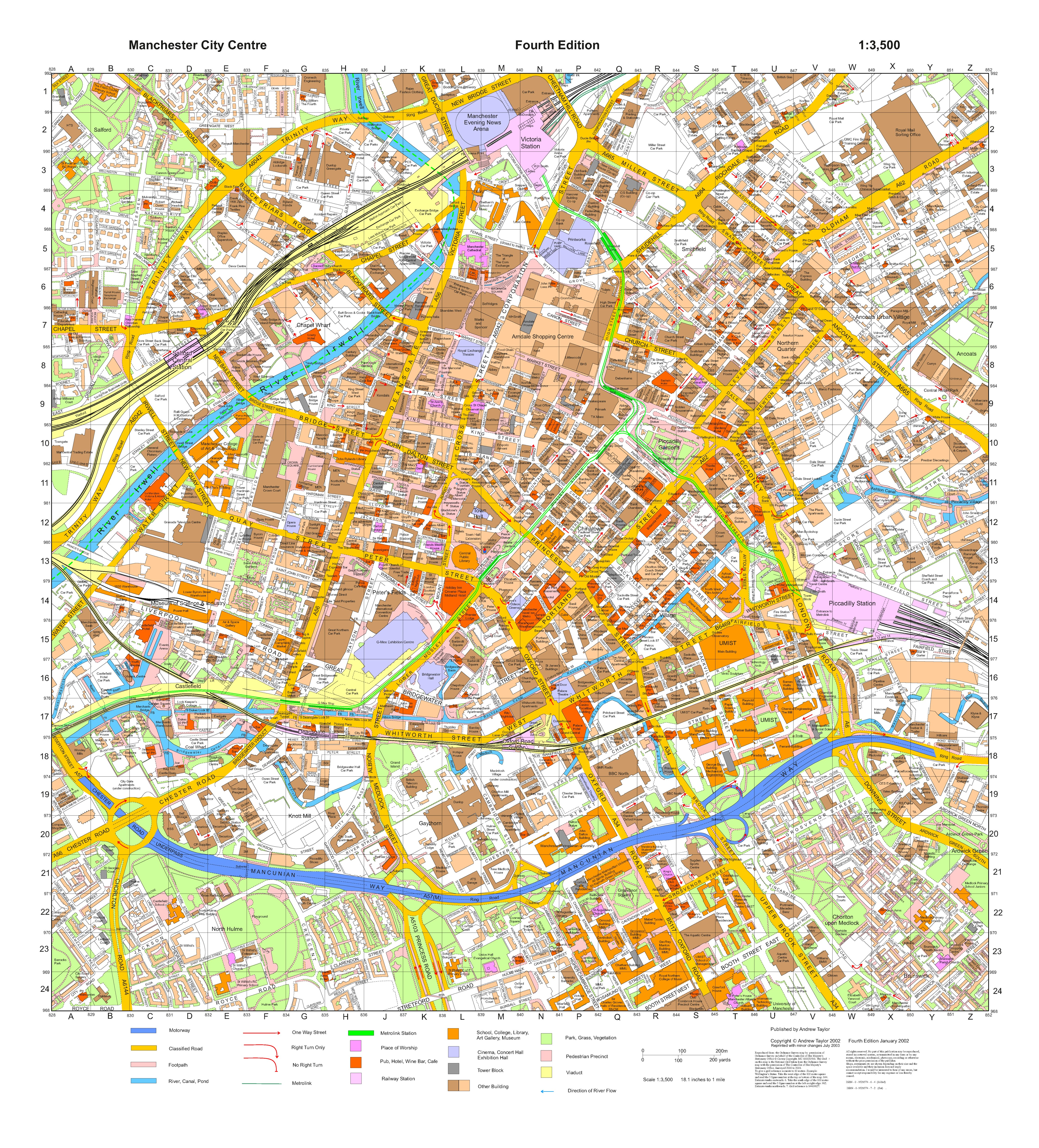
- 2002, 4th Edition map. Download: pdf ; large jpeg
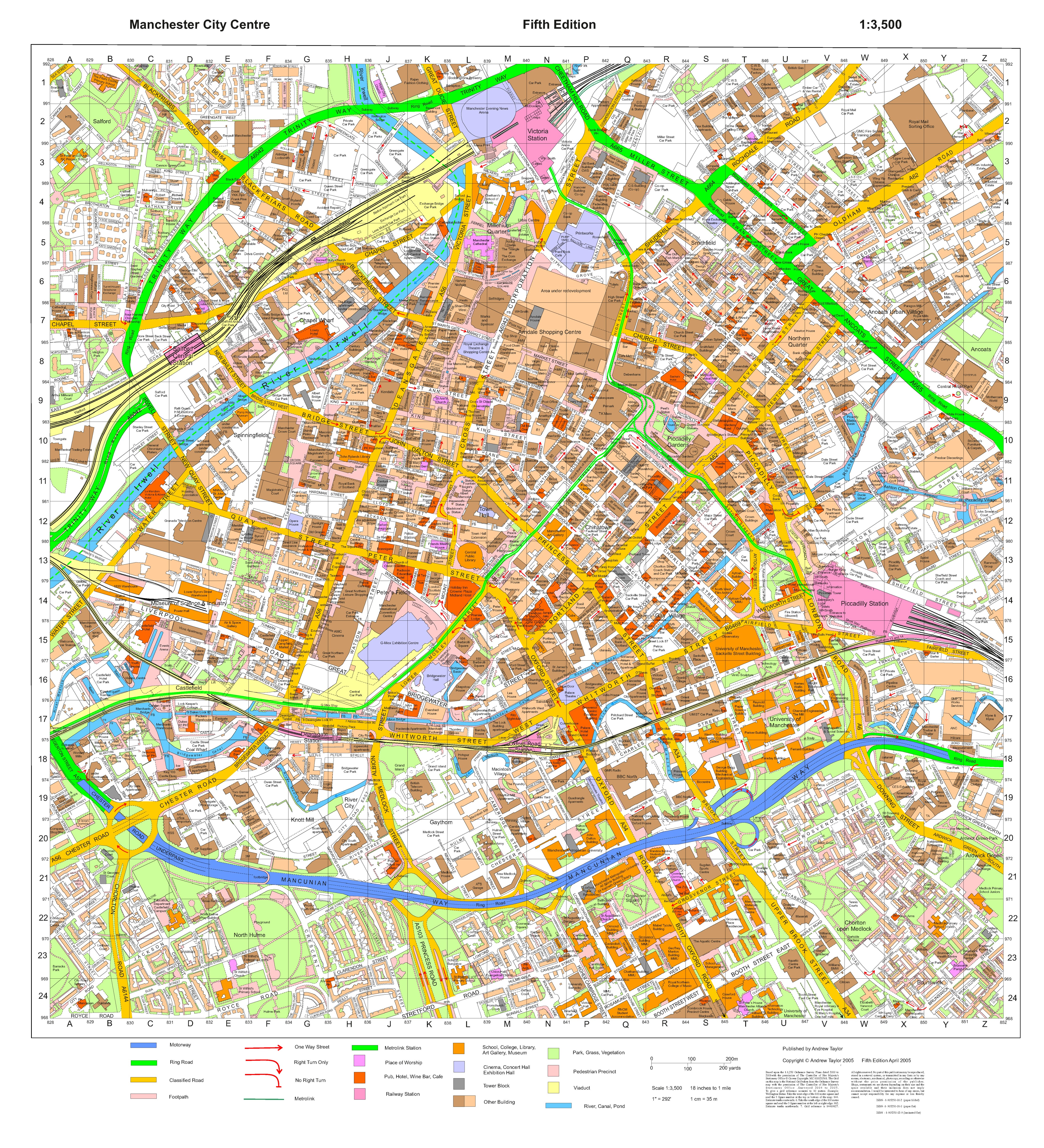
- 2005, 5th Edition map. Download: pdf ; large jpeg
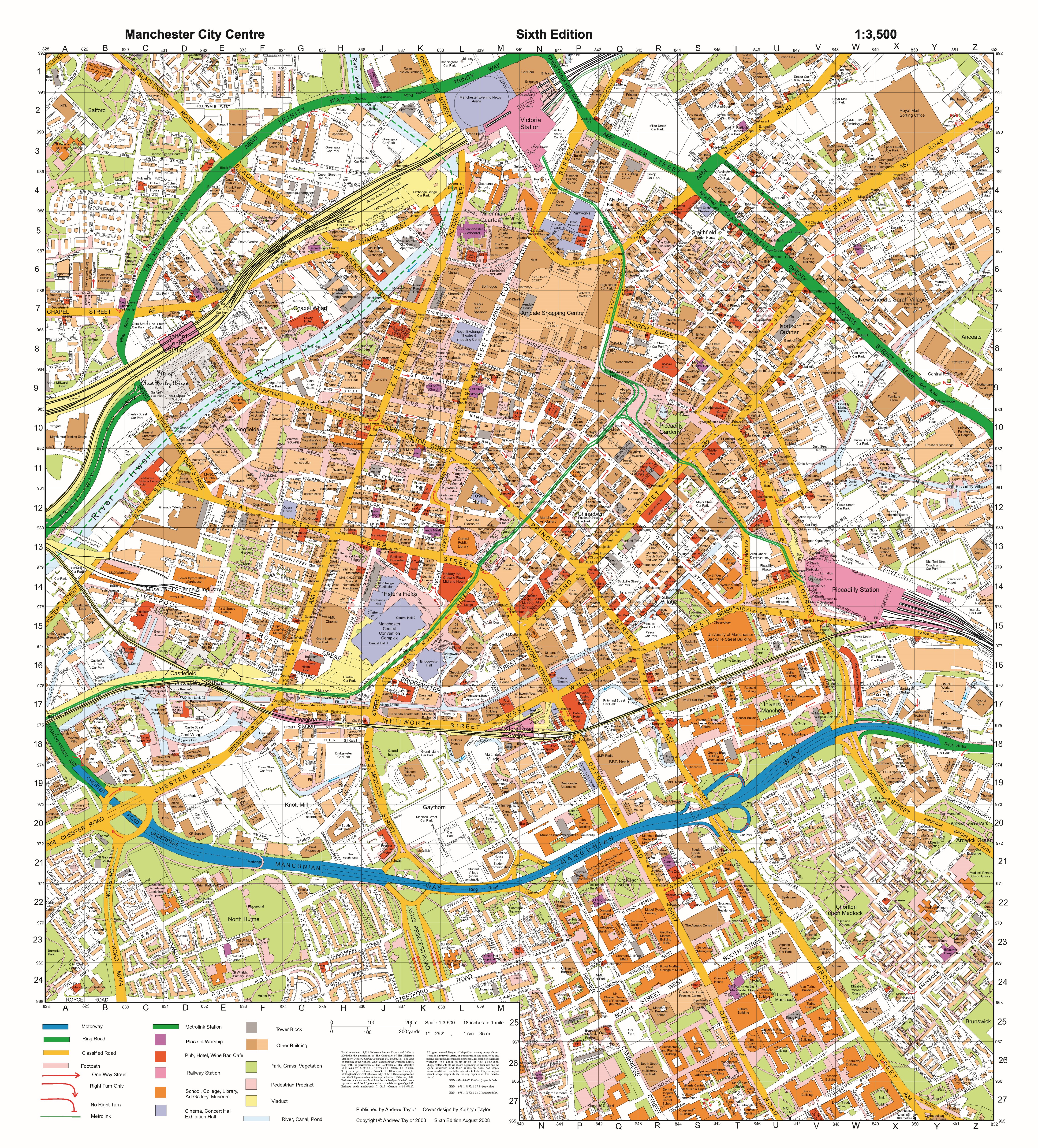
- 2008, 6th Edition map. Download: pdf ; large jpeg
- 2011, 7th Edition map. Download: pdf ; large jpeg
- 2013, 8th Edition map. Download: pdf ; large jpeg
- 2021,
9th Edition map, published
August. The most detailed
Manchester City Centre full
colour map available. It has
been fully updated and extended,
and includes the Middlewood
Locks and New Islington areas.
Marks all tower blocks with
heights in feet and metres. A
comprehensive index on reverse.
- Available as folded map (ISBN: 9781905250172). Order from Waterstones ; Amazon
- Available
as flat map (ISBN: 9781905250189).
Order from Waterstones
; Amazon

Further information
- "The man who mapped Manchester city centre - by walking every street and alley time and time again", Damon Wilkinson, Manchester Evening News, 25th October 20202
- "Mapping Manchester: One Mans Contribution to City Centre Maps", Andrew Taylor, The Cartographic Journal, June 2004
- "One map maps the city centre", Martin Dodge, Manchester: Mapping the City, 2008
