| Census | Topology | Info Maps | Info Landscapes | Info Spaces | ISP Maps | Weather Maps |
|
|
Sorry, the Cybergeography Research web pages are no longer being updated. The project ran from 1997-2004, but my research has moved away into other areas (see my blog for latest). If you have any questions or comments, please email me at: m.dodge (at) manchester.ac.uk. Cheers, Martin Dodge, February 2007. |
| Wireless communications is becoming an ever more important aspect of cyberspace. Maps of infrastructure and coverage of wireless data networks are shown here. |
![]()
802.11b Wireless Networks
|
One of the most interesting area of wireless network provision in the last couple years has been the emergence of community LANs based on sharing network access using the the 802.11b standard (commonly known as Wi-Fi or WLAN). Many local groups are forming in cities. This is largely an unplanned, activist lead movement, working to share access for free. Here are example maps produced by different groups in London, New York City, and Seattle. These maps show the location of WLAN base station nodes that provide wireless access. |
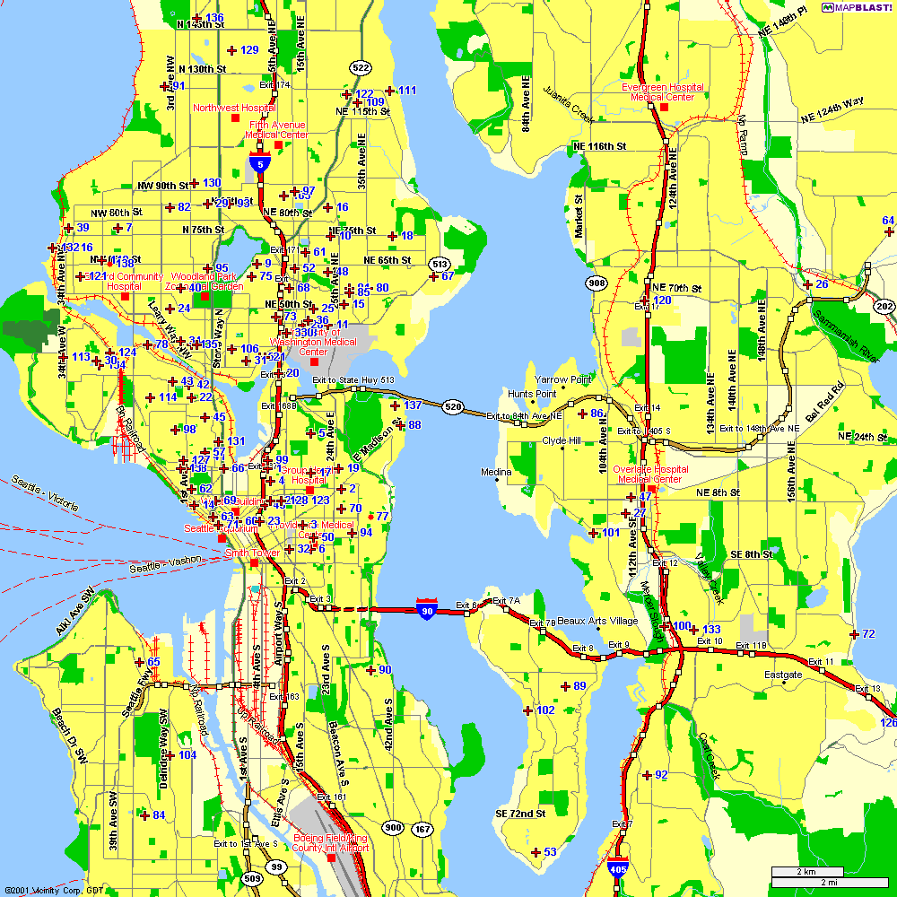
802.11b network node map from Seattle Wireless. |
 |
 |
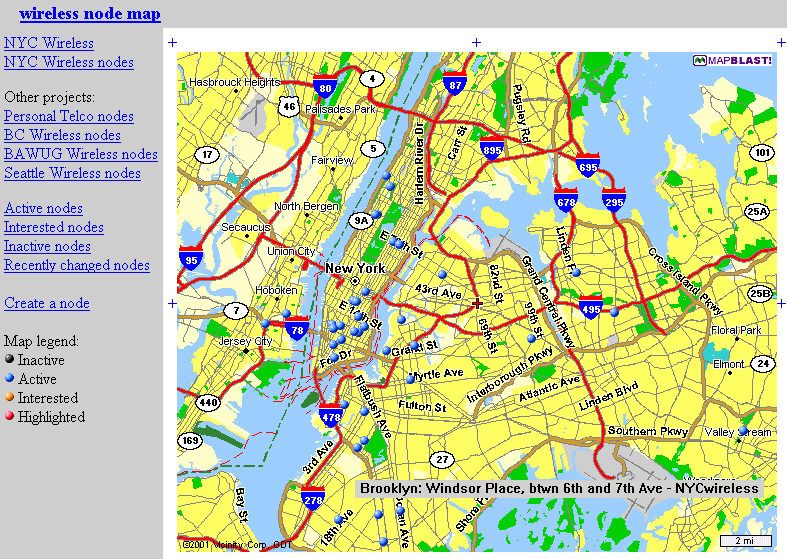
| The blue dots on the map show bases stations registered with NYCWireless in New York City. |
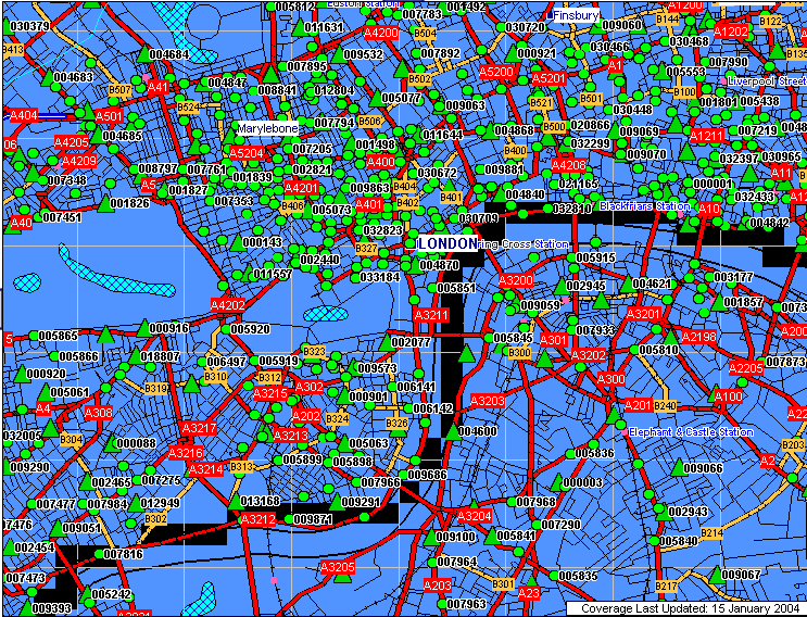
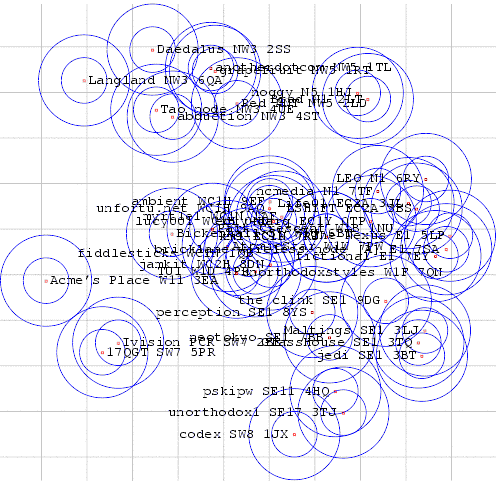
A more abstract map of some of
the 802.11b wireless base station nodes in central London, provided by Consume.
|
|
A useful review article, "802.11b Access Point Mapping", by Simon Byers and Dave Kormann, Communications of the ACM, May 2003. Many other WLAN groups are organising in cities and towns in many countries. A comprehensive list is provided by the Personal Telco Project. Also worth checking out is Freenetworks.org. Background information on the 802.11b free network movement: "A LAN line", The Economist,11th January 2001. "Motley Crew Beams No-Cost Broadband to New York High Speed Freed", Village Voice, by Peter Meyers, 15th August 2001. |
|
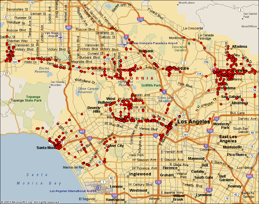
People are searching for active 802.11b nodes by so called 'war driving' - i.e. driving around sniffing for unsecured wireless networks. (This is named after the 80s idea of war dialing.) This example map by Frank Keeney shows the results of his war driving in the Los Angeles area. NetStumbler is a popular utility for used in war driving. |
 |
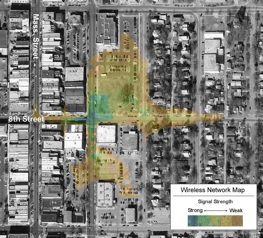 |
Wireless network mapping by researchers at University of Kansas' Information & Telecommunications Technology Center and Kansas Applied Remote Sensing Program. This map shows interpolated signal strength from a 802.11b access point on aerial photographs. |
![]()
Locating mobile phone antennas
|
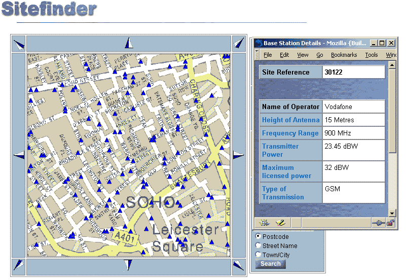
Sitefinder is an interactive map of all mobile phone base stations in the UK provided by the Radiocommunications Agency. The map above shows the density of antennas on a base street map for a small part of central London. Each small blue triangle is an antenna and clicking on them brings up further technical details on emissions. Sitefinder was created in response to health fears of mobile phone towers. As of October 2002 the map database contained about 24,000 base stations and is updated every three months. |
|
The map on the right shows the high density of antennas
in central London, contrasting with suburban south London shown below. |
|
 |
|
![]()
 |
A simple dot map of commercial wireless antennas in the USA. The full database of tower locations can be purchased from Tower Maps. |
![]()
|
Sorry, the Cybergeography Research web pages are no longer being updated. The project ran from 1997-2004, but my research has moved away into other areas (see my blog for latest). If you have any questions or comments, please email me at: m.dodge (at) manchester.ac.uk. Cheers, Martin Dodge, February 2007. |