| Census | Topology | Info Maps | Info Landscapes | Info Spaces | ISP Maps | Weather Maps |
| Wireless | Web Site Maps |
|
Sorry, the Cybergeography Research web pages are no longer being updated. The project ran from 1997-2004, but my research has moved away into other areas (see my blog for latest). If you have any questions or comments, please email me at: m.dodge (at) manchester.ac.uk. Cheers, Martin Dodge, February 2007. |
| We present a range of surf maps, dynamic tools for visualising Web browsing. They provide a visual history by graphing the structure of the Web as you go. The examples use both 2d graphs and more sophisticated three dimensional visualisation techniques. |
| An early example of a surf map called WebMap developed by Peter Dömel in 1994. For background information see his paper "WebMap - A Graphical Hypertext Navigation Tool", from The Second International WWW Conference. | 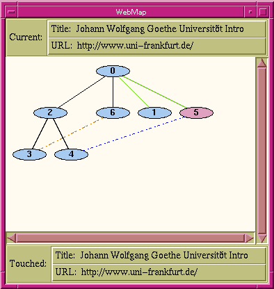 |

| The WWW Graphic History Browser developed by Eric Ayers and John Stasko at Graphics Visualization, and Usability Center, Georgia Tech in 1995. Further information on this surf map is contained in their paper "Using Graphic History in Browsing the World Wide Web", from The Fourth International World Wide Web Conference. |
|
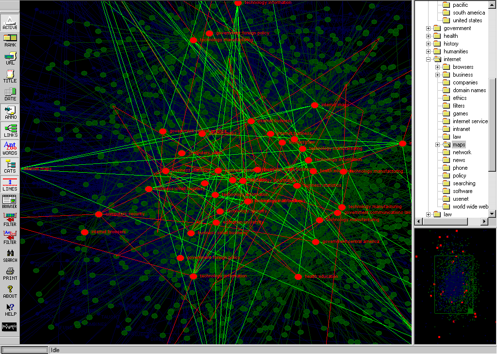
Internet Cartographer, by Inventix Software, is an application that works alongside your Web browser to classify and map all pages you visit. The map can be interrogated to find Web sites. |
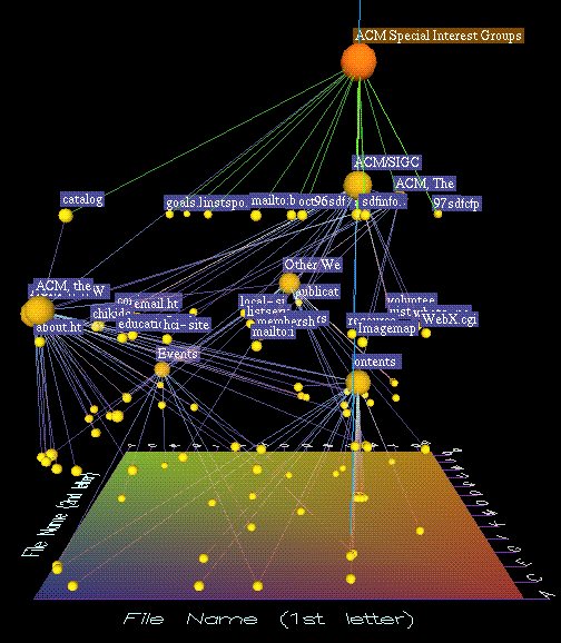
| SurfSerf, shown opposite, is another helper application that produces a two dimension graph of your Web browsing. It shows you the structure of the sites you visited and how they are linked together. It is being developed by James Wen. | 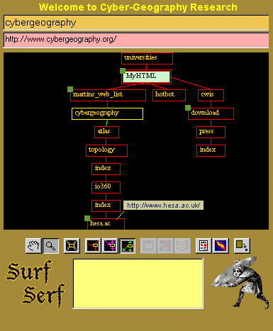
|
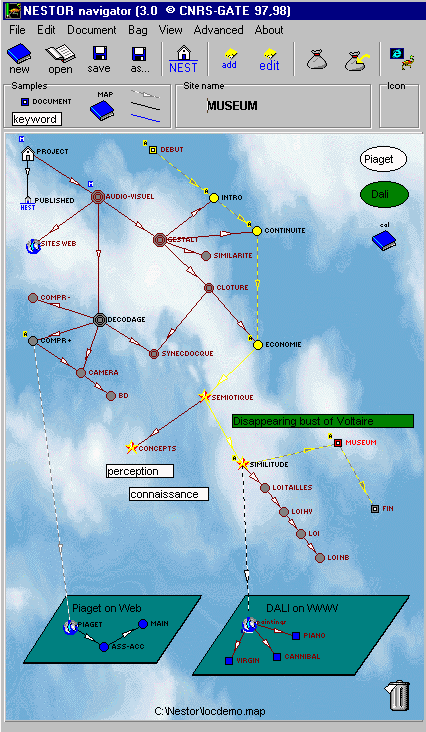 |
The Nestor Navigator is an experimental tool that provides several navigational and mapping tools for Web browsing. It is being developed by Romain Zeiliger, a researcher at Centre National de la Recherche Scientifique (CNRS) GATE, near Lyon, France. |
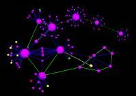
| Natto View, a dynamic 3D visualisation of the Web. It is being developed by H. Shiozawa and Y. Matsushita, Faculty of Science and Technology, Keio University, Japan. |
|
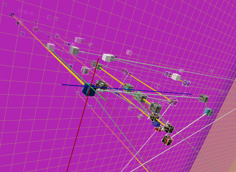
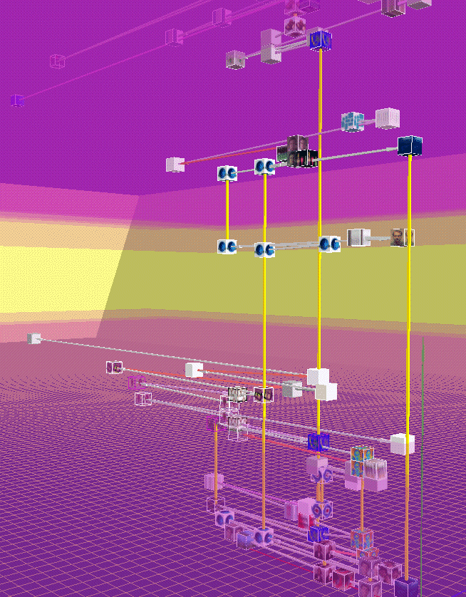
These images show WebPath, "... a tool that unobtrusively visualises a user's trail as they browse the Web", developed by Emmanuel Frécon, a researcher in the Distributed Collaborative Environments group at SICS, and Gareth Smith in the Computing Department, at Lancaster University. See Frécon and Smith's 1998 paper for more information. "WebPath - A three-dimensional Web History", IEEE Symposium on Information Visualization (InfoVis '98), Chapel Hill. NC, USA. |
![]()
 |
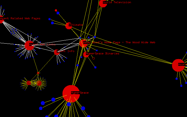
The HyperSpace World-Wide Web Visualiser was developed by a team at the University of Birmingham, United Kingdom in the mid 1990s. The system produced 3D "molecular model" topology maps of Web surfing. |
![]()
|
Sorry, the Cybergeography Research web pages are no longer being updated. The project ran from 1997-2004, but my research has moved away into other areas (see my blog for latest). If you have any questions or comments, please email me at: m.dodge (at) manchester.ac.uk. Cheers, Martin Dodge, February 2007. |