| Census | Topology | Info Maps | Info Landscapes | Info Spaces |
| Wireless | Web Site Maps | Surf Maps | MUDs & Virtual Worlds | Historical |
|
Sorry, the Cybergeography Research web pages are no longer being updated. The project ran from 1997-2004, but my research has moved away into other areas (see my blog for latest). If you have any questions or comments, please email me at: m.dodge (at) manchester.ac.uk. Cheers, Martin Dodge, February 2007. |
| In this page of the Atlas we present a sample of some of the best network topology maps created by Internet Service Providers (ISPs) and Internet backbone operators. The maps are often created for promotional purposes to demonstrate the large bandwidth and good connections available. |

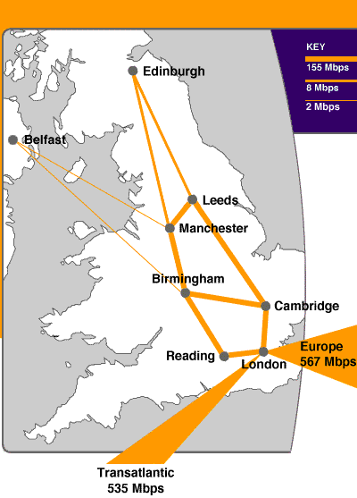
| The London MAN (metropolitan area network) of SuperJANET - the UK's high-speed academic and research network. The map above shows the topology of the network in May 1999. While the map below showed the network 1996. |

 |
 |
|
Maps of UUNET's UK backbone network. The left hand one is taken from February 1999 and the right hand one was from mid 1998. Check their Web site for current details on their network. [For more information on this map see the Map of the Month article "Maps to Market Your Network" in Mappa.Mundi Magazine.] |
 |
 |
|
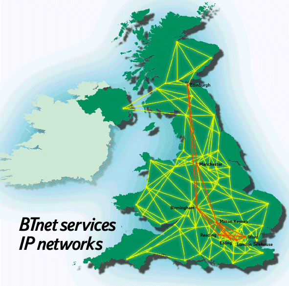
The IP backbone network of BTnet
in the United Kingdom, as early 2000.
|
![]()
Some European examples
|
The backbone network of GARR-B which connects scientific institutions in Italy.
|
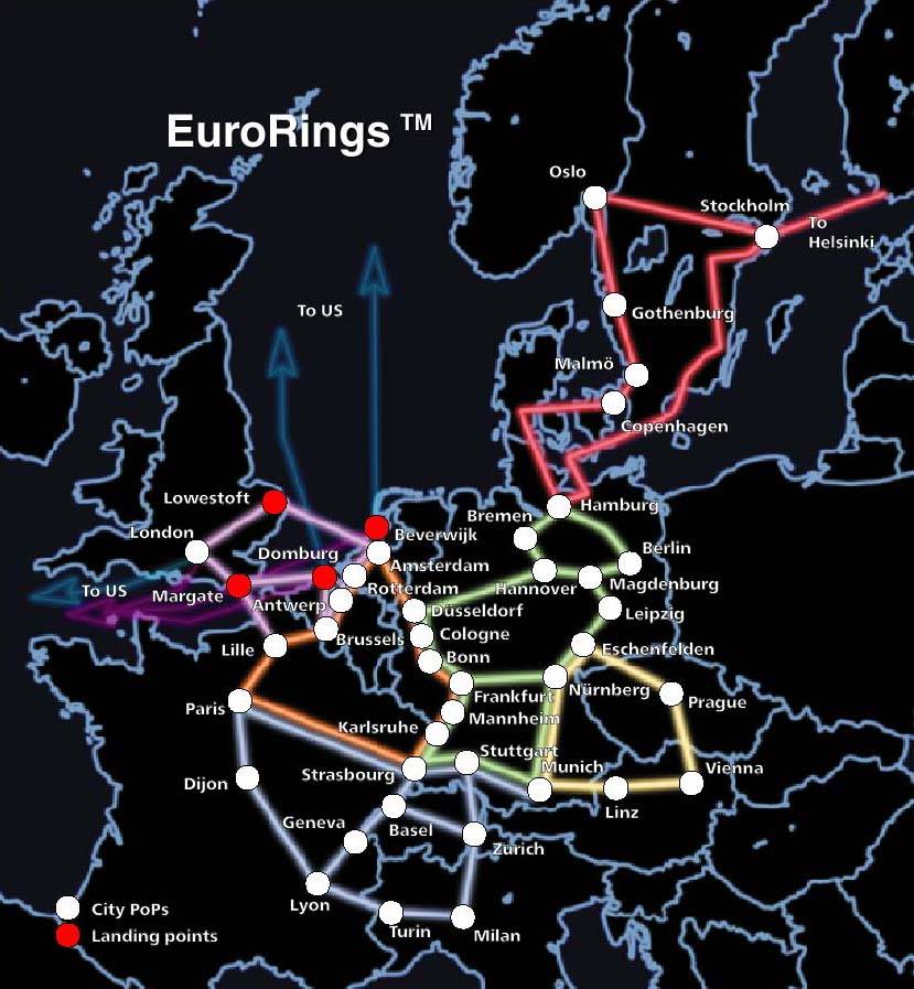
The pan European KPNQwest network, when complete, will connect major cities together by six high-capacity backbone rings. |
|
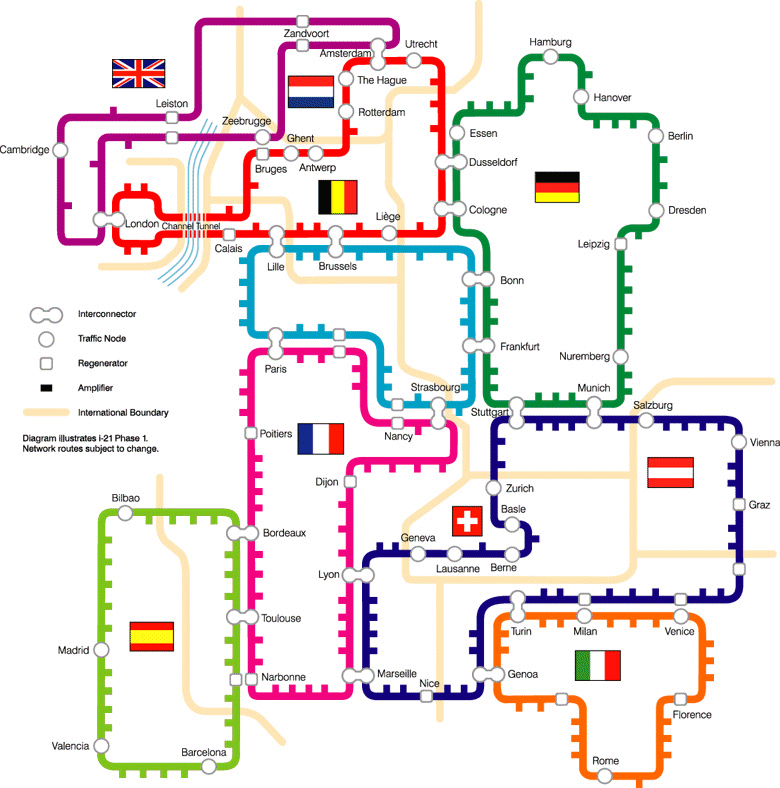
A map of the Interoute i-21 network spanning much of Europe. It is a nice example of the use of a subway map metaphor. |

| An interesting 3D VRML map of CESNET - the Czech educational and scientific network. Unfortunately, the map is no longer available, but details on current topology is here. | 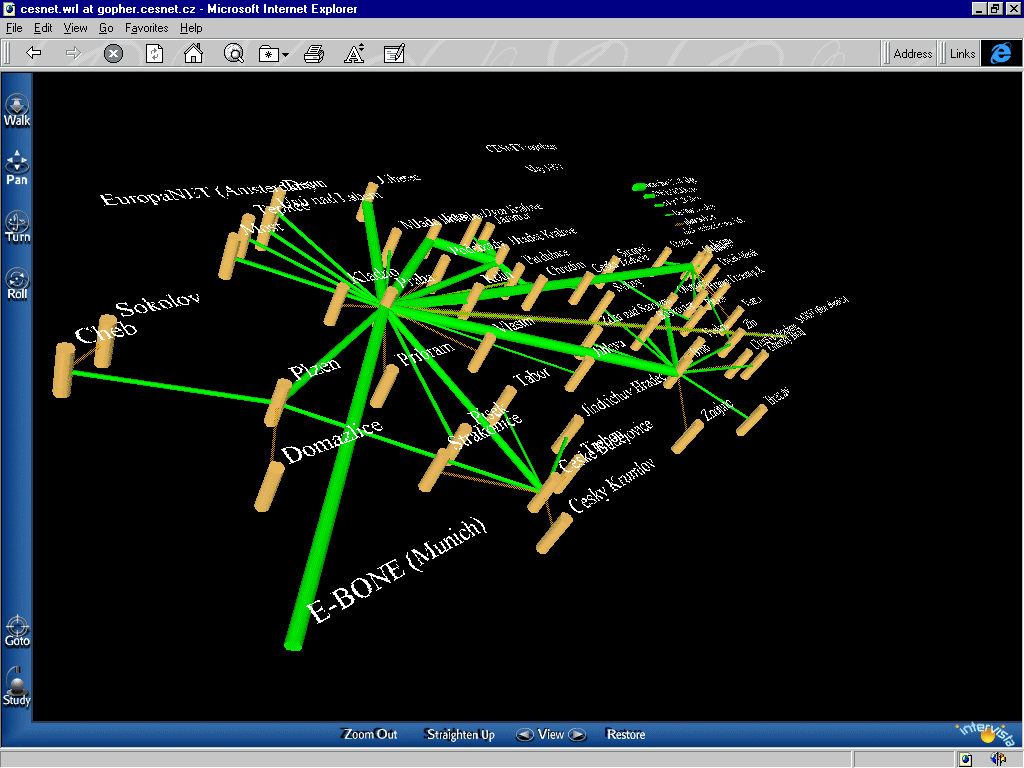 |
|
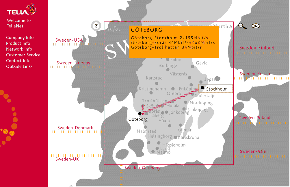
A nice interactive network map of the TeliaNet Internet backbone, based in Sweden, but with connections to many other countries. The map includes interactive query of details on the link capacities. |
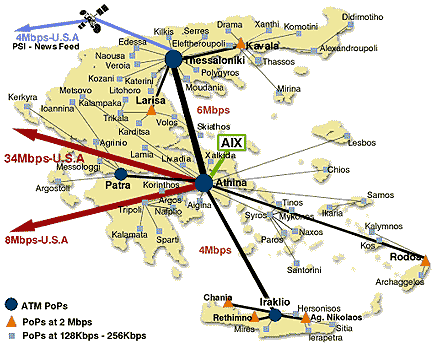 |
The backbone network of FORTHnet, a major Internet provider in Greece. |
|
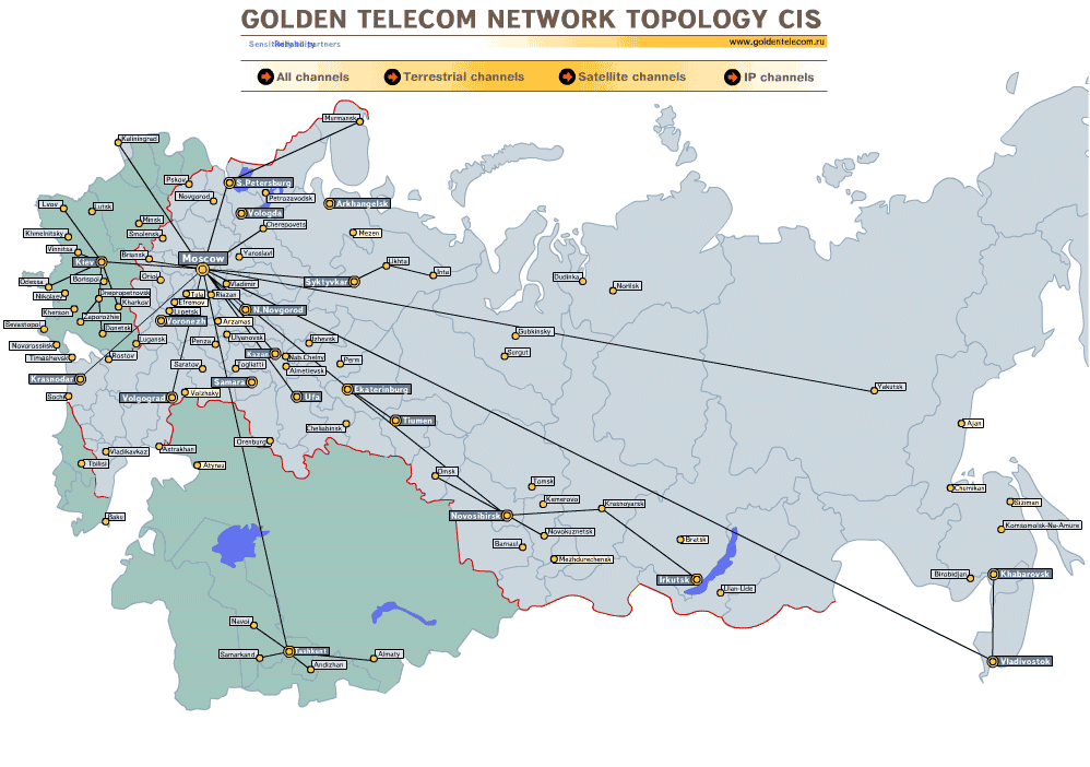
A collection of other Russian Internet maps is available. |
 |
|
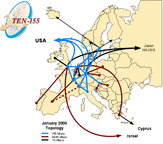
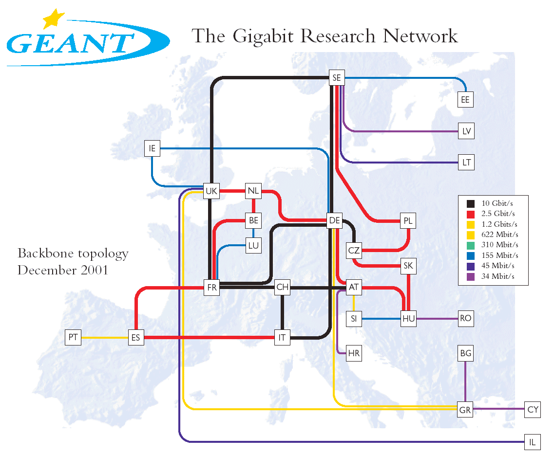
Ten-155 was the pan European high-speed network connecting the national reseach and education networks of 20 countries from 1998 until the end of 2001.
|
 |
It should be noted that in the rapidly changing commercial Internet,
the backbone maps shown here may not necessarily match the current
infrastructure. Please consult the companies web sites for most up to
date maps and information on their networks.
|
Sorry, the Cybergeography Research web pages are no longer being updated. The project ran from 1997-2004, but my research has moved away into other areas (see my blog for latest). If you have any questions or comments, please email me at: m.dodge (at) manchester.ac.uk. Cheers, Martin Dodge, February 2007. |
