| Census | Topology | Info Maps | Info Landscapes | Info Spaces | ISP Maps | Weather Maps |
| Wireless | Web Site Maps | Surf Maps | MUDs & Virtual Worlds | Historical |
|
Sorry, the Cybergeography Research web pages are no longer being updated. The project ran from 1997-2004, but my research has moved away into other areas (see my blog for latest). If you have any questions or comments, please email me at: m.dodge (at) manchester.ac.uk. Cheers, Martin Dodge, February 2007. |
A utility called traceroute probes the paths that data packets take through the Internet, recording all the "hops" (routers) along the way. The original traceroute was written by Van Jacobson at Lawrence Berkeley National Laboratory in USA. It is an important tool for exploring and mapping the structure of the global Internet.
The normal output from traceroute is a text listing of the hops. As an example we used the Windows 95 traceroute utility (called tracert) to run a trace to the Atlas mirror site in the US at www.cybergeography.com. This took 14 hops from my machine in London.
C:\>tracert www.cybergeography.com

Tracing route to www.cybergeography.com [209.8.64.161]
over a maximum of 30 hops:

 1 10 ms <10 ms <10 ms cisco-2.bart.ucl.ac.uk [128.40.59.245]
 2 10 ms 40 ms 10 ms 128.40.255.53
 3 <10 ms <10 ms <10 ms 128.40.20.254
 4 <10 ms <10 ms <10 ms atmr-ulcc.lonman.net.uk [194.83.100.62]
 5 <10 ms <10 ms <10 ms atmr-ulcc.lonman.net.uk [194.83.100.62]
 6 <10 ms 70 ms 40 ms tglobe-gw2.ja.net [193.63.94.80]
 7 91 ms 90 ms 90 ms Teleglobe.net [207.45.215.201]
 8 80 ms 90 ms 101 ms Teleglobe.net [207.45.215.2]
 9 90 ms 130 ms 110 ms gin-nyy-ac1.Teleglobe.net [207.45.199.233]
 10 110 ms 110 ms 110 ms gin-nyy-bb1.Teleglobe.net [207.45.201.33]
 11 111 ms 120 ms 170 ms gin-maee-bb1.Teleglobe.net [207.45.223.2]
 12 150 ms 121 ms 140 ms mae-east.cais.com [192.41.177.85]
 13 120 ms 120 ms 111 ms hssi12-0.mcl1.cais.net [209.8.159.26]
 14 110 ms 120 ms 120 ms 209.8.64.161

Trace complete.
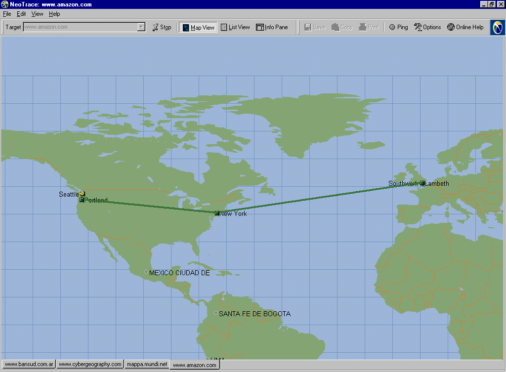
| There are a number of geographical traceroute utilities that try to map the geographical locations of routers. A good example of a geographical traceroute is NeoTrace from Neoworx. The image below shows NeoTrace running a trace from my office in central London to Mappa Mundi magazine based in Redwood City, California. NeoTrace can also show trace results as a listing and a performance chart. |
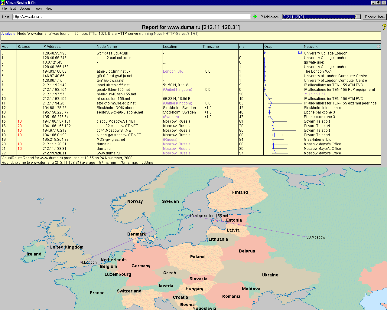
| This is VisualRoute, an
another excellent traceroute utility that maps the router locations
onto the real-world, as well as showing you the details of each hop in
table.
Try the VisualRoute Server for web-based geographic traceroute from many different start locations around the world. |
| tracemap from Matrix.Net a is a Web-based geographical traceroute. The traces run from Alexa in California. The map shows a trace to UCL in London. Tracemap also produces a table of hops and a graph of the times for the trace. |  |
![]()
 |
This map is the result from the Sarangworld Traceroute Project, a web-based geographic traceroute system. It allows you to trace from a range of start locations. It was developed by Sarang Gupta. |
![]()
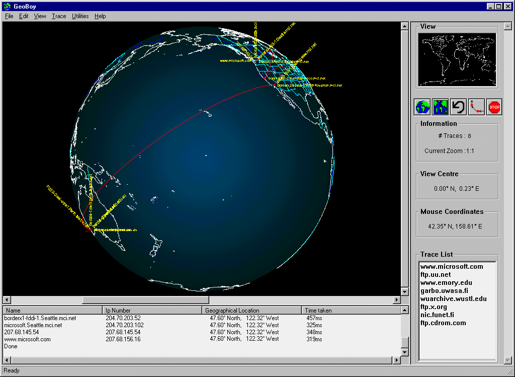
| A map produced by GeoBoy, a geographical traceroute program that uses a 3d global interface, from the NDG Software. In this example, it is tracing the route from Australia to Microsoft in Seattle. [Note, GeoBoy is no longer available.] |
|
|
WhatRoute, a graphical and geographical traceroute utility for the Mac created by Bryan Christianson, IHUG. |
|
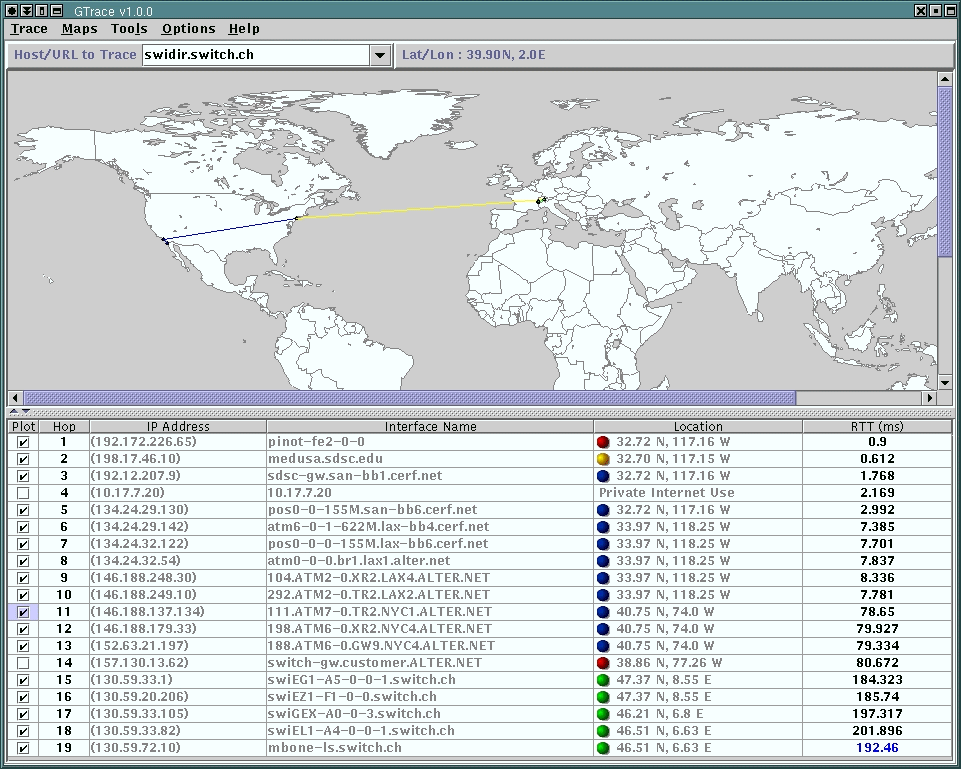
A geographical traceroute
application called GTrace
being developed by researchers at Caida.
|
|
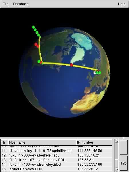
Xtraceroute is an experimental 3D geographical traceroute being developed for Unix machines by Björn Augustsson. |
 |
|
For more information on traceroute see: Jeffery Carl's article "The Imprecise Art of Tracerouting" (ISP Directory). Martin Dodge's article "Mapping How The Data Flows" (Mappa Mundi Magazine, September 1999). CAIDA's animated movie explaining how traceroute work, May 2001. (4 minutes long, mpeg format, 14 Meg download). |
|
Sorry, the Cybergeography Research web pages are no longer being updated. The project ran from 1997-2004, but my research has moved away into other areas (see my blog for latest). If you have any questions or comments, please email me at: m.dodge (at) manchester.ac.uk. Cheers, Martin Dodge, February 2007. |
