| Census | Topology | Info Maps | Info Landscapes | Info Spaces | ISP Maps | Weather Maps |
| Wireless | Web Site Maps | Surf Maps | MUDs & Virtual Worlds | Historical |

Here are the latest additions to the Atlas of Cyberspace
|
|
|
|
|
|
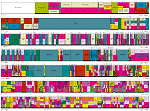
| The citizen's guide to the airwaves provides an excellent visual explanation of the allocation radio spectrum in the U.S. | 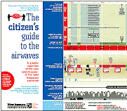 |
|
|
|
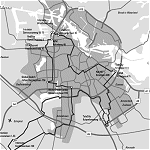
| An example of mapping the location of weblogs onto city subway maps, such as D.C. Metro blog map for Washington D.C., to provide a visual catalogue. | 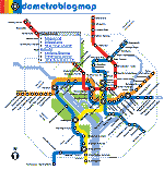 |
|
|
|
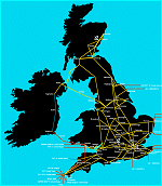
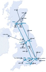
| Interactive map of the O2 mobile phone network infrastructure in the United Kingdom. | 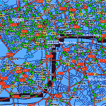 |
|
|
|
|
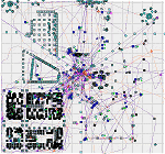
A self-organising map of key themes in geographic research produced by André Skupin.
|
 |
|
|
|
Want to know more?
Why not check out the new book of the Atlas

|
23rd August 2003 |
|
|
|
|
| TextArc, an artistic tool for visualising the structure of writing, developed by W. Bradford Paley | 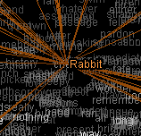 |
|
|
|
|
A map of user trails in a 3D virtual world produced by Katy Börner and colleagues.
|
 |
|
|
|
|
25th April 2003 |
|
|
|
|
| A map of the websites with a GeoURL |  |
|
|
|
|
An example of TeleGeography's mapping of metropolitan area networks
|
 |
|
|
|
| A cartogram of Internet Users by Antonio Scarponi |  |
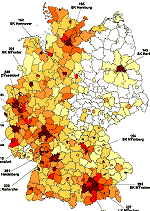
| Maps from the Technology Policy Group's NetmapUSA project benchmarking information infrastructure in U.S. states | 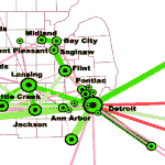 |
|
|
|
| Mapping aging research by Katy Börner and Kevin Boyack | 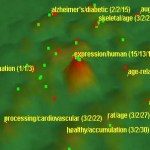 |
|
|
|
|
18th December 2002 |
|
|
|
|
| Sitefinder is an interactive map of mobile phone base stations in the UK | 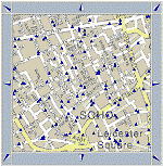 |
|
|
|
| City of News, a 3D information browser by Flavia Sparacino | 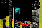 |
|
|
|
| Cobot map of social relations in a MOO by Charles Isbell and Michael Kearns | 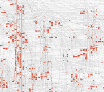 |
|
|
|
|
16th August 2002 |
|
|
|
|
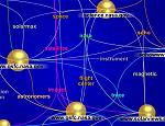
| Geographic distribution of Internet routers by Soon-Hyung Yook and colleagues |  |
|
|
|
| ContactMap, a prototype map of your personal social network | 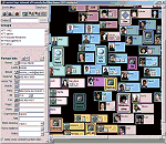 |
|
|
|
| The Spamdemic Map by Clueless Mailers shows the organisation of the spam industry | 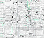 |
| The TouchGraph GoogleBrowser, an interactive graph of web site connections | 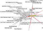 |
|
|
|
|
30th April 2002 |
|
|
|
|
| Visualization of the Linux kernel by the Free Code Graphing Project | 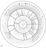 |
|
|
|
| The minitasking visual gnutella client | 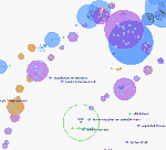 |
|
|
|
|
20th March 2002 |
|
|
|
|
| Mapping WLAN signal strength by researchers at the University of Kansas | 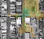 |
|
|
|
|
8th February 2002 |
|
|
|
|
|
New mirror sites:
New Atlas pages looking at weather maps and wireless infrastructure maps.
|
|
|
|
|
| Mapping the Web Infome net art project by Lisa Jevbratt | 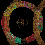 |
|
|
|
| The Czech Republic's CESNET2 network weather map | 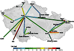 |
| Weather map for GRNET in Greece | 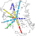 |
| Topological diagram of traffic loads on the GARR-B network in Italy | 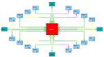 |
|
|
|
|
|
|
| Network map for Golden Telecom in Russia | 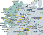 |
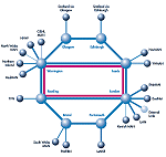
| The topology of the new pan European R&E GÉANT network | 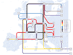 |
|
|
|
| NYCWireless 802.11b network node map | 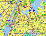 |
| Consume 802.11b network node map for central London |  |
| 802.11b network node map from Seattle Wireless |  |
| A map of war driving for 802.11b nodes in Los Angeles by Frank Keeney | 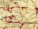 |
| Antennas in the USA from Tower Maps | 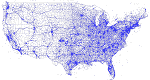 |
|
|
|
|
|
|
|
|
|
| Philadelphia fibre optic cable map | 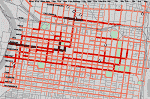 |
|
|
|
| AlphaWorld satellite map from August 2001 by Roland Vilett | 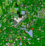 |
|
|
|
|
|
|
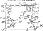
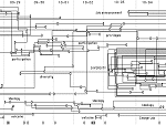
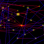
| A sketch map of ARPANET topology by Larry Roberts | 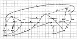 |
|
|
|
|
17th October 2001 |
|
|
|
|
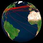
| Africa ONE route map | 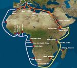 |
|
|
|
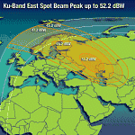
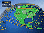
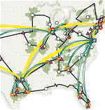
| Internet bandwidth diagrams by TeleGeography | 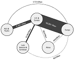 |
|
|
|
| Internet mapping work of Stephen Coast | 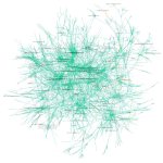 |
| Map of a corporate intranet by Lumeta | 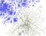 |
| gnuTellaVision visualization of the gnutella peer to peer network | 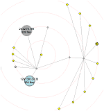 |
| Another gnutella graph created using the Gnucleus client | 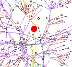 |
|
|
|
| The Smithsonian Institute's HistoryWired information map by Martin Wattenberg | 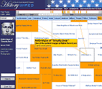 |
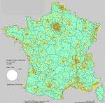
| The UK academic map provides a geographic directory of websites | 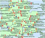 |
|
|
|
| Web Forager 3D information environment |  |
|
|
|
|
|
|
| First map of the ARPANET connection between UCLA and SRI | 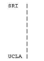 |
| USENET geographic traffic map by Brian Reid from 1986 | 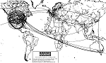 |
|
|
|
| 18th June 2001 | |
|
|
|
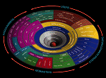
| Communications taxonomy sphere by Nathan Shredroff | 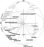 |
|
|
|
| A map of USENET newsgroups from the Netscan project at Microsoft Research | 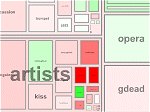 |
| The Kartoo visual search engine |
|
|
|
|
| Introduction | ![]() Whats New | Conceptual
| Artistic | Geographic
| Cables & Satellites | Traceroutes
|
Whats New | Conceptual
| Artistic | Geographic
| Cables & Satellites | Traceroutes
|
| Census | Topology
| Info Maps | Info
Landscapes | Info Spaces | ISP
Maps | Weather Maps |
| Wireless | Web Site
Maps | Surf Maps | MUDs
& Virtual Worlds | Historical |
Want to know more?
Why not check out the new book of the Atlas