| Census | Topology | Info Maps |
| Wireless | Web Site Maps | Surf Maps | MUDs & Virtual Worlds | Historical |
|
Sorry, the Cybergeography Research web pages are no longer being updated. The project ran from 1997-2004, but my research has moved away into other areas (see my blog for latest). If you have any questions or comments, please email me at: m.dodge (at) manchester.ac.uk. Cheers, Martin Dodge, February 2007. |
|
These example cybermaps
represent cyberspaces as three dimensional landscapes.
|
![]()
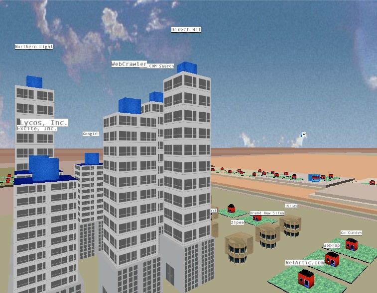 |
The 3D cityscape view of the Web generated by Map.Net. You fly-through the world, with individual websites represented by different buildings. The large skyscrapers are the most popular and important site on the Web. Map.Net also provide 2D information maps of the Web. |
![]()
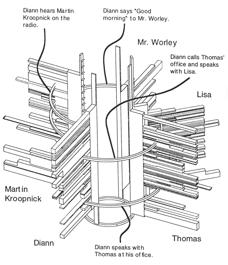
| A visualisation of human extensibility produced by Paul Adams, a geographer at the University of Texas at Austin. The image is of a CAD-model that shows the different communications spaces used by five connected people during one day. |

| The Harmony Internet browser provides 3D information landscape visualisations of Web sites. It was developed by Keith Andrews and colleagues at the Institute for Information Processing and Computer Supported New Media (IICM) at Graz University of Technology. (See Keith Andrew's paper "Visualising Cyberspace: Information Visualisation in the Harmony Internet Browser") |
![]()
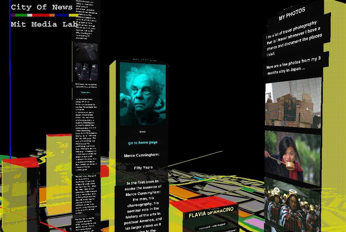
|
The system allows multiple people to 'inhabit' the City of News landscape in real-time via wearable computers and gestural interfaces. |
 |
![]()
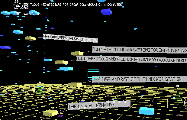 PITS - Populated Information Terrains, an experimental
information visualisation technique developed by Dave Snowdon, Steve
Benford and colleagues in the University of Nottingham. It is an
advanced VR system that allows multiple participants to interact with
information and collaborate with each other.
PITS - Populated Information Terrains, an experimental
information visualisation technique developed by Dave Snowdon, Steve
Benford and colleagues in the University of Nottingham. It is an
advanced VR system that allows multiple participants to interact with
information and collaborate with each other.
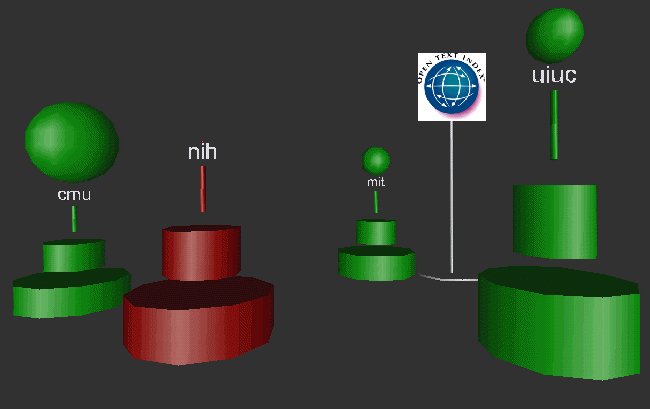 |
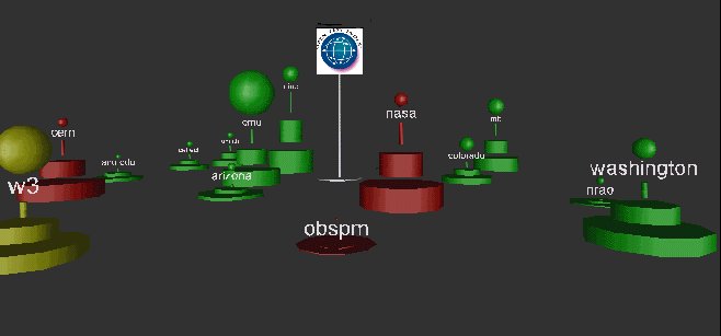
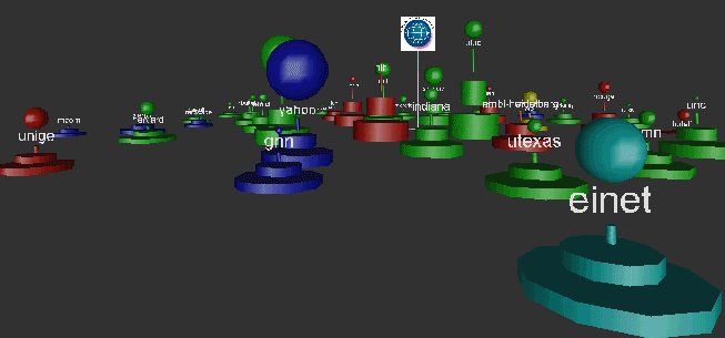
Tim
Bray's visualisation of sites in the 'Web Space', calculated
from metrics derived from the OpenText search engine. For more
information see Bray's paper
"Measuring the Web".
[For more information see the Map of the Month article "Tim Bray's Hyperlink Totems (1995)" in Mappa.Mundi Magazine.] |
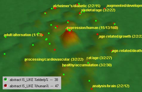 |
The visualisation was created using VxInsight,
a tool for discovering relationships within large databases. |
![]()
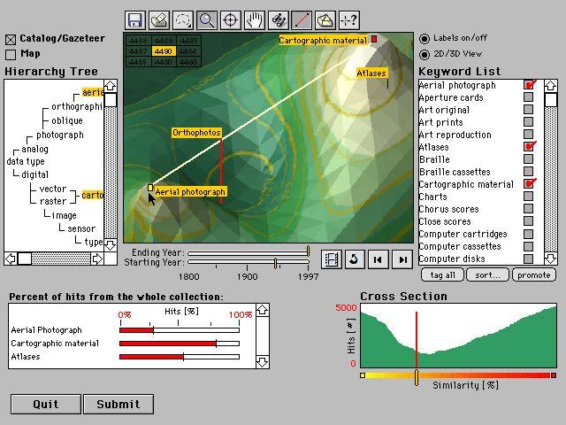
| The research of Sara Fabrikant, whilst a graduate student at the Department of Geography, University of Colorado at Boulder , into information searching and browsing using spatial metaphor of the landscape. The screen-shot below shows the prototype landscape interface. |
|
Sorry, the Cybergeography Research web pages are no longer being updated. The project ran from 1997-2004, but my research has moved away into other areas (see my blog for latest). If you have any questions or comments, please email me at: m.dodge (at) manchester.ac.uk. Cheers, Martin Dodge, February 2007. |