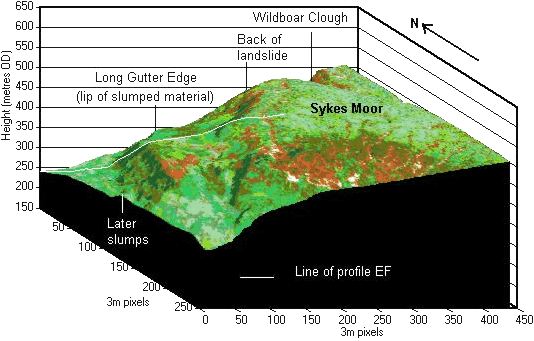
The back of the landslide is the northern edge of Sykes Moor.
A mass of material has slipped north towards Torside Reservoir.
The lip forms Long Gutter Edge.
More recent slumping has occurred on the slope below the lip.
The land cover image draped over the block diagram was made from the HyMap image.
- The colours are approximately true colours.
- White is mineral soil.
- Brown is peat, except for the patch on Long Gutter Edge which is a burn scar from a recent fire.