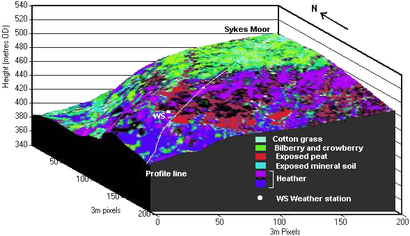
The block diagram CD shows how land cover types relate to topography, e.g.: Cotton grass prefers poorly drained, flat, upland areas.
Bilberry and crowberry occur on the better drained, eroding layer of this blanket peat.
The position of the weather station (which you will shortly visit) is also shown (WS).
