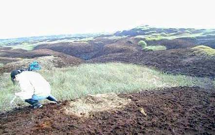
The area west of Hern Stones is a water collecting area.
It lies in a col (low point) between Shelf Moor and Bleaklow Head.
Here, the peat is less well drained and tends to be less severely eroded.
- The yellowy patch at the front of this photograph is where the peat is less decomposed than the peats surrounding it.
- It is lighter as does not contain as much humus, decomposed vegetation, which is a dark brown colour.
- It may have formed at a time when the accumulation of plant material was rapid and decomposition was slow i.e. when the water table was higher than normal and the acrotelm layer was thinner.
The degrading hummock and hollows can be seen where water channels completely separate the landscape into a series of small islands.