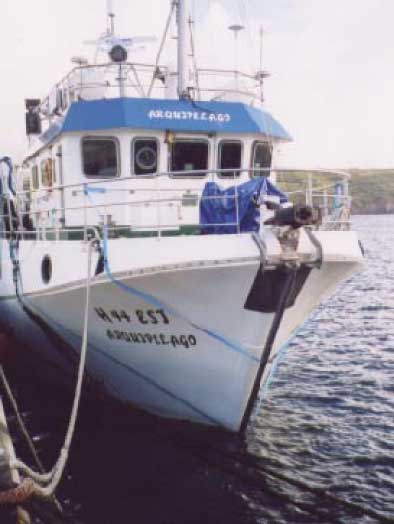
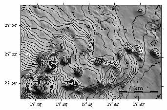
 From the small University of the Azores ship Arquipelago (right) in 2003, we surveyed the coasts with a high-resolution multibeam sonar installed beneath the vessel's bows. The data revealed remarkable branching lava structures such as those shown below. We interpreted these as the lava repeatedly arrested by enhanced cooling at the flow front where fractures are continually opened but then repeated repressurisation within the lava causes it to break out somewhat like pahoehoe lava on land. More details:
Mitchell, NC, C Beier, P Rosin, R Quartau, F Tempera, Submarine lava flows around the coasts of Pico Island, Azores, Geochem. Geophys. Geosyst., 9, Q03024, doi:10.1029/2007GC001725, 2008.
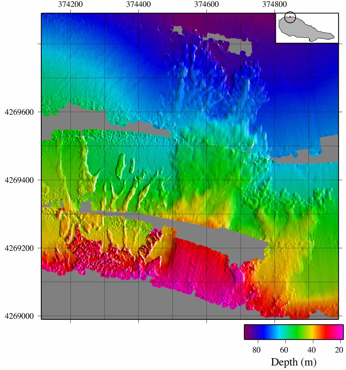
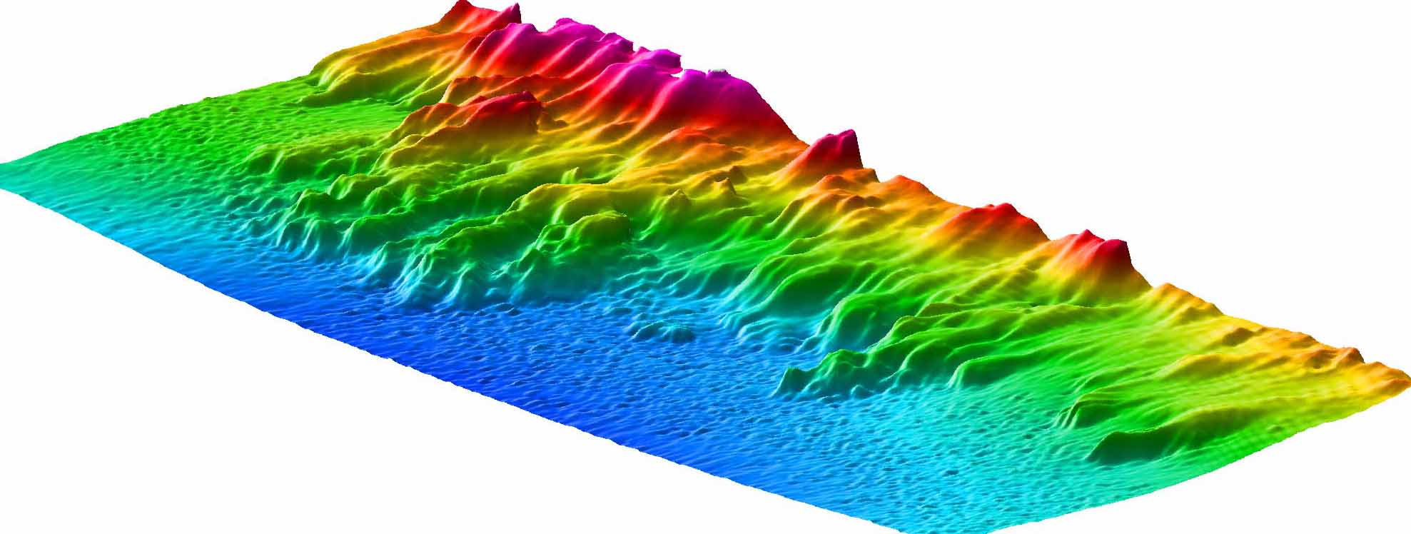
The computer-generated image above shows lava flows in 3D along the southeast coast of the island. The flows to the left show branching geometries to the northwest of the Pico and offshore an area where a lava flow entered the sea in 1718 AD.
 Volcanism in the extensional zone between the African and European tectonic
plates has produced some remarkable major elongate volcanic ridges, in
particular those forming the islands of Sao Jorge and Faial-Pico (map on the right). In 1999, we carried out a survey of the submarine ridges with TOBI, the Southampton deep-tow sonar system, funded by the EU. Preliminary results can be found in our AGU abstract and in the cruise report on the ISMAR Bologna web site. A second survey was carried out with the University of the Azores DOP ship Arquipelago using a portable
multibeam sonar owned by Cardiff University (a Reson SeaBat 8160). An article submitted to Inter Ridge News can be accessed here.
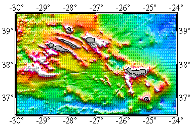
Volcanism in the extensional zone between the African and European tectonic
plates has produced some remarkable major elongate volcanic ridges, in
particular those forming the islands of Sao Jorge and Faial-Pico (map on the right). In 1999, we carried out a survey of the submarine ridges with TOBI, the Southampton deep-tow sonar system, funded by the EU. Preliminary results can be found in our AGU abstract and in the cruise report on the ISMAR Bologna web site. A second survey was carried out with the University of the Azores DOP ship Arquipelago using a portable
multibeam sonar owned by Cardiff University (a Reson SeaBat 8160). An article submitted to Inter Ridge News can be accessed here.
 My interest has been in developing a geological comparison between the Canaries and the
Hawaiian islands based on a dataset collected in the Canaries in 1997 on RRS Charles
Darwin with Doug Masson of Southampton and Tony Watts of
Oxford. This involved developing a new method described in the published article
to summarise the slope characteristics for a given sector of an island's
submarine flanks, which then allowed us to compare different flank areas quantitatively.
My interest has been in developing a geological comparison between the Canaries and the
Hawaiian islands based on a dataset collected in the Canaries in 1997 on RRS Charles
Darwin with Doug Masson of Southampton and Tony Watts of
Oxford. This involved developing a new method described in the published article
to summarise the slope characteristics for a given sector of an island's
submarine flanks, which then allowed us to compare different flank areas quantitatively.