
|
|
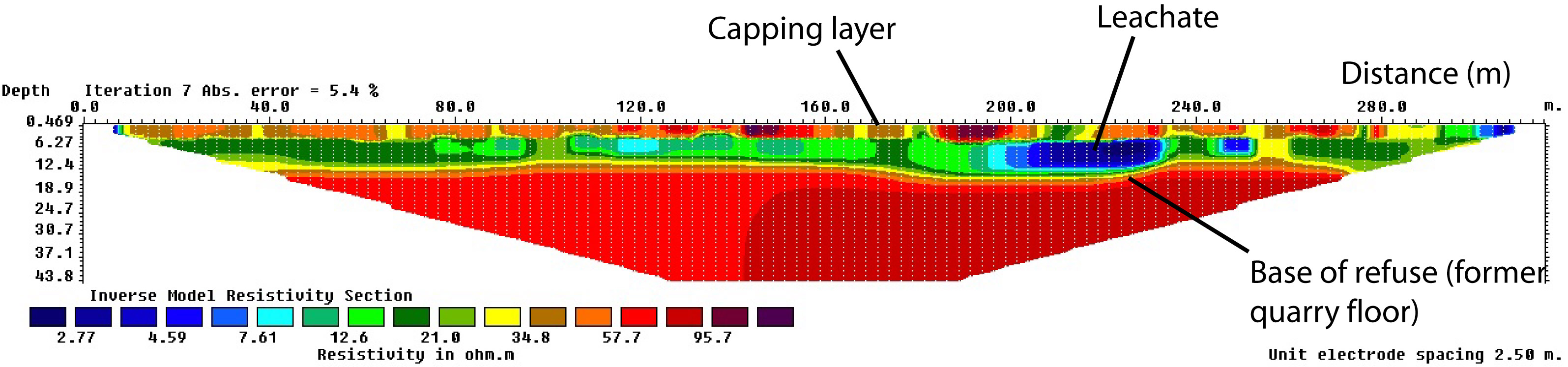
| The image above shows a profile collected across a previous landfill site near Manchester in collaboration with Tameside MBC. The site is now capped and fills a former brick quarry. The image shows a possible leachate (high conductivity) body within the fill and a sharp resistivity contrast at the base of the fill. (Collaborators: Steve Boult, Nicola Sellers and Arthur Nwachukwu (Manchester) and Andrew Taylor (Tameside MBC).) |
|
|
| The profile above was collected running north-south across the centre (waist) of the Mam Tor landslide (an active slump in shales). The top panel (a) shows the resistivity structure obtained after inverting the field data. The second two panels (b and c) show the vertical and horizontal gradients of the resistivity structure to highlight sharp gradients possibly indicating structure within the landslide. Panel (d) shows a rough interpretation with interesting resistivity boundaries marked. The survey was carried out after heavy rain so the areas marked FB are suspected fault breccias that became flooded with rainwater. (Collaborators: Nicola Sellers and Ernie Rutter (Manchester).) |