Maps & plans from History of the Manchester Ship Canal
|
The
Manchester Ship Canal is an iconic engineering feat of the Victorian
era and was a vital infrastructure to the economic success of the city during the twentieth century.
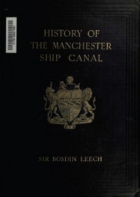
Bosdin Leech's two volume book History of the Manchester Ship Canal
(1907) is the most important contemporaneous written account of the building of
this audacious 36 mile link from Manchester to the Sea. The full text of Leech's book has been scanned and made freely available online via the Internet Archive, however the numerous maps and plans included in the printed volumes have unfortunately not been captured in the digital version. Therefore, it was decided to scan them and make them available for download under a Creative Commons license as free for non-commercial use.
|
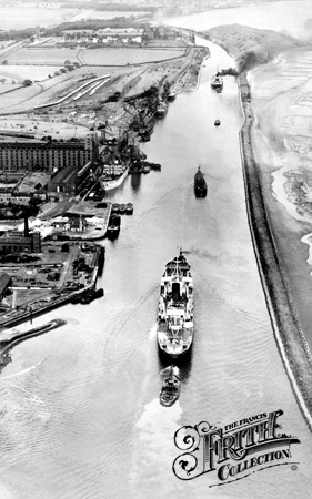
(Image courtesy of The Francis Frith Collection.)
|
 |
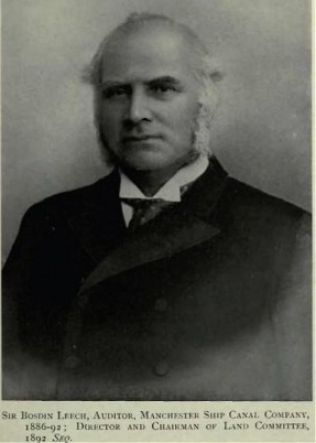 Portrait of Bosdin Leech |
|||||
| Volume 1 materials | Volume 2 materials | |||||
| Cartoons | Charts | |||||
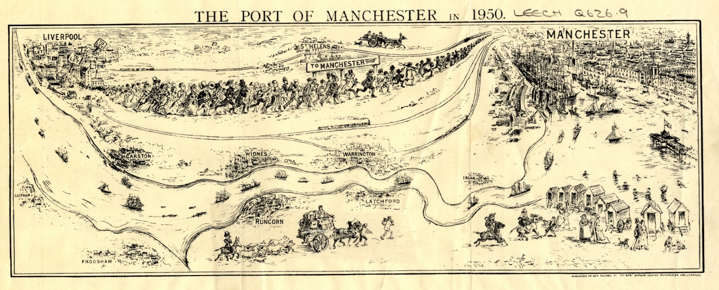
| Humorous Sketch. The Port of Manchester in 1950. From Tit-Bits. (facing p. 116)[1] |
 |
Statistical Diagram of the Progress of the Mancheser Ship Canal, 1894-1905. (facing p. 256)[1] | 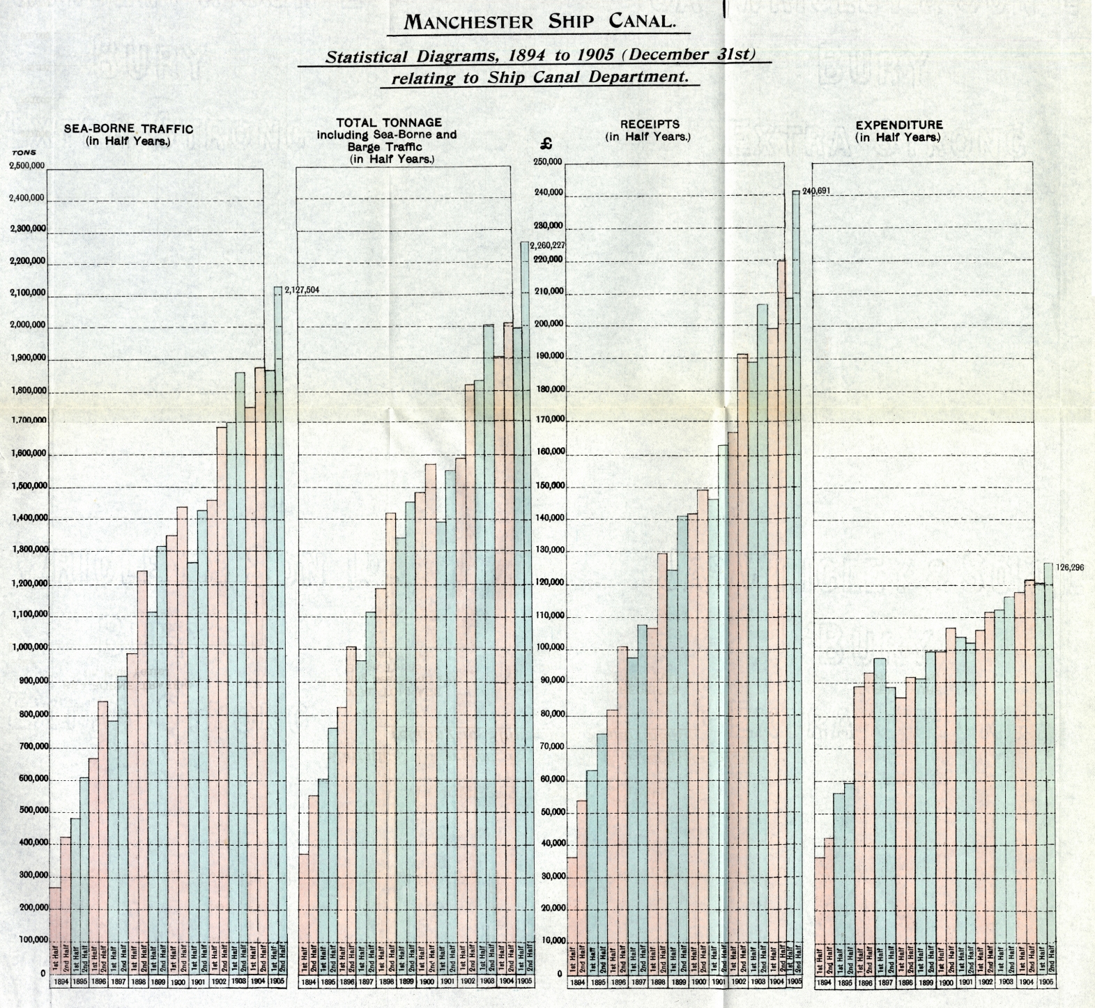 |
|||
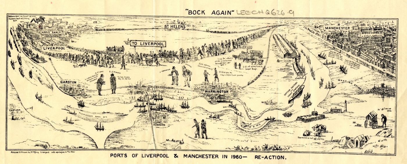
| Ports of Liverpool and Manchester in 1960. Re-action "Bock Again" Rejoinder by W. T. Gray, Liverpool. (facing p. 116)[1] |
 |
|||||
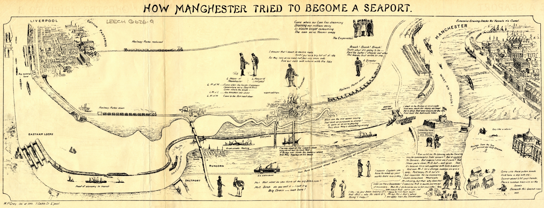
| How Manchester Tried to Become a Seaport. By W. T. Gray. (facing p. 116)[1] |
 |
|||||
| The Great Race for the Manchester Ship Canal Stake. (facing p. 260)[1] |  |
|||||
Plans |
Plans
|
|||||
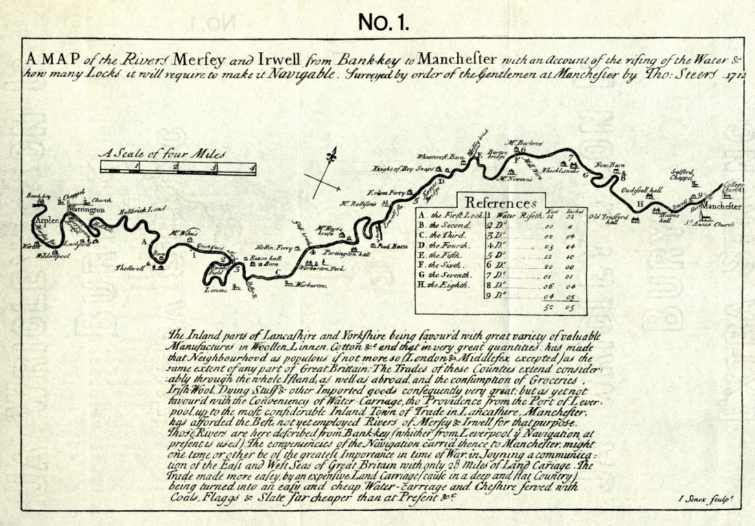
| Map of the Rivers Mersey and Irwell from Bank Key to Manchester. By Thos. Steers, 1712. (facing p. 54)[1] |
 |
Manchester Ship Canal, Eastham to Runcorn. (facing p. 50)[1] | 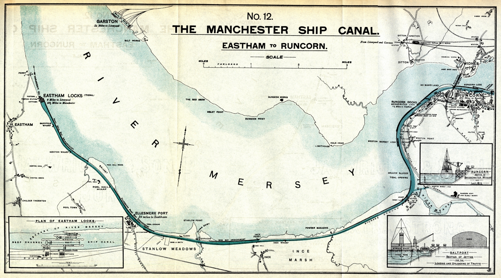 |
|||
| Plan of the Docks, etc., at Dawpool for the intended Manchester and Liverpool Ship Canal, 1825. (facing p. 56)[1] | 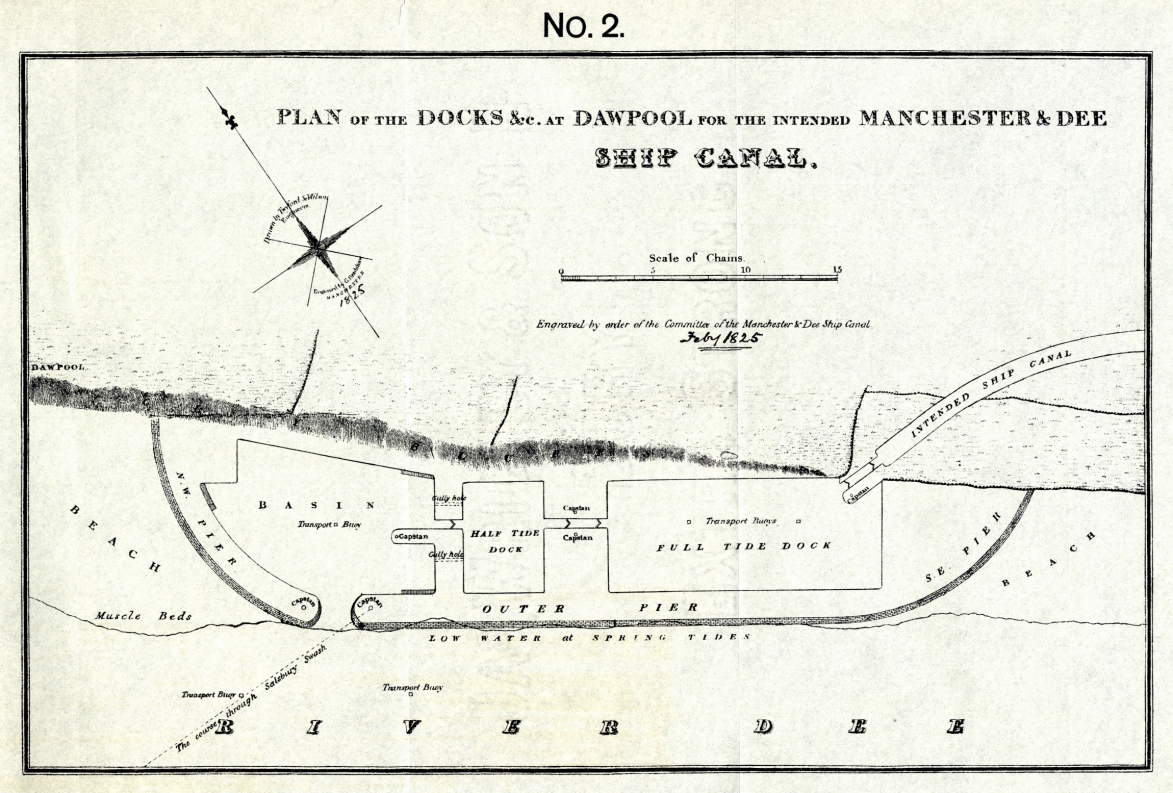 |
Manchester Ship Canal, Runcorn to Warburton. (facing p. 52)[2] |
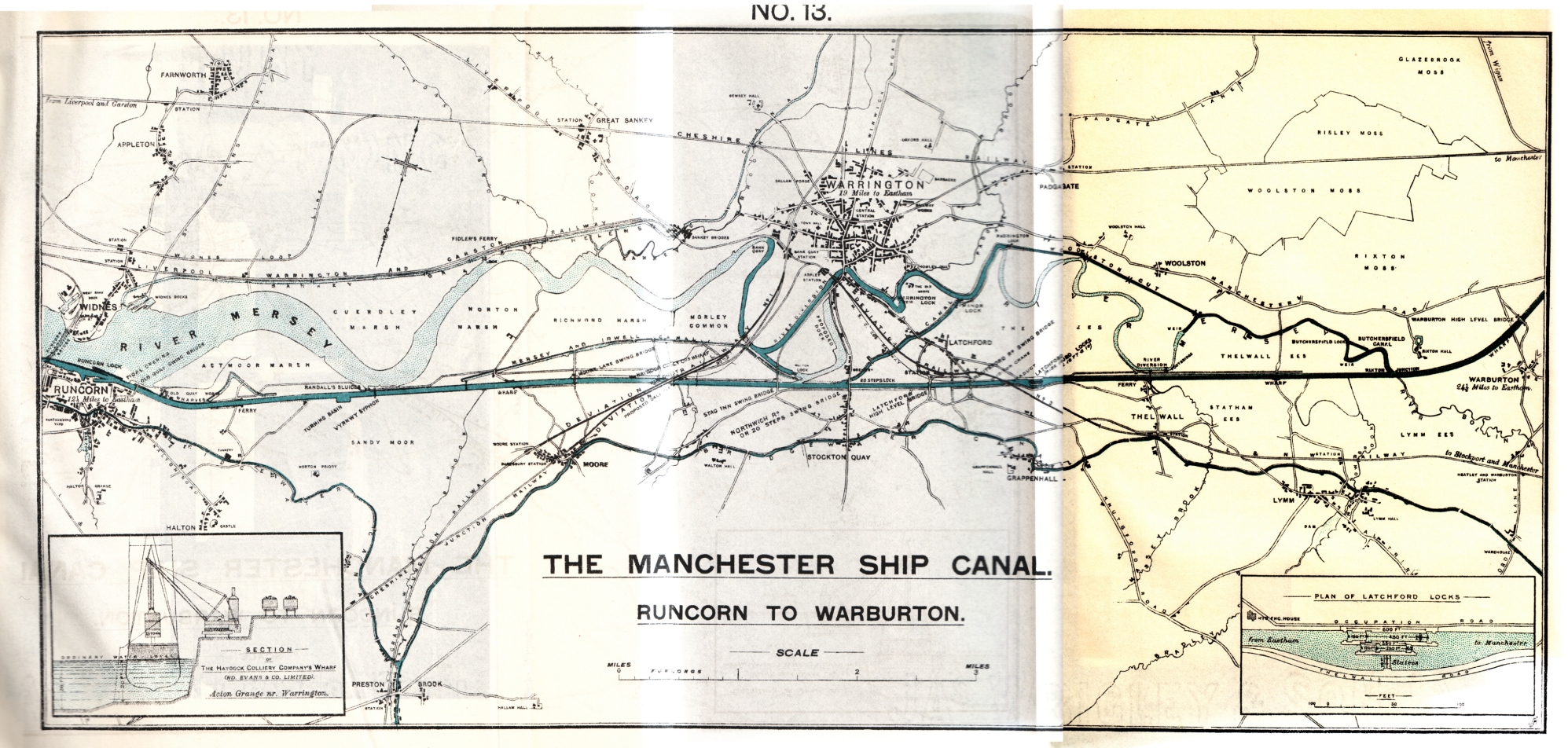 [Apologies for poor quality scan] |
|||
| Plan of the Rivers Mersey and Irwell between Western Point and Manchester, showing Proposed Improvements for Sea-Going Vessels. By H. R. Palmer, F.R.S. (facing p. 70)[1] | 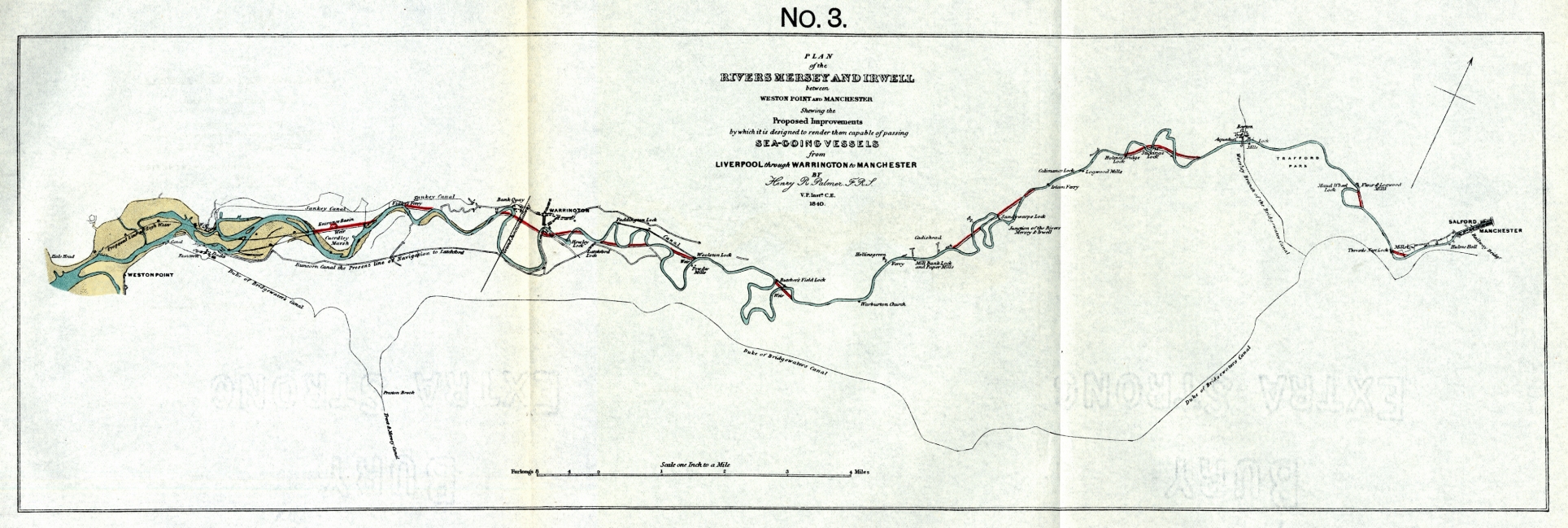 |
Manchester Ship Canal, Warburton to Manchester. (facing p. 54)[1] | 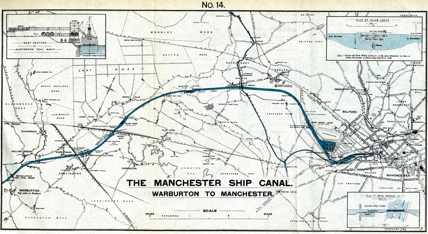 |
|||
| Comparative Plans of the Ship Canal Docks in 1885 and 1888. (facing p. 210)[1] | 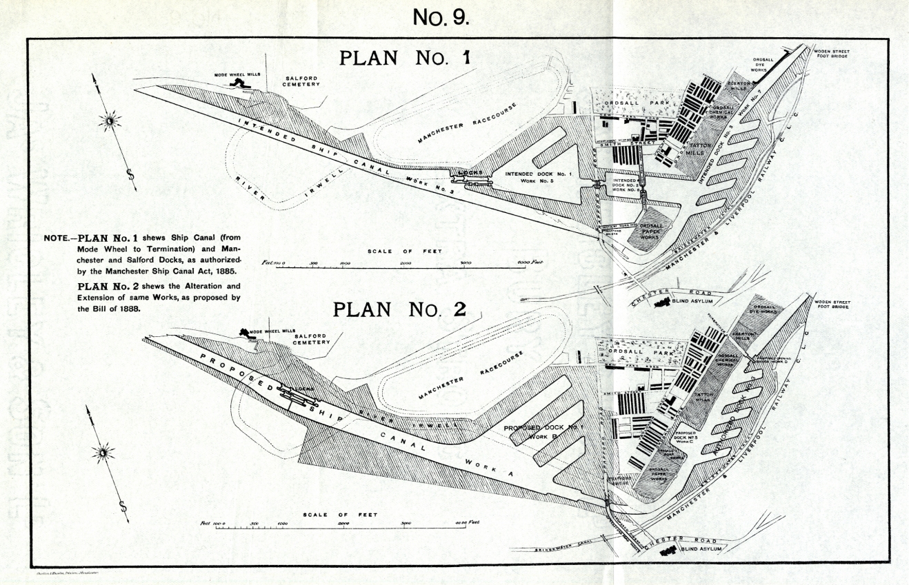 |
Bird's-Eye View of the Port of Manchester, 1898. (facing p. 240)[1] | 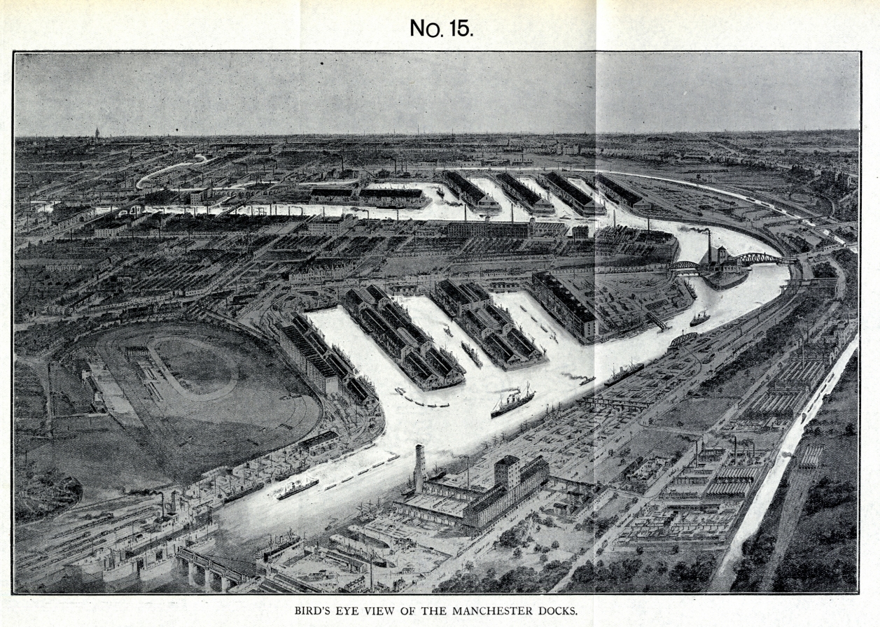 |
|||
| Bridgewater Docks at Runcorn, 1893. (facing p. 290)[1] | 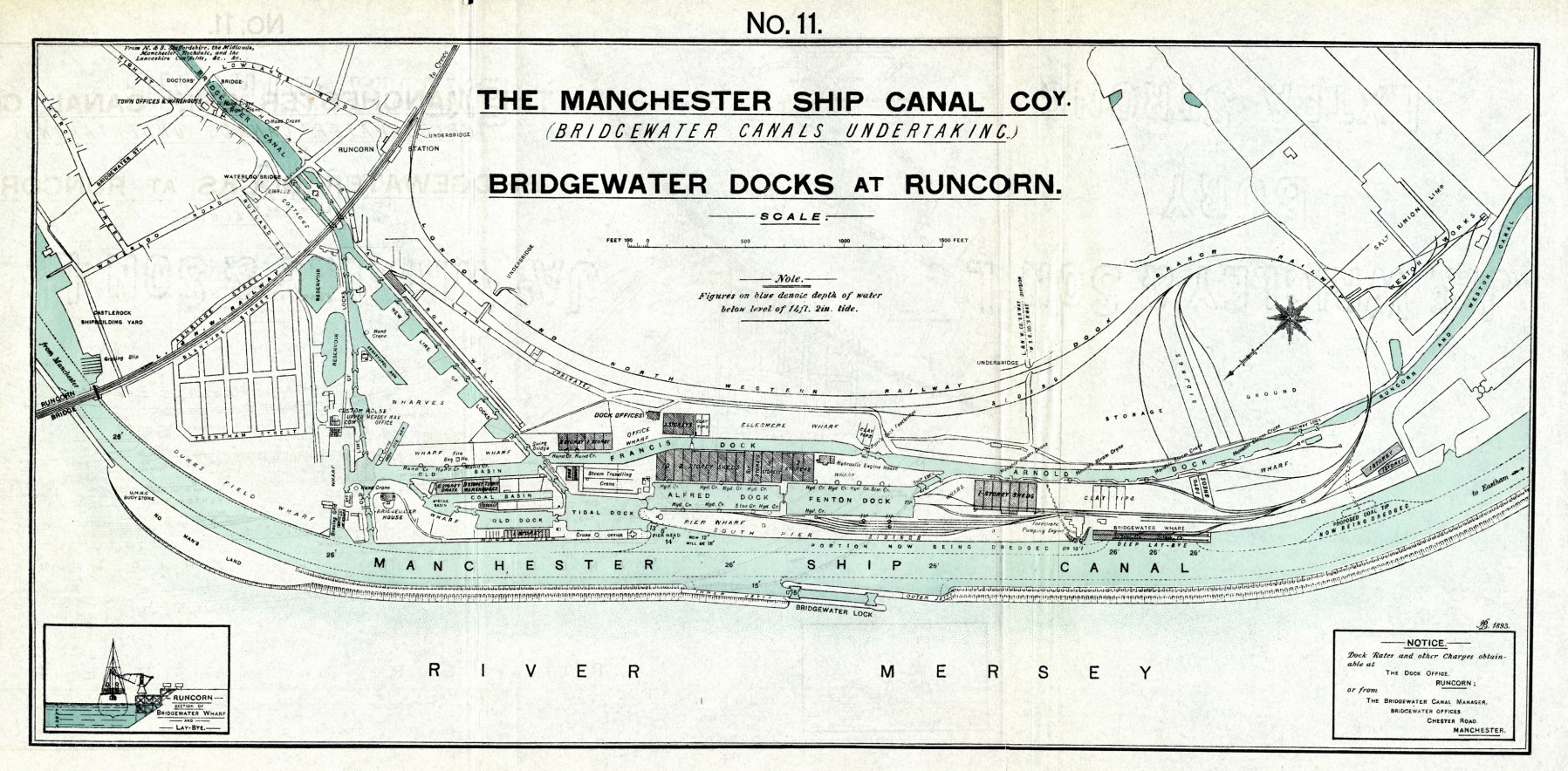 |
Map of the Manchester Ship Canal with the Latest Additions. (facing p. 258)[1] | 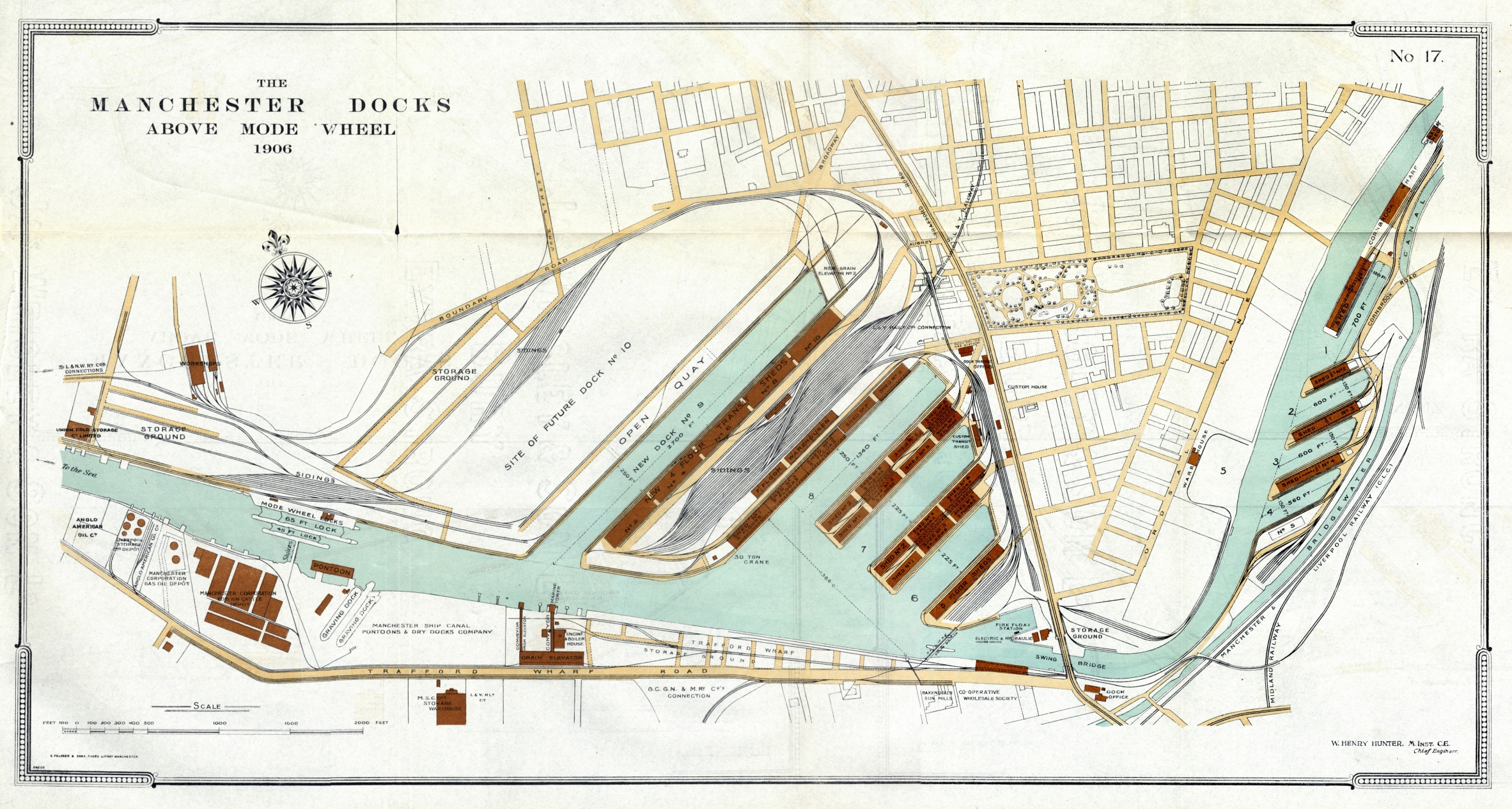 |
|||
|
Plans in Pocket
|
Plans in Pocket | |||||
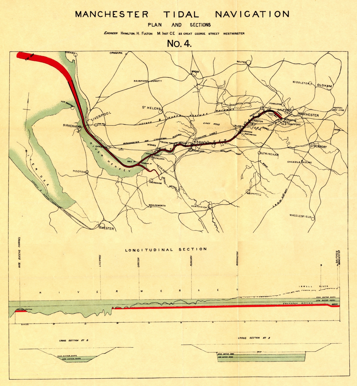
| Plan of the Proposed Manchester Tidal Navigation. By Hamilton H. Fulton, M.I.C.E., 1882. (facing p. 80)[1] |
 |
Manchester Ship Canal Amended Plan after Arrangements with the Trafford Estate, 1890. (facing p. 26)[1] | 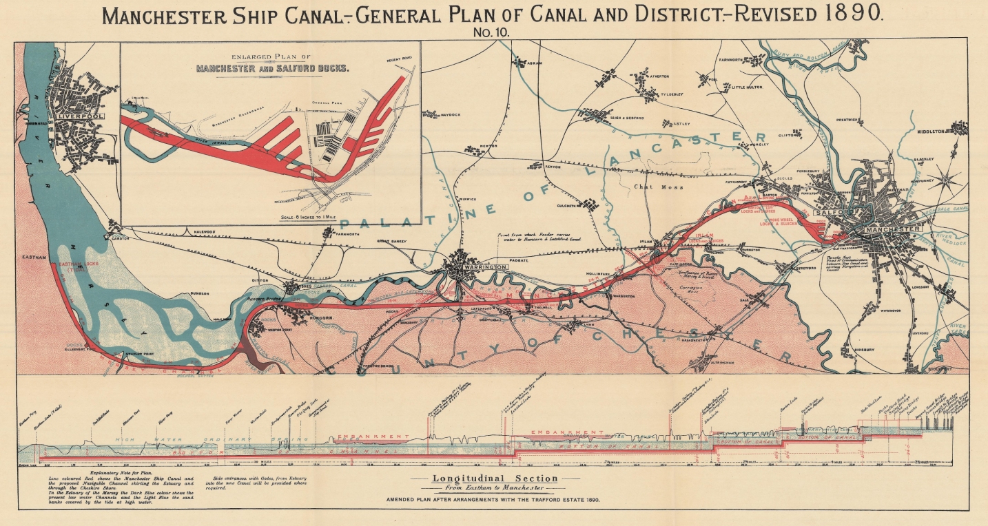 |
|||
| Boddington's Plan of the Manchester Ship Canal, with Entrance at Runcorn and Railway passing under Canal. Scheme as applied for in the Bill of 1883. (facing p. 112)[2] | 
[Apologies for poor quality scan]
|
Map of the Manchester Ship Canal as Developed in 1898. (facing p. 238)[1] | 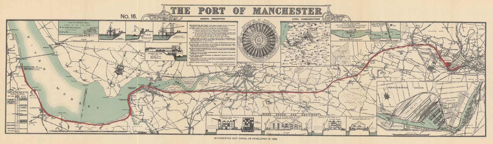 |
|||
| Plan of the Manchester Ship Canal as applied for in the Session of 1884. (facing p. 189)[1] | 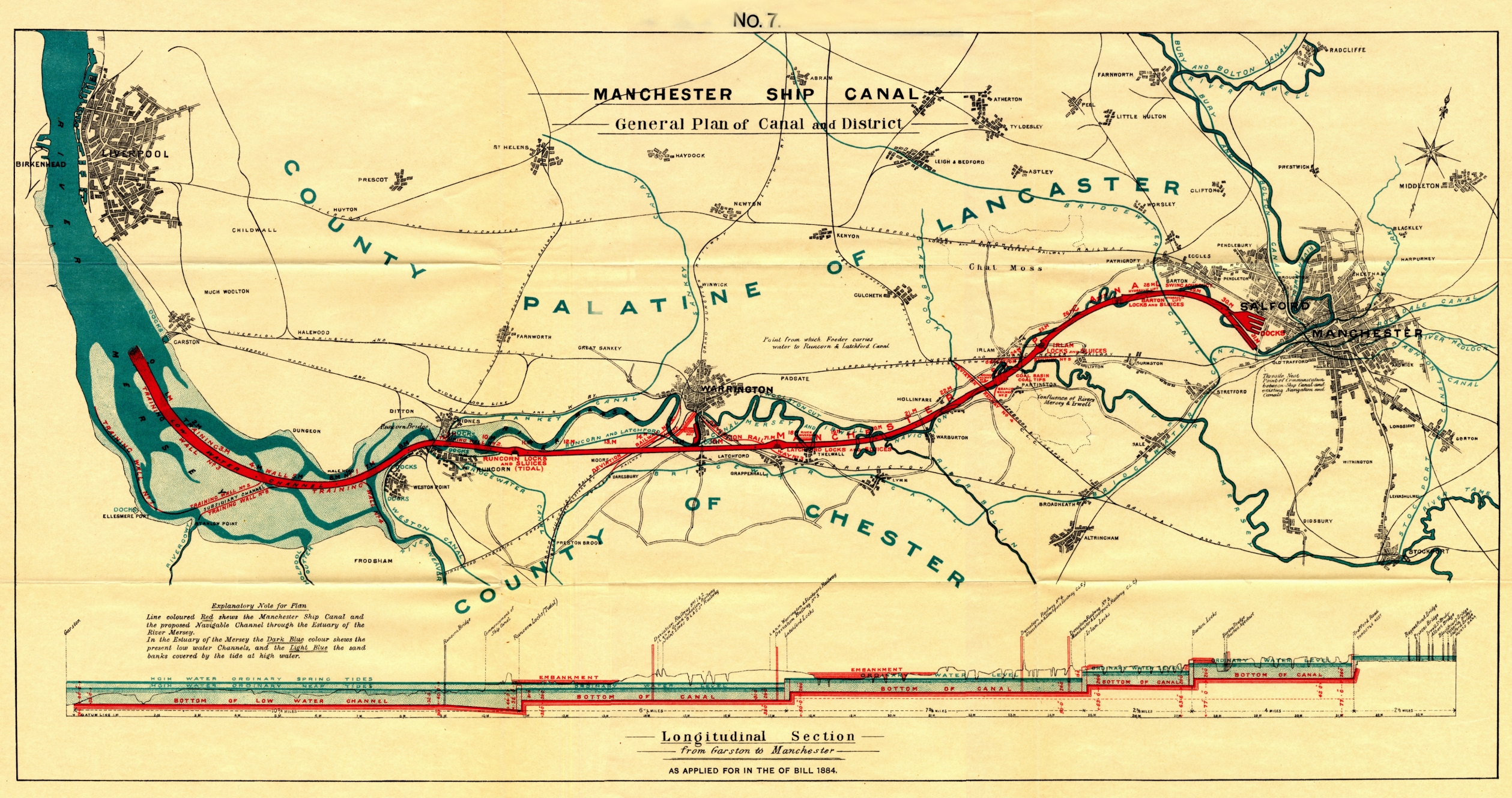 |
|||||
| Chart of the River Mersey from Runcorn to Liverpool, showing Variations of Sailing Channel between the years 1829 and 1884. (facing p. 241)[1] | 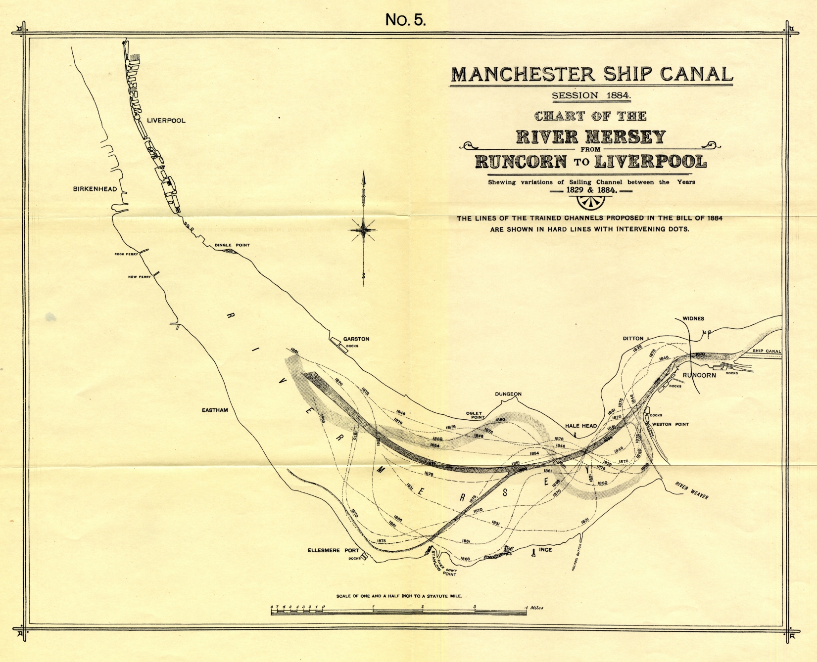 |
|||||
| Plan of the Manchester Ship Canal as applied for in the Bill of 1885. (facing p. 250)[1] | 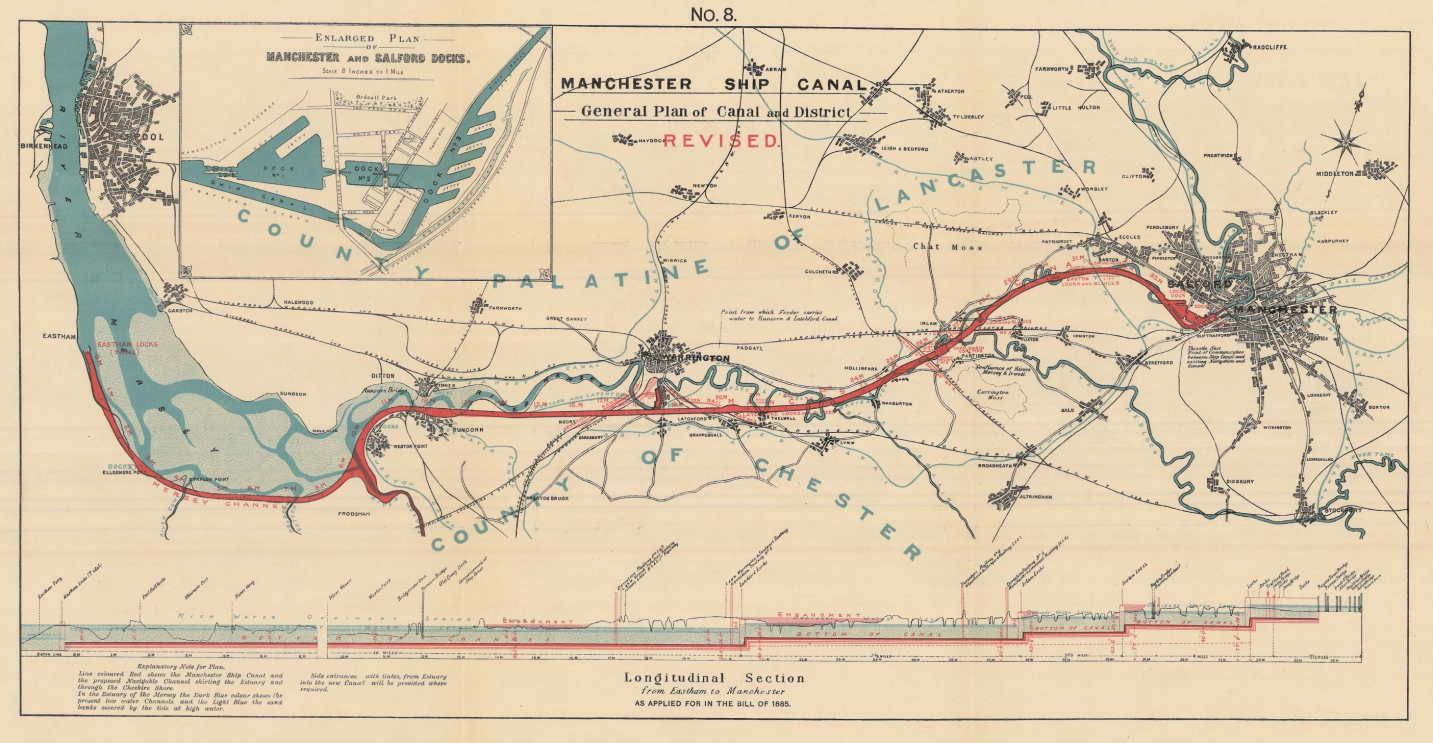 |
|||||
Sources: [1] Courtesy of The John Rylands University Library. [2] Courtesy of Manchester Metropolitan University Library. |
||||||
