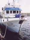
 From the small University of the Azores ship Arquipelago (right) in 2003, we surveyed the coasts with a high-resolution multibeam sonar installed beneath the vessel's bows. The data revealed remarkable branching lava structures such as those shown below. We interpreted these as the lava repeatedly arrested by enhanced cooling at the flow front where fractures are continually opened but then repeated repressurisation within the lava causes it to break out somewhat like pahoehoe lava on land. More details:
Mitchell, NC, C Beier, P Rosin, R Quartau, F Tempera, Submarine lava flows around the coasts of Pico Island, Azores, Geochem. Geophys. Geosyst., 9, Q03024, doi:10.1029/2007GC001725, 2008.
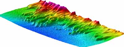
The computer-generated image above shows lava flows in 3D along the southeast coast of the island. The flows to the left show branching geometries to the northwest of the Pico and offshore an area where a lava flow entered the sea in 1718 AD.
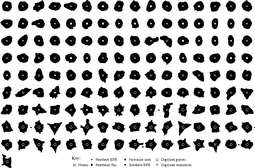 Small submarine volcanoes tend to have simple round outlines, whereas tall seamounts, guyots and volcanic ocean islands have more complicated outlines with radiating promontories due to volcanic rift zones and deep embayments due to landslides. The figure on the right shows the mid-height contours of some submarine volcanoes, with the smallest volcanoes in the top-left to tallest bottom-right (heights vary from 200 m to 5000 m). The contours are plotted with normalized scales so that the shapes of small and large edifices can be compared. This study quantified and explored the origins of this change, which appears to occur over 2000-4000 m height, and may relate to depths of magma chambers within the growing edifices. (Abstract and full article (PDF)*.)
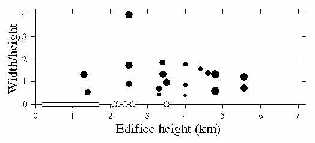 Continuing the above study, this project involved accumulating all the evidence available for landslides in volcanic islands and seamounts grown on young oceanic lithosphere (near to mid-ocean ridges). Landslides were identified using various sonar data and from reported observations on land. The graph on the left shows these classifications, with larger symbols implying higher confidence level. Landslides are relatively common in oceanic volcanoes taller than 2500 m, but are rare in smaller volcanoes, for example only 2 possible landslides were found in 44 seamounts examined. What are the causes of this transition? The transition coincides with the appearance of volcanic rift zones, a factor that affects the morphological transition mentioned above. Various effects accompanying the intrusion of dykes have been proposed elsewhere to trigger volcanic landslides and this coincidence provides circumstantial evidence. A further factor is that many edifices taller than 2500 m were or have been in the past volcanic islands, whereas most of those <2500 m have always been seamounts. Lava-sea interactions create weak material (hyaloclastite) - perhaps many of the coasts of volcanic islands are underlain by this material which makes them susceptible to landsliding. (Abstract and full article (PDF)*.)
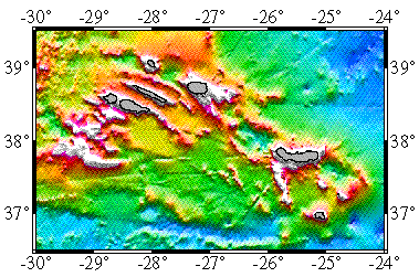 Volcanism in the extensional zone between the African and European tectonic
plates has produced some remarkable major elongate volcanic ridges, in
particular those forming the islands of Sao Jorge and Faial-Pico (map on the right). In 1999, we carried out a survey of the submarine ridges with TOBI, the Southampton deep-tow sonar system, funded by the EU. Preliminary results can be found in our AGU abstract and in the cruise report on the ISMAR Bologna web site. A second survey was carried out with the University of the Azores DOP ship Arquipelago using a portable
multibeam sonar owned by Cardiff University (a Reson SeaBat 8160). An article submitted to Inter Ridge News can be accessed here.
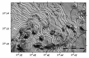 My interest has been in developing a geological comparison between the Canaries and the
Hawaiian islands based on a dataset collected in the Canaries in 1997 on RRS Charles
Darwin with Doug Masson of Southampton and Tony Watts of
Oxford. This involved developing a new method described in the published article
to summarise the slope characteristics for a given sector of an island's
submarine flanks, which then allowed us to compare different flank areas quantitatively.