Back to my unofficial home page
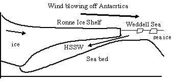
| This NERC-funded project is to investigate flows under ice shelves. We are concentrating on the flow of dense, salty water (HSSW) formed just beyond the ice shelf as it flows down under the ice shelf (see figure). The salty water is formed as sea water freezes to produce sea ice in the Weddell Sea leaving the salt in the sea water. The cold winds blowing off Antarctica that help cool the water also blow the sea ice away from the edge of the ice shelf. Dense flows on slopes can produce eddy structures that involve the overlying water and this is important for mixing and melting in the cavity under the ice shelf. |  |
 |
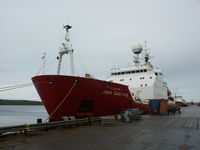
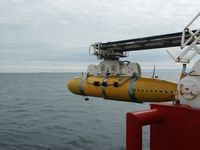
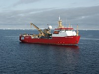
We will examine these flows by sending an autonomous (unmanned) submarine under the Ronne Ice Shelf, launched from a research ship (the RRS James Clark Ross), during a research cruise in early 2005. More details about Autosub (the submarine) and the British Antarctic Survey (BAS - who run the research ship) can found using the links at the bottom of the page. We hope to update this page with information during the research cruise itself. |
|
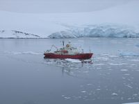
Delayed start The cruise will be led by Keith Nicholls from BAS, and involves a number of related projects, using Autosub, as well as a planned call at Halley Base to transfer people and equipment. We originally expected to start from the Falkland Islands on 31 January 2005, but the ship couldn't make it to Rothera on an earlier cruise (too much sea ice - see picture) and so some rescheduling was necessary. Now due to depart 4 February 2005. Justin Buck was on the earlier cruise, part of a team making measurements across Drake Passage (between South America and the tip of the Antarctic Peninsula). |
|
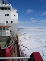
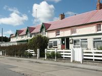
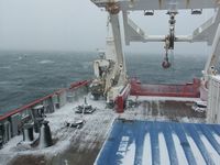
| Travelling South Arrived in the Falklands on Saturday 29 January, with a stopover in Santiago, Chile. We had a couple of days in the Upland Goose in Stanley and are now on board making final preparations to sail. The weather seems to be making its preparations too. After several sunny days the wind has got up to make sure the South Atlantic will give us a vigorous welcome! Expecting to sail 11:30 (local time) tomorrow (Thursday 3 February). |
|
|
|
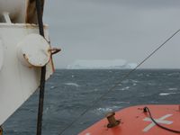 |
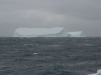
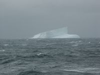
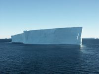
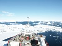
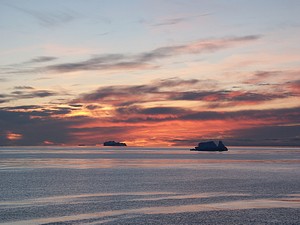
Ice Bergs! We are now (Sunday 6 February) south of 60 S, the air and water temperatures have dropped to about 2 degrees Celsius and we've been going past a large number of ice bergs. Ice bergs are formed when lumps of ice shelf break off and float away. In contrast, sea ice is formed when the sea gets cold enough to freeze (though marine ice sometimes forms on the underside of ice shelves). |
|
|
|
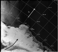
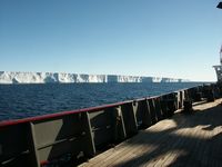
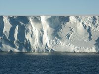
Change of plan Yesterday (Tuesday 8 February) we decided that there was just too much sea ice in the Weddell Sea to make it worthwhile going there, so we have changed course for the Fimbul Ice Shelf. This is a smaller ice shelf than the Ronne or Filchner Ice Shelves in the Weddell Sea. It is further north, where the Greenwich meridian meets Antarctica. The centre of this ice shelf is fed by a single glacier (ice stream shown by the black arrow on the satellite picture, white arrow shows north). There is a central depression in the sea bed under the main ice stream, with relatively warm, salty water flowing down into the depression (not as salty as the HSSW near the Ronne) and fresher water flowing out (because of some melting of the underside of the ice shelf). We expect to get there sometime tomorrow (Friday 10 February), with a short stop today for a practice CTD station. |
|
|
|
Fimbul Ice Shelf For the past few days we have been operating in the bay on the western side of the central tongue of the Fimbul Ice Shelf. The work has included surveying the seabed (there aren't any very accurate charts of the area), continuing to measure water speeds and doing CTD stations: lowering a package of instruments and sampling bottles down into the water to measure a range of water properties. There have also been some trial runs with Autosub in open water. Today (Sunday 13 February) we hope to send Autosub on its first mission under the ice shelf. |
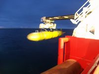
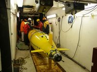
| First under ice shelf mission successful Late on Sunday 13 February, Autosub was successfully recovered from the first ever deployment of an autonomous vehicle underneath an ice shelf. On this first mission Autosub penetrated approximately 25 km into the ice shelf cavity, travelling at various depths between the sea floor and the underside of the ice shelf. The data from the various instruments on board are now being analysed, though there was a short break for a small celebration of this historic achievement first! |

|
|
|
|
Bad weather and bad luck The weather closed in, with winds in excess of 40 knots (Strong Gale, Force 9). Fortunately we were in the lee of the ice tongue, so the waves were not too high and we could continue with some work: yo-yoing the CTD package up and down in the water for several hours. This gives a picture of how the conditions vary over time, and in this case gave an illustration of how the surface mixed layer depth can increase from virtually nothing to over 100 m in a relatively short time. Once the weather improved Autosub was sent on another mission under the ice shelf. Unfortunately this time it didn't return. This is very disappointing, of course, though we can console ourselves with the data that we have recovered from the first mission, which (among other things) shows the underside of the ice shelf to be much more irregular than any of us first thought. We will now have to carry on collecting information from the ship from the edge of the ice shelf, and have moved to the eastern end of the region and are working our way back westwards. There is more sea ice here, so the going will be a bit slower. |
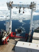 |
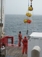
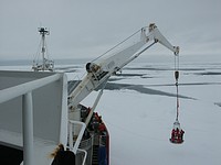
Leaving the Fimbul We have now (Tuesday 22 February) left the Fimbul Ice Shelf, having completed a good, detailed survey. In places we were deploying instruments in sea ice (see picture) which had to be done over the stern: usually we deploy over the side (which is a more stable location with better control) but it's easier to keep a clear patch of water behind the ship than beside it. One of the final things we did in the Fimbul area was recover a mooring which we had put down soon after we arrived. We are now travelling towards the eastern Weddell Sea, where we hope to recover and deploy more moorings, and do some work on sea ice and sea ice production. |
|
 |
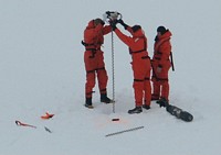
Weddell Sea We met up with the other BAS ship, the RRS Ernest Shackleton, near the Brunt Ice Shelf to pick up passengers who had been working at the Halley Base on the Brunt Ice Shelf. We also tried to pick up three moorings, and successfully recovered (most of!) two of them. These had both been moved a few miles by passing icebergs since they were deployed a couple of years ago. Next we found some good thick sea ice for the sea ice team to work on, deploying instruments which will tell them where and how it moves, and drilling holes to find the ice thickness. Once we had got out of the sea ice we followed a route roughly SE towards the coast, making measurements and stopping for CTD stations along the way. As we approached the coast we reached what we expect be our most southerly latitude of just over 76 deg 51 min S, at 14:34 GMT today (Saturday 26 February). |
|
 |
Coming home Our final work was to examine the flow of dense, ice shelf water (ISW) flowing out of the Filchner Depression. This water is formed when warmer water flowing under the ice shelf melts the underside of the ice shelf, making it colder and fresher. In places the ice shelf water is so cold that it would freeze if you brought it to the surface very rapidly, and only stays liquid because of the high pressure so far down. After further mixing, the ice shelf water eventually leaves the continental shelf, flowing through a channel at the northern end of the Filchner Depression and down into the deep ocean. Being another dense flow on a slope, this flow is similar to the initial flow of dense HSSW down into the cavity under the ice shelf mentioned at the top of the page, with similar instabilities and eddies. We were able to carry out observations over several hours and saw large variations in the thickness, temperature and speed of the ice shelf water. We are now (Sunday 6 March) heading north to Stanley, writing our initial cruise reports and with a large amount of data to analyse when we get back home. |
You can contact us by e-mail:
e-mail: g.f.lane-serff@manchester.ac.uk
e-mail: J.Buck@postgrad.manchester.ac.uk
The photos on this page are by us unless otherwise stated: you're welcome to use them for non-commercial use with suitable acknowledgement - please let us know if you do (larger versions may also be available).